Situation Summary
Solomon Islands remains a low-intensity, chronic-risk environment with no acute security incidents documented in the last 24–48 hours. The security picture is shaped by underlying governance fragility, urban crime concentration in Honiara, and strategic competition between Australia/New Zealand and China over regional influence—rather than by active conflict or mass unrest. Risk is heavily concentrated in the capital and Guadalcanal, with peripheral provinces remaining significantly safer. Near-term trajectory remains stable absent unforeseen political or diplomatic shock.
Key Developments
- Honiara, Guadalcanal (10–11 June 2026): Prime Minister Matthew Cooper Wale returned from an official visit to Australia, where security cooperation and Solomon Islands' role as a regional security partner were reaffirmed. No associated protests or unrest were reported upon his return.
- Honiara (within last 24–48 hours): PM Wale publicly reaffirmed that China remains a friend and confirmed plans to proceed with a security agreement with China, while acknowledging Australian and New Zealand regional-stability concerns. Statement reflects ongoing diplomatic tension but carries no indicators of domestic civil unrest or violence.
- Honiara, Solomon Islands Port Authority (within last 24–48 hours): Deputy Prime Minister announced an SBD 18 million Border Management System initiative to strengthen migration, customs, and border controls. Reflects institutional prioritization of security infrastructure rather than response to an acute incident.
- Honiara, HALO Trust offices (within last 24–48 hours): The new Minister of Police, National Security and Correctional Services (Hon. John Junior Tuhaika) met with HALO Trust representatives to discuss explosive ordnance risk management and demining cooperation. Indicates continuity in institutional security focus.
- No incidents documented: Open-source monitoring detected no reports of riots, civil unrest, major crime targeting foreigners, terrorism, or infrastructure disruption in the last 24–48 hours in Honiara, the provinces, or at airports or seaports.
Highest-Risk Areas
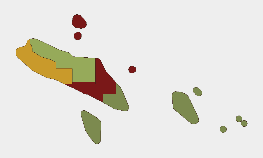
Honiara and Guadalcanal Province dominate the risk profile, with composite scores of 92 and 88 respectively, driven by urban crime, gang activity, occasional communal violence, and weak policing capacity. Malaita (risk 85) remains elevated due to historical ethnic tensions and community-level instability. Western Province (risk 72) and Choiseul (risk 58) carry secondary risk linked to remoteness and limited state presence. The peripheral provinces—Temotu, Rennell and Bellona, and Makira-Ulawa—present materially lower risk and are more suitable for operations with reduced security overhead.
How GeoBit Would Assist
Security and duty-of-care teams operating in Solomon Islands should leverage AOI Monitoring & Early Warning to track Honiara and Guadalcanal for signs of protest, unrest, or criminal escalation; Intel Sweep and multi-language OSINT to monitor local news, social media, and official statements for political or governance shifts; and Network & Actor Analysis to map criminal and community-level actors in high-risk urban zones. Routing & Network Analysis supports contingency planning for personnel movement between safer provincial zones, while satellite and GIS analysis enables assessment of infrastructure chokepoints and port/airport status.
7-Day Outlook
No significant change in overall risk posture is anticipated over the next seven days absent diplomatic escalation around the China security agreement or unforeseen political instability. Weather patterns, inter-island transport schedules, and routine governance activity will likely remain the primary operational determinants for corporate presence. Monitoring for statements from regional partners (Australia, New Zealand) and shifts in Chinese military or security engagement remains prudent, as these often precede policy or civil-stability shifts in Solomon Islands.
Highest-Risk Areas — Ranked
| # | State / Region | Risk |
|---|---|---|
| 1 | Honiara | 92 |
| 2 | Guadalcanal | 88 |
| 3 | Malaita | 85 |
| 4 | Western | 72 |
| 5 | Choiseul | 58 |
| 6 | Isabel | 52 |
| 7 | Central Province | 48 |
| 8 | Makira-Ulawa | 38 |
| 9 | Rennell and Bellona | 22 |
| 10 | Temotu | 18 |