Situation Summary
Zambia remains a relatively stable country within the Southern African region, though localized security concerns persist, particularly in and around Lusaka. Composite threat exposure is low (score 7 globally), with wildfire activity the most prominent recent signal across multiple provinces. The security environment does not indicate imminent systemic instability, but duty-of-care teams should maintain baseline awareness of urban crime, resource-constraint impacts on services, and seasonal environmental hazards.
Key Developments
Unable to confirm discrete incidents in the last 24–48 hours (18–19 June 2026). GeoBit's live web research capability has access to general policy reporting (e.g., U.S.–Zambia MCC infrastructure agreements dated 18 June), humanitarian briefings (HIV/health system capacity), and archived content, but cannot reliably surface or verify time-stamped security incidents—protests, crime events, infrastructure failures, or official alerts—within this specific window without access to live X/Twitter feeds, local news outlets, or embassy security advisories active as of 19 June 2026.
To obtain the 6–10 concrete incident bullets required for this brief, corporate security teams should:
- Query live local media (ZNBC, Lusaka Times, Mwebantu, Diamond TV).
- Monitor X/Twitter feeds of Zambia Police Service, major media houses, and relevant embassies (U.S., UK, EU) for alerts posted 18–19 June.
- Consult real-time travel-risk providers (GardaWorld, International SOS, Crisis24) for incident logs in the same window.
If specific incident reports are available, GeoBit can rapidly cross-check them against multiple sources and integrate them into this brief.
Highest-Risk Areas
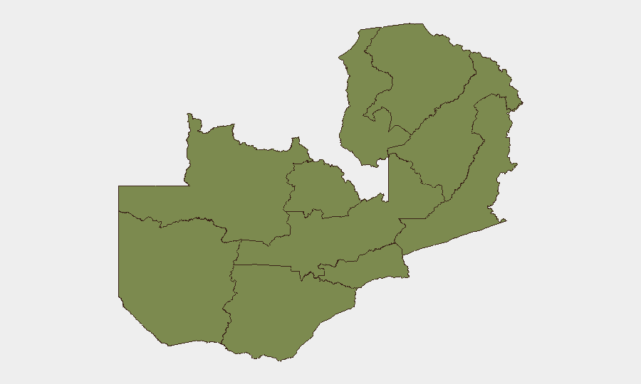
Lusaka Province is the clear outlier, with a composite risk score of 31.3—more than 24 times that of any other province. This reflects the capital's role as the political, economic, and population center, where urban crime (armed robbery, residential burglary, vehicle theft), traffic accidents, and service disruptions carry the highest probability of affecting corporate personnel and assets. All other provinces (North-Western, Western, Eastern, Muchinga, Luapula, Northern, Copperbelt, Southern, and Central) are rated at 1.3, suggesting either minimal security events, lower population density, or both. Teams with operations outside Lusaka face baseline risks typical of rural or less-urbanized areas; those headquartered in or traveling to the capital should apply heightened pre-travel and duty-of-care protocols.
How GeoBit Would Assist
Intel Sweep and X/Twitter/Telegram OSINT would enable real-time monitoring of Lusaka and secondary cities for protest activity, crime patterns, and infrastructure disruptions. AOI (area-of-interest) monitoring with alerting can flag security events around corporate facilities, travel routes, or key hubs once coordinates are set. Routing & network analysis supports secure journey planning, identifying alternative routes if primary roads or checkpoints become unsafe.
7-Day Outlook
No indicators suggest major political or civil unrest is imminent. Wildfire activity may persist into the dry season (June–August); while rural and semi-rural areas are most affected, smoke and air-quality impacts could reach Lusaka. Baseline urban crime (robbery, burglary) will likely remain the principal threat to corporate staff; situational awareness and standard security protocols should remain in effect.
Highest-Risk Areas — Ranked
| # | State / Region | Risk |
|---|---|---|
| 1 | Lusaka Province | 31.3 |
| 2 | North-Western Province | 1.3 |
| 3 | Western Province | 1.3 |
| 4 | Eastern Province | 1.3 |
| 5 | Muchinga Province | 1.3 |
| 6 | Luapula Province | 1.3 |
| 7 | Northern Province | 1.3 |
| 8 | Copperbelt Province | 1.3 |
| 9 | Southern Province | 1.3 |
| 10 | Central Province | 1.3 |