Situation Summary
The Bahamas (global threat rank #79, composite score 21) remains a mid-tier jurisdiction dominated by localized urban gun violence rather than systemic instability. The past 24–36 hours have witnessed a sharp cluster of fatal shootings in Nassau's commercial and residential corridors, with three confirmed homicides and one group shooting resulting in hospitalizations, alongside concurrent sexual-assault investigations involving minors. New Providence, home to Nassau and ~70% of the national population, accounts for the overwhelming majority of recorded incidents and drives the nation's threat profile.
Key Developments
- Soldier Road, Nassau (New Providence) – Aug 24–25, 2026: A man in his early fifties was fatally shot in broad daylight in a brazen public homicide; police confirmed active investigation.
- Joe Farrington Road, Nassau (New Providence) – Aug 24, 2026: Fatal shooting at a residential apartment complex; victim in his fifties died on scene; part of a three-incident cluster within 24 hours.
- Gladstone Road near bus stop, Nassau (New Providence) – Aug 24, 2026: Midday fatal shooting in a transport corridor; victim shot near public transit infrastructure, signaling risk to routine commuter activity.
- Fox Hill/Reeves Street, Nassau (New Providence) – Aug 24, 2026: Armed assailants opened fire on a group; two men hospitalized with gunshot injuries; consistent with neighborhood gang-violence patterns.
- Sexual assault investigations, Nassau (New Providence) – Aug 24–25, 2026: Police investigating two separate cases involving a 14-year-old girl and an 18-year-old woman; both reported within the last 24 hours and highlighted in local media.
- Gambier Village firearms seizure (New Providence) – Aug 20, 2026 (marginal to 24–48h window): Drug Enforcement Unit warrant execution yielded firearm and ammunition recovery; illustrates ongoing illegal weapons circulation.
- US State Department Level 2 advisory remains active: Travel advisory (issued July, still operational as of Aug 24–25) cites crime, robbery, sexual assault, and boating hazards; specifically flags Nassau and Freeport.
Highest-Risk Areas
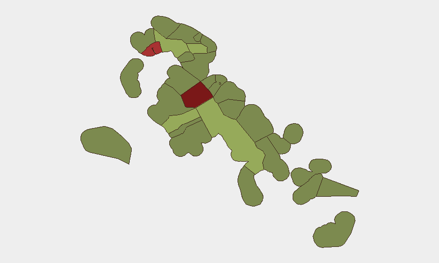
New Providence (risk score 92) dominates the threat landscape, with three fatal shootings and one group shooting clustered in Nassau's urban core within 36 hours. Freeport, Grand Bahama (risk 78) represents the secondary concentration point, though current event signals are centered on New Providence. The spatial clustering of incidents on Soldier Road, Joe Farrington Road, and Gladstone Road—all major Nassau arteries—indicates that routine business, residential, and commuter activity in urban corridors now carries heightened risk of gun violence. Peripheral islands (Exuma, North Eleuthera, Cat Island, risk 28–45) show markedly lower incident density and remain substantially safer for corporate operations and personnel.
How GeoBit Would Assist
Corporate security teams in the Bahamas should deploy AOI Monitoring & Early Warning to watch high-risk Nassau neighborhoods (Soldier Road, Fox Hill, Joe Farrington Road corridors) for escalation signals in real time. Intel Sweep and X/Twitter & Telegram OSINT fusion capabilities enable continuous monitoring of gang-activity chatter and police incident announcements across 24–48 hour windows, allowing rapid threat notification to personnel. Routing & Network Analysis should inform alternative commute and supply-chain planning around confirmed shooting locations, with dynamic re-routing as incidents cluster.
7-Day Outlook
The three-homicide cluster in 24 hours suggests sustained gun-violence momentum in Nassau rather than a single incident spike; retaliatory shootings historically follow within days in gang-affected jurisdictions. Personnel transit through New Providence should assume elevated risk for the next 7 days, with particular caution around residential complexes and public transport nodes. No indicators suggest national destabilization or spread to outer islands, but localized escalation in New Providence remains the dominant near-term threat vector.
Highest-Risk Areas — Ranked
| # | State / Region | Risk |
|---|---|---|
| 1 | New Providence | 92 |
| 2 | City of Freeport | 78 |
| 3 | Central Abaco | 52 |
| 4 | Central Andros | 48 |
| 5 | Exuma | 45 |
| 6 | East Grand Bahama | 42 |
| 7 | South Andros | 38 |
| 8 | North Abaco | 35 |
| 9 | North Eleuthera | 33 |
| 10 | South Abaco | 32 |
| 11 | Cat Island | 30 |
| 12 | Mangrove Cay | 28 |
Sources
Previous Daily Briefs
A new Bahamas brief is written every day — each with its own risk map and downloadable CSV. Here's the last week; use the calendar to go further back.
- August 23, 2026
- August 21, 2026
- August 19, 2026
- August 17, 2026
- August 15, 2026
- August 13, 2026
- August 12, 2026
📅 Browse every day by calendar →
Highlighted days have a brief. Tap a day for that day's map & analysis, or “csv” for that day's dataset ($5).
Atlas — our AI intelligence desk — emails them this snapshot personally. Nothing else, no list.