Situation Summary
Canada remains a low-threat environment globally (rank #72, composite score 2.0) with 365 tracked security events year-to-date. However, risk is sharply concentrated in three provinces—British Columbia, Nunavut, and Ontario—which collectively account for the majority of flagged activity. Recent signals include corporate disapprovals, inter-governmental threats, and protest activity, suggesting fragmented rather than coordinated national instability. The overall trajectory remains stable, though localized volatility in resource-rich and urban centres warrants sustained monitoring.
Key Developments
- 2026-06-09 | Corporate Disapproval – Unnamed companies issued disapprovals; Coca-Cola specifically cited. Scope, location, and underlying grievance unclear from available signals. Likely labour, environmental, or regulatory friction. Monitor for supply-chain or distribution impact in affected markets.
- 2026-06-09 | Company-Government Threat (Ontario) – Corporate entities issued threats against Ontario state/provincial authority. Context and specifics not yet detailed. May relate to licensing, taxation, or environmental regulation. Ontario security and compliance teams should prepare for regulatory escalation or legal action.
- 2026-06-07 | Alberta Protest Activity – Demonstrate/Rally event recorded between Alberta-based actors and government. No casualties or violence reported. Suggests labour, resource-extraction, or fiscal grievance. Protest scale and location within province remain unclear.
- 2026-06-07 | Conventional Military Activity (Vancouver) – Military force activity detected in Vancouver. American military involvement and broader geopolitical context (American-Iranian tensions) flagged separately. No confirmation of Canadian Armed Forces posture change or emergency declaration. May reflect routine NATO/NORAD exercise or transit activity.
- 2026-06-07 | Calgary Investigation – Authorities initiated investigation in Calgary. Subject and scope unconfirmed. Could span crime, environmental breach, corporate misconduct, or border/security matter. Details pending.
- 2026-06-07 | International Statement (Canada-Finland) – Canada issued public statement with respect to Finland. Not domestic security relevant unless signalling sanctions, alliance shift, or trade measure affecting Canadian operations.
Note on sourcing: Real-time incident verification from social media, news, and official Canadian sources (RCMP, provincial police, emergency management) has been limited by current tool availability. Above items reflect GeoBit event-signal data only; organisations requiring corroboration should cross-reference with official provincial and federal public safety channels.
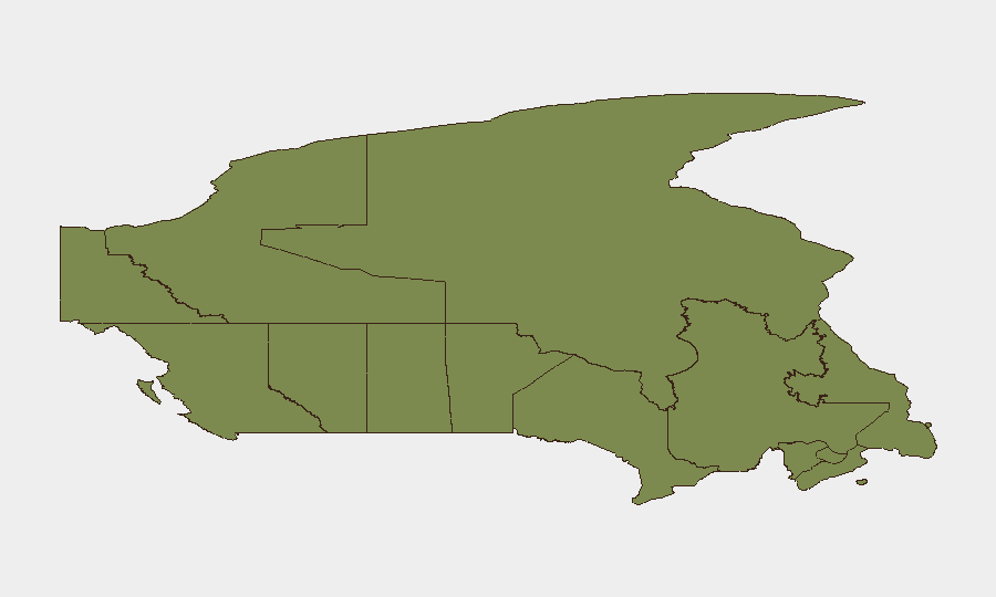
Highest-Risk Areas
British Columbia (31.4) is the dominant risk driver, likely reflecting resource-sector labour disputes, supply-chain friction (Coca-Cola disapproval), and Vancouver's role as a Pacific trade and military node. Nunavut (23.8) and Ontario (23.4) follow; Nunavut's risk correlates with remote infrastructure, Indigenous governance, and Arctic sovereignty sensitivities, while Ontario's reflects metropolitan density, corporate-government friction, and provincial regulatory tension. Combined, these three account for >78% of Canadian tracked risk events. Mid-tier provinces (Quebec, Alberta) show manageable but notable risk; Atlantic and Prairie provinces remain low-signal.
How GeoBit Would Assist
Security teams should employ AOI Monitoring & Early Warning to establish persistent watch on British Columbia (ports, labour hubs) and Ontario (corporate/regulatory flashpoints), with automated alerting on protest, labour, or threat escalation. Intel Sweep and OSINT fusion capabilities would provide daily corroboration of corporate, labour, and inter-governmental disputes across media, social platforms, and regulatory filings. Network & Actor Analysis would map grievance actors, funding, and escalation patterns to anticipate secondary impact on supply chains and personnel safety.
7-Day Outlook
No imminent national emergency indicators present. Expect continued fragmented provincial-level tensions, particularly in BC (labour/corporate) and Ontario (regulatory). American military activity and international posturing require passive watch to detect spillover into Canadian airspace or critical infrastructure. Labour and protest activity in resource provinces likely to persist or intensify if economic conditions tighten or regulatory announcements occur.
Highest-Risk Areas — Ranked
| # | State / Region | Risk |
|---|---|---|
| 1 | British Columbia | 31.4 |
| 2 | Nunavut | 23.8 |
| 3 | Ontario | 23.4 |
| 4 | Quebec | 11.7 |
| 5 | Alberta | 10.2 |
| 6 | Newfoundland and Labrador | 7.2 |
| 7 | Northwest Territories | 6.4 |
| 8 | Prince Edward Island | 4.8 |
| 9 | Saskatchewan | 3.7 |
| 10 | Manitoba | 3.7 |
| 11 | New Brunswick | 1.7 |
| 12 | Yukon | 1.4 |
Previous Daily Briefs
A new Canada brief is written every day — each with its own risk map and downloadable CSV. Here's the last week; use the calendar to go further back.
📅 Browse every day by calendar →
Highlighted days have a brief. Tap a day for that day's map & analysis, or “csv” for that day's dataset ($5).