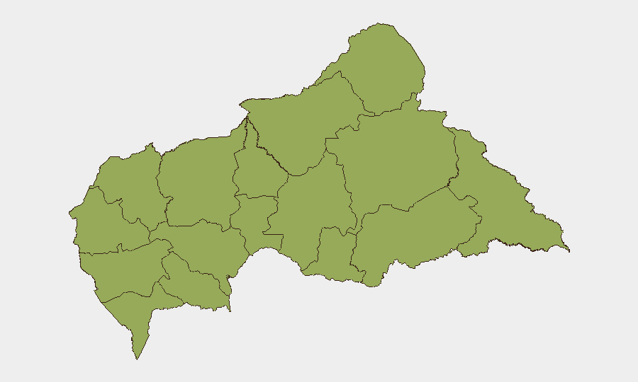
Situation Summary
Central African Republic remains classified as a moderate-tier global security risk (#29 globally, composite score 73) with no tracked acute incidents reported in the last 24–48 hours. The country's security environment is characterized by persistent armed group activity, localized criminal networks, and weak state capacity across provincial areas, though the capital and major administrative centers retain relatively stable baseline conditions. Risk is distributed broadly across the periphery; all 12 tracked sub-national zones carry equivalent elevated risk scores (51.2), indicating endemic rather than acutely escalating instability. Current trajectory shows no evidence of imminent deterioration, but operational hazards remain consistent with the long-term operating environment.
Key Developments
No credible, time-stamped security, conflict, crime, infrastructure, or acute travel-risk incidents specific to Central African Republic have been identified in open sources within the last 24–48 hours (as of 2026-07-08 0800 UTC).
Note: Two public statements flagged by GeoBit event signals on 2026-07-08 require verification for operational relevance; preliminary review indicates these may reference continental (Africa-wide) rather than CAR-specific messaging. Recommend direct platform query for statement text and originating entity.
Duty-of-care teams should monitor routine developments through established regional feeds; absence of reported incidents does not indicate absence of risk.
Highest-Risk Areas
All 12 tracked provinces in CAR carry identical composite risk scores (51.2), indicating that threat drivers—armed group presence, criminal networks, and state-capacity constraints—are dispersed nationally rather than concentrated in one or two zones. The ranking reflects provincial coverage uniformity rather than relative differentiation. Vakaga (far north), Bambingui-Bangoran (northeast), and Haut-Mbomou (southeast) historically experience higher frequency of armed group activity and cross-border criminal movement; Bangui and Ombella-M'Poko (capital region) remain lower-risk for organized violence but retain petty crime and civil-unrest exposure. Remote border zones and mining areas carry elevated kidnap and trafficking risk; urban centers face armed robbery, home invasion, and civil-disorder scenarios.
How GeoBit Would Assist
Intel Sweep and multi-language OSINT fusion enable continuous monitoring of armed-group messaging, regime-stability indicators, and cross-border criminal networks across Telegram, X, and regional French-language sources. AOI Monitoring & Early Warning with persistent geographic watch over Bangui, border crossings (Chad, Sudan, DRC), and provincial capitals provides 24/7 alerting when new incidents, protest activity, or armed-group movement occur. Routing & Network Analysis supports rapid alternative-route planning for staff movement in event of road closures, armed-group checkpoints, or civil unrest, and Conflict & Military force-structure tracking helps corporate teams understand armed-actor disposition and operational tempo.
7-Day Outlook
No acute escalation is anticipated over the next seven days. Baseline armed-group and criminal activity will likely continue; rainy-season access constraints may reduce cross-border movement and lower short-term incident frequency in remote zones. Corporate security teams should maintain standard vigilance protocols and confirm staff welfare at regular intervals, particularly those stationed in provincial posts or near extraction/mining operations.
Highest-Risk Areas — Ranked
| # | State / Region | Risk |
|---|---|---|
| 1 | Bamingui-Bangoran | 51.2 |
| 2 | Vakaga | 51.2 |
| 3 | Haute-Kotto | 51.2 |
| 4 | Haut-Mbomou | 51.2 |
| 5 | Mbomou | 51.2 |
| 6 | Nana-Mambéré | 51.2 |
| 7 | Ouham-Pendé | 51.2 |
| 8 | Mambéré-Kadéï | 51.2 |
| 9 | Sangha-Mbaéré | 51.2 |
| 10 | Ouham | 51.2 |
| 11 | Nana-Grébizi | 51.2 |
| 12 | Kémo | 51.2 |
Sources
Previous Daily Briefs
A new Central African Republic brief is written every day — each with its own risk map and downloadable CSV. Here's the last week; use the calendar to go further back.
📅 Browse every day by calendar →
Highlighted days have a brief. Tap a day for that day's map & analysis, or “csv” for that day's dataset ($5).
Atlas — our AI intelligence desk — emails them this snapshot personally. Nothing else, no list.