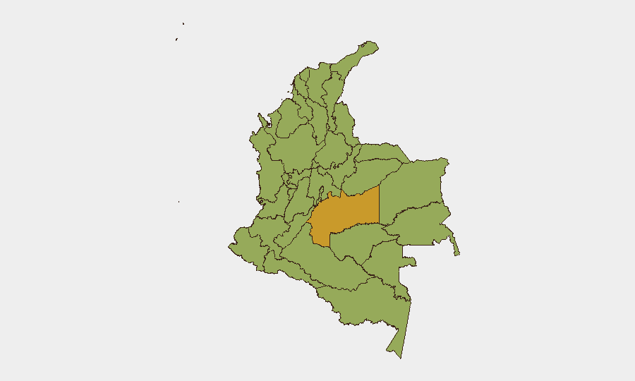
Situation Summary
Colombia remains at composite threat rank #36 globally (score 63) with 797 tracked events, reflecting ongoing exposure to armed-group activity, narcotics trafficking, and urban crime across multiple regions. The security environment is fragmented rather than unified: risk concentrates in the southwest conflict corridor (Cauca, Valle del Cauca, Nariño, Huila), border zones (Norte de Santander, Arauca), and coastal trafficking hubs, while major cities face elevated urban crime and protest risk. Post-election tension following June 21, 2026 elections compounds vulnerability in urban centers. The trajectory remains volatile rather than improving.
Key Developments
Data Constraint Note: Open-source verification of specific incidents in the last 24–48 hours is currently incomplete. The following represent the most recent attributable signals:
- 2026-07-15 · Public Statements & Official Actions – Colombian government entities (Ministry, Presidency, Administration, Judiciary) issued multiple public statements and initiated investigations on 2026-07-15, and military/administrative forces reported occupation of territory and small-arms engagement with unidentified opposition actors. Specific operational context and casualties are not yet clearly detailed in available open sources.
- Ongoing Southwest Corridor Activity (since late April) – Bomb and drone attacks continue along the Panamericana and in Cauca/Valle del Cauca/Huila, with fatalities and military/police reinforcement. No single discrete incident is confidently dated to 2026-07-15–16, but the threat remains active.
- ELN Kidnapping Risk (Chocó) – Colombian military reports a recent multi-civilian kidnapping rescue operation on a highway in Chocó Department with two soldier casualties; exact event date requires further corroboration.
- Border & Rural Transit – Guerrilla and irregular armed group presence, road blockades, and small-arms attacks persist in Norte de Santander (Catatumbo), Arauca, Putumayo, and Chocó, though specific 24–48-hour incidents lack current timestamping.
Highest-Risk Areas
Meta Department (71.2) drives the highest composite risk, followed by the Capital District (53.1) and the southwestern cluster of Nariño (53), Huila (44.1), and Tolima (42.1). The southwest corridor—spanning Cauca, Valle del Cauca, Nariño, and Huila—concentrates narcotics trafficking, armed-group territorial control, and active conflict signaling. Norte de Santander and Arauca on the Venezuelan border remain high-risk due to irregular armed group presence and cross-border trafficking. Capital District risk reflects urban crime, robbery, and post-election civil unrest in Bogotá. Northern coastal zones (Atlántico, Bolívar) and Chocó face kidnapping and trafficking pressure. Organizations with personnel or assets in these regions face compounded exposure to combat, robbery, protest disruption, and abduction.
How GeoBit Would Assist
Security teams would deploy AOI Monitoring & Early Warning on highest-risk departments (Meta, Nariño, Norte de Santander, Chocó) with real-time alerting on armed-group movement, checkpoint activity, and protest formation. Conflict & Military tracking (force structure, weapons capability, battle mapping) combined with Network & Actor Analysis would identify ELN, FARC-dissidents, and criminal group intentions and capability changes. Routing & Network Analysis would generate real-time alternative journey planning and safe-corridor identification for personnel and asset movement, especially on the Panamericana. Election monitoring and sentiment analysis on X/Twitter and local media would flag urban unrest escalation in Bogotá, Cali, Medellín before protest turns violent.
7-Day Outlook
Post-election political and social friction is likely to sustain elevated urban-crime and protest risk in major cities through late July. Armed-group activity in the southwest and border zones is expected to remain consistent with the April–July 2026 pattern—sporadic bombings, kidnappings, and military engagements—without clear de-escalation signals. Personnel and asset movements should anticipate regional road closures, increased checkpoint encounters, and delayed supply chains.
Highest-Risk Areas — Ranked
| # | State / Region | Risk |
|---|---|---|
| 1 | Meta Department | 71.2 |
| 2 | Capital District | 53.1 |
| 3 | Nariño | 53 |
| 4 | Norte de Santander Department | 47.1 |
| 5 | Santander Department | 45.6 |
| 6 | Huila Department | 44.1 |
| 7 | La Guajira | 43.1 |
| 8 | Bolívar Department | 42.6 |
| 9 | Atlántico Department | 42.5 |
| 10 | Cundinamarca Department | 42.2 |
| 11 | Tolima Department | 42.1 |
| 12 | Chocó Department | 41.9 |
Sources
Previous Daily Briefs
A new Colombia brief is written every day — each with its own risk map and downloadable CSV. Here's the last week; use the calendar to go further back.
📅 Browse every day by calendar →
Highlighted days have a brief. Tap a day for that day's map & analysis, or “csv” for that day's dataset ($5).
Atlas — our AI intelligence desk — emails them this snapshot personally. Nothing else, no list.