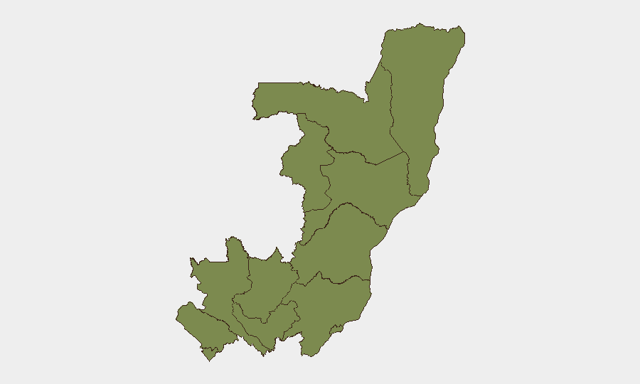
Situation Summary
Congo remains a regional flashpoint amid concurrent political instability in the Democratic Republic of the Congo (DRC), armed group activity in eastern border zones, and an expanding Ebola outbreak. While Congo itself ranks #35 globally for composite threat (score 54), the primary security drivers are transnational: spillover from DRC armed clashes, cross-border militia operations, and public-health escalation affecting regional mobility and business continuity. The security environment is deteriorating incrementally rather than acutely, but risk trajectories in border-adjacent regions warrant close operational monitoring.
Key Developments
- Kinshasa, DRC – 12 June 2026: Security forces dispersed an opposition sit-in outside Parliament using tear gas and live ammunition in response to planned constitutional changes; at least one opposition politician (Delly Sesanga) was shot in the leg and multiple protesters injured. This marks a significant escalation in DRC political risk and reinforces instability in a capital proximal to Congo's northern border.
- Masisi territory, North Kivu, DRC – 11–12 June 2026: M23 rebels engaged pro-government and Wazalendo militia forces across multiple localities with reports of shifting front lines; ongoing clashes indicate sustained armed group presence and territorial contestation in a zone of concern for cross-border displacement and humanitarian access.
- South Kivu highlands (Minembwe/Itombwe), DRC – 11–12 June 2026: Pro-government forces reportedly captured villages from M23-aligned militias, signaling intensified military operations and elevated risk of armed confrontation along key transit routes affecting civilian and commercial movement.
- Kabare territory, North Kivu, DRC – 11–12 June 2026: M23 elements engaged Wazalendo fighters north of Bukavu in multiple localized firefights, raising risks for civilian movements and transport on approaches to Bukavu and regional supply corridors.
- Eastern DRC provinces (Ituri, North Kivu, South Kivu) – 11–12 June 2026: The Ebola outbreak continues to expand into new health zones almost daily with significant isolation-capacity gaps, according to WHO briefings; this represents a material public-health and travel-restriction risk for personnel and asset movement across affected provinces and potentially into Congo.
- Ituri province, DRC – 11–12 June 2026: Human Rights Watch released documentation of month-long forced recruitment and abusive detention campaigns by M23 and Rwandan military forces in Uvira and surrounding areas, underscoring security risks for civilian populations and heightened instability in eastern border zones.
Highest-Risk Areas
Cuvette-Ouest Department dominates the sub-national ranking (31.4), though the remaining 11 departments cluster at 1.4–1.7, indicating risk is diffuse rather than geographically concentrated within Congo proper. The disparity in Cuvette-Ouest warrants investigation; however, the primary threat vectors are transnational: DRC instability (particularly North and South Kivu armed clashes), M23 operations, and Ebola-zone proximity. Border departments—particularly those adjacent to DRC (Sangha, Likouala, Pool, Plateaux)—inherit elevated exposure to cross-border militia activity, displacement, and health-risk propagation, even where local incident counts remain low.
How GeoBit Would Assist
Intel Sweep and OSINT Fusion provide real-time monitoring of M23 movements, DRC security-force posture, and Ebola case tracking across border zones. AOI Monitoring & Early Warning on Pool and Sangha Departments would alert security teams to cross-border militia incursions or displacement waves before operational impact. Routing & Network Analysis enables alternative journey planning and supply-chain risk mitigation for personnel and assets in border-adjacent locations, while Conflict & Military mapping tracks the North Kivu front-line dynamics driving regional instability.
7-Day Outlook
DRC parliamentary tensions and Kivu armed clashes are unlikely to de-escalate in the next 7 days; Ebola case incidence will likely continue expanding. Cross-border spillover risk into Congo's northern departments remains elevated but not imminent. Security teams should assume sustained operational friction on DRC routes and heightened health-screening requirements for any intra-regional movement.
Highest-Risk Areas — Ranked
| # | State / Region | Risk |
|---|---|---|
| 1 | Cuvette-Ouest Department | 31.4 |
| 2 | Bouenza Department | 1.7 |
| 3 | Sangha | 1.4 |
| 4 | Likouala | 1.4 |
| 5 | Cuvette Department | 1.4 |
| 6 | Kouilou Department | 1.4 |
| 7 | Niari Department | 1.4 |
| 8 | Pointe-Noire (département) | 1.4 |
| 9 | Lékoumou Department | 1.4 |
| 10 | Plateaux Department | 1.4 |
| 11 | Pool Department | 1.4 |
| 12 | Brazzaville (department) | 1.4 |
Sources
Previous Daily Briefs
A new Congo brief is written every day — each with its own risk map and downloadable CSV. Here's the last week; use the calendar to go further back.
📅 Browse every day by calendar →
Highlighted days have a brief. Tap a day for that day's map & analysis, or “csv” for that day's dataset ($5).