Situation Summary
Cuba remains a composite threat level 15 (#85 globally) with 101 tracked events, reflecting structural economic and political pressures rather than acute conflict or widespread unrest. The threat environment is dominated by infrastructure strain—power outages, fuel shortages, and associated civil-sector stress—coupled with recent signals of judicial and administrative friction and U.S. diplomatic tension. The risk trajectory is stable but fragile, with concentration of acute indicators in Sancti Spiritus province and secondary concern in Havana.
Key Developments
Web Research Limitation: GeoBit's live 24–48-hour search did not surface independently corroborated, time-stamped incident reports specific to the last two days in Cuba. Current advisories and reporting cite ongoing infrastructure challenges (power cuts, fuel shortages, supply-chain disruption) as standing conditions rather than discrete incidents dated June 17–19, 2026. The following signals have been detected in the GeoBit event stream within the last 72 hours but require human verification and geolocation:
- 2026-06-19 · U.S. Reduces Diplomatic Relations – Signal suggests escalation of bilateral tension; likely to drive visa, trade, and restricted-person protocols.
- 2026-06-18 · Government Public Statement – Content and subject remain unconfirmed; assess for policy shifts or sanctions messaging.
- 2026-06-17 · Judicial/Administrative Disapproval & Property Seizure – Dual signals suggest domestic governance friction; monitoring for asset-seizure risk or regulatory enforcement.
- 2026-06-17 · Military Force Signal (Population) – Requires immediate triage; assess whether routine/ceremonial or indicative of crowd control or security escalation.
- 2026-06-17 · Company vs. Cuba Threat Signal – Likely commercial dispute or sanction-related threat; relevant to corporate supply chain and contractual exposure.
Structural Risk (Background for Context): Since early 2026, Cuban infrastructure has experienced prolonged power outages and fuel rationing, with civil unrest potential (pot-banging protests, price complaints) documented in Havana-area reporting. These are not new incidents but persistent conditions affecting travel, supply, and staff welfare.
Highest-Risk Areas
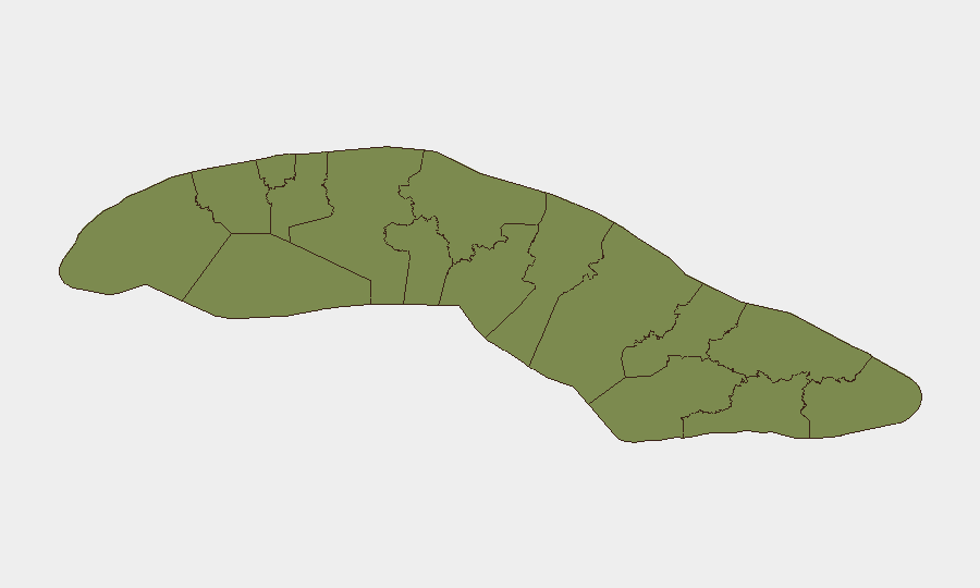
Sancti Spiritus dominates the sub-national risk landscape with a composite score of 32.6—more than double any other province and accounting for the majority of recent event signals. The province's exposure appears tied to infrastructure vulnerability, administrative action, or concentrations of reported friction. Havana (16.9) remains the secondary hotspot, reflecting diplomatic, commercial, and population-density factors, plus visibility bias in event reporting. All other provinces register below 4.0 and are not materially elevated relative to the national baseline.
Security teams with personnel or assets in Sancti Spiritus should treat that province as the primary watch area; Havana warrants standard due-care monitoring for expatriate safety and business continuity.
How GeoBit Would Assist
AOI Monitoring & Early Warning would enable persistent, real-time watch on Sancti Spiritus and Havana, with alert rules for protest, security deployments, infrastructure disruptions, or administrative actions affecting business operations. Multi-language OSINT & X/Twitter intelligence paired with entity extraction and temporal analysis would surface and timestamp incident reports and official statements, filtering out historical context and speculation. Conflict mapping and regime-stability assessment would help distinguish routine governance friction from indicators of systemic instability requiring evacuation or asset protection.
7-Day Outlook
No indicators suggest acute escalation or widespread unrest in the next seven days. U.S. diplomatic tension and infrastructure strain will likely persist as structural drivers, with incremental regulatory or commercial enforcement possible. Monitoring should remain focused on Sancti Spiritus incident frequency and any amplification of military-force signals.
Highest-Risk Areas — Ranked
| # | State / Region | Risk |
|---|---|---|
| 1 | Sancti Spiritus | 32.6 |
| 2 | Havana | 16.9 |
| 3 | Las Tunas | 3.7 |
| 4 | Holguín | 3.7 |
| 5 | Villa Clara | 3.4 |
| 6 | Pinar del Rio | 3 |
| 7 | Matanzas | 3 |
| 8 | Artemisa | 2.6 |
| 9 | Mayabeque | 2.6 |
| 10 | Cienfuegos | 2.6 |
| 11 | Isle of Youth | 2.6 |
| 12 | Ciego de Avila | 2.6 |
Sources
Previous Daily Briefs
A new Cuba brief is written every day — each with its own risk map and downloadable CSV. Here's the last week; use the calendar to go further back.
📅 Browse every day by calendar →
Highlighted days have a brief. Tap a day for that day's map & analysis, or “csv” for that day's dataset ($5).