Situation Summary
El Salvador's security environment remains elevated but contained, with a composite national threat score of 16 and three tracked events in the current reporting window. Natural hazard signals (seismic activity and flooding) are dominating the threat feed, while the underlying gang and organized-crime landscape remains in a state of relative operational constraint consistent with sustained security force pressure over the past 18 months. The absence of major incident escalation in the last 24–48 hours suggests stability, though Cabañas Department continues to register substantially higher risk (31.3) than all other regions, indicating persistent localized criminal or gang activity.
Key Developments
- Seismic Activity (South Pacific, El Salvador EEZ). Two magnitude 4.4 earthquakes recorded approximately 109–112 km south of Puerto El Triunfo within recent days. No damage or casualties reported; however, proximity to coastal infrastructure warrants continued monitoring for secondary hazards (tsunamis, landslides in adjacent terrain).
- Hydrological Alert. Recent flooding event (ID: 1103930) reported in El Salvador; alert status escalated to orange/yellow in at least one zone. Specific location, duration, and damage estimates not yet confirmed in independent sources. Typical impacts include transport disruption and displacement in low-lying and coastal areas.
- Limited Corroborating Event Reporting. Web research conducted in the last 24 hours did not surface independently verified incident reports (criminal, security-force, or gang-related) with specific dates and locations for the period 2026-06-14 to 2026-06-15. A public statement attributed to El Salvador (2026-06-13) and an unrelated investigative matter (SCIENTIST vs SVALBARD, 2026-06-14) appear in the signal feed but fall outside operational security event scope.
Highest-Risk Areas
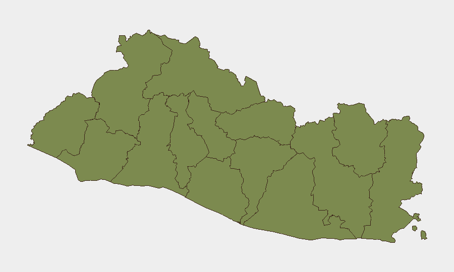
Cabañas Department stands apart with a composite risk score of 31.3—approximately 24 times higher than every other department, which cluster at 1.3. This extreme variance suggests concentrated criminal or gang activity, possibly linked to territorial control, trafficking routes, or extortion networks centered in that region. All other departments (Ahuachapán through San Miguel) present statistically uniform and significantly lower risk profiles, indicating either effective containment measures or lower baseline criminal density. Organizations with personnel or assets in Cabañas should maintain elevated situational awareness and implement area-specific protective measures; operations in the remainder of the country face baseline regional risk consistent with Central American norms.
How GeoBit Would Assist
Security teams should employ Intel Sweep and OSINT fusion to monitor Cabañas Department and surrounding zones for gang-related incident escalation, trafficking indicators, and force-response activity. AOI Monitoring & Early Warning on Cabañas and key corridors (e.g., northern highways, ports) will provide persistent watch and alert capability for emerging incidents before they reach mainstream reporting. Environmental & Health monitoring (integrated with seismic and flood tracking) enables proactive logistics and personnel routing adjustments, while Routing & Network Analysis supports real-time journey planning around hazard zones and high-risk departments.
7-Day Outlook
Natural hazards (seismic aftershock risk and residual flooding) are likely to persist in the next 7 days and may disrupt transport and supply chains in coastal and low-lying areas. Gang and organized-crime activity is expected to remain within current operational baseline; no indicators suggest imminent escalation nationally, though Cabañas Department remains a persistent flashpoint requiring continuous monitoring.
Highest-Risk Areas — Ranked
| # | State / Region | Risk |
|---|---|---|
| 1 | Cabañas Department | 31.3 |
| 2 | Ahuachapán Department | 1.3 |
| 3 | Sonsonate Department | 1.3 |
| 4 | Santa Ana Department | 1.3 |
| 5 | Chalatenango Department | 1.3 |
| 6 | La Libertad Department | 1.3 |
| 7 | San Salvador Department | 1.3 |
| 8 | Cuscatlán Department | 1.3 |
| 9 | La Paz Department | 1.3 |
| 10 | San Vicente Department | 1.3 |
| 11 | Usulután Department | 1.3 |
| 12 | San Miguel Department | 1.3 |
Sources
Previous Daily Briefs
A new El Salvador brief is written every day — each with its own risk map and downloadable CSV. Here's the last week; use the calendar to go further back.
📅 Browse every day by calendar →
Highlighted days have a brief. Tap a day for that day's map & analysis, or “csv” for that day's dataset ($5).