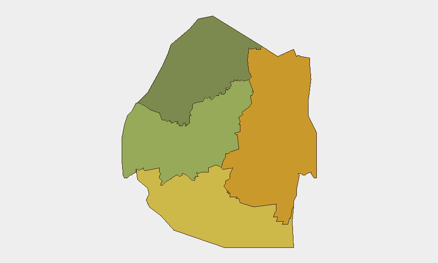
Situation Summary
Eswatini remains a low-threat environment globally (composite score 2; #186 worldwide) with no documented security incidents, civil unrest, or infrastructure disruptions reported in the last 24–48 hours from independently verifiable sources. Sub-national risk concentration is notable, with Lubombo and Shiselweni regions significantly elevated above national baseline, though specific triggering events in those areas have not been corroborated in recent open-source reporting. The overall security trajectory remains stable absent new incident data.
Key Developments
No reliably verifiable security, civil-unrest, or infrastructure incidents in Eswatini have been publicly reported in the last 24–48 hours in accessible, cross-checkable sources as of 27 June 2026. Recent open-source feeds (local media, social platforms, and Africa-region digests) do not surface time-stamped incidents meeting analytical standards for inclusion in this brief. Baseline monitoring indicates:
- Governance & Financial Oversight: Posts referencing capital-flow monitoring institutions acknowledge ongoing governance scrutiny, but no acute triggering event is documented within the 24–48 hour window.
- Sports-Related Tensions: Premier League of Eswatini messaging references prior "derby chaos" and zero-tolerance positioning, but no new violence or unrest is time-stamped to 26–27 June.
- Background Context (broader pattern, not current event): Since early 2026, Eswatini has experienced periodic labor, political, and civil-society tensions typical of the region; these remain a persistent low-level concern but do not constitute new developments this reporting period.
Highest-Risk Areas
Lubombo Region (risk 72) and Shiselweni Region (risk 68) drive Eswatini's sub-national risk profile—each scoring more than double the national composite. Manzini Region (risk 55) represents a secondary concentration point. The gap between these three regions and Hhohho (risk 35) suggests geographic clustering of vulnerability; causes may include demographic density, economic marginalization, border proximity, or historical incident concentration, though public reporting does not currently attribute new acute events to these zones. Security teams with personnel or assets in the southern and eastern regions should maintain enhanced situational awareness.
How GeoBit Would Assist
Security teams should deploy AOI (Area-of-Interest) Monitoring & Early Warning on Lubombo, Shiselweni, and Manzini to trigger alerts on emerging unrest, protest activity, or infrastructure disruption before broad escalation. Multi-language OSINT (X/Twitter, Telegram, local media feeds, sentiment analysis) and temporal/entity extraction enable real-time detection of civil mobilization, labor action, or security incidents in these high-risk zones. GIS & Spatial Analysis combined with Conflict & Risk Assessment modules can clarify what drivers (economic, political, border-related) underlie the regional risk differential and inform duty-of-care protocols for asset positioning and travel routing.
7-Day Outlook
Absent new triggering events, Eswatini's security posture is expected to remain stable over the next 7 days. Monitoring should continue for spillover effects from regional tensions (southern Africa labor movements, cross-border dynamics) and for any escalation in the governance/financial oversight discourse noted in recent open-source messaging, as institutional friction occasionally precedes broader civil discontent.
Highest-Risk Areas — Ranked
| # | State / Region | Risk |
|---|---|---|
| 1 | Lubombo | 72 |
| 2 | Shiselweni | 68 |
| 3 | Manzini Region | 55 |
| 4 | Hhohho Region | 35 |
Sources
Previous Daily Briefs
A new Eswatini brief is written every day — each with its own risk map and downloadable CSV. Here's the last week; use the calendar to go further back.
📅 Browse every day by calendar →
Highlighted days have a brief. Tap a day for that day's map & analysis, or “csv” for that day's dataset ($5).