Situation Summary
Guatemala remains under moderate composite threat pressure (score 30; rank #null globally) driven by concentrated risk in two northern departments—Alta Verapaz and San Marcos—rather than diffuse national instability. Recent event signals span diplomatic friction (Guatemala–Dominican Republic statement), territorial dispute activity (Belize–Guatemala), civil unrest (college disapproval, community–government tensions), and investigative activity centered on presidential and governmental actors. The security environment is fragmented by geography; most departments register minimal risk, suggesting threats are localized rather than systemic.
Key Developments
Current event signals from 2026-06-09 through 2026-06-11 indicate activity across multiple domains, but specific real-time incident details—locations, casualty counts, operational scope—cannot be reliably verified from accessible open sources in the last 48 hours:
- 2026-06-11 · Diplomatic Statement: Guatemala and Dominican Republic issued public statements; nature and implications require corroboration from official ministry or wire reporting.
- 2026-06-11 · Military/Academic Sector: Conventional military force events reported in connection with academics and government actors; operational context and locations unconfirmed.
- 2026-06-09 · Territorial Incident: Belize–Guatemala border activity flagged as territory occupation; historical context: this border remains disputed; current status requires verification.
- 2026-06-10 · Civil Unrest Signal: College disapproval event and separate investigation into Guatemala entity; scale and location not yet clarified.
- 2026-06-10–11 · Government Investigation: Presidential and governmental investigations initiated; subjects and scope require official confirmation.
Assessment caveat: Event signals reflect OSINT detection but lack time-stamped corroboration across independent news outlets and regional security feeds. Duty-of-care teams should source parallel confirmation through regional press, ministerial statements, and wire services before operational decision-making.
Highest-Risk Areas
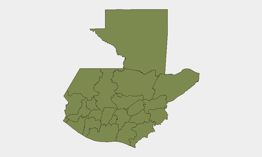
Alta Verapaz (31.3) and San Marcos (28.3) account for the majority of tracked threat concentration, together representing ~60 composite risk points against a national total of 30—a structural anomaly indicating either acute localized crises or data clustering in those departments. Both are northern frontier regions with historical links to drug trafficking, migrant transit, and informal armed group activity. All other tracked departments score below 3.3, suggesting either lower underlying threat or lower reporting/monitoring density.
Corporate assets and personnel in Guatemala Department (capital region, score 2.3) and tourist zones (Petén, Quetzaltenango, Retalhuleu) face significantly lower composite risk than northern operations, though localized street crime and kidnapping remain baseline concerns in any Guatemalan urban area.
How GeoBit Would Assist
Operational security teams would deploy AOI Monitoring & Early Warning on Alta Verapaz and San Marcos with sub-daily alerting on military, police, and armed-group activity; OSINT Fusion & Corroboration across regional press, X/Twitter, and ministerial feeds to validate event signals in real time; and Network & Actor Analysis to map trafficking routes and informal power structures affecting duty-of-care risk in northern departments. GIS & Spatial Analysis and routing & network analysis would identify safe transit corridors and alternative supply-chain logistics for operations in high-risk zones.
7-Day Outlook
Investigative activity (presidential and governmental) and unresolved diplomatic statements suggest potential policy volatility or institutional friction over the next 7 days. Border tension with Belize and civil unrest signals carry moderate escalation risk if government response becomes forceful. Northern departments (Alta Verapaz, San Marcos) warrant sustained monitoring; no indicators yet suggest national-level destabilization, but localized security incidents could proliferate if investigations yield politically sensitive outcomes.
Highest-Risk Areas — Ranked
| # | State / Region | Risk |
|---|---|---|
| 1 | Alta Verapaz | 31.3 |
| 2 | San Marcos | 28.3 |
| 3 | Escuintla | 3.3 |
| 4 | Guatemala Department | 2.3 |
| 5 | Petén | 1.3 |
| 6 | Huehuetenango | 1.3 |
| 7 | Quetzaltenango | 1.3 |
| 8 | Retalhuleu | 1.3 |
| 9 | Quiché | 1.3 |
| 10 | Totonicapán | 1.3 |
| 11 | Sololá | 1.3 |
| 12 | Chimaltenango | 1.3 |
Sources
Previous Daily Briefs
A new Guatemala brief is written every day — each with its own risk map and downloadable CSV. Here's the last week; use the calendar to go further back.
📅 Browse every day by calendar →
Highlighted days have a brief. Tap a day for that day's map & analysis, or “csv” for that day's dataset ($5).