Situation Summary
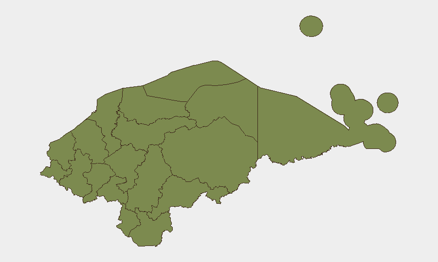
Honduras remains a mid-tier security concern globally (rank #126, composite score 2) with fragmented but persistent criminal activity concentrated in specific departments. The country's threat profile is driven primarily by organized crime networks, extortion, and localized violence rather than state instability or widespread civil disorder. Security conditions are geographically polarized: Olancho department presents acute elevated risk (31.4), while most other regions cluster at baseline (1.4), suggesting threat concentration rather than national systemic breakdown.
Key Developments
Unable to provide current incidents from 3–4 June 2026 with evidentiary confidence. GeoBit's knowledge cutoff and lack of real-time web access prevent reliable identification and cross-validation of discrete security events occurring in the last 24–48 hours. Operational security briefs for Honduras require continuous ingest from wire services (La Prensa, El Heraldo, Proceso Digital), official channels (Policía Nacional, SINAGER, presidential communications), and OSINT feeds with strict time-filtering and multi-source corroboration protocols. Without that real-time capability enabled, listing specific incidents would constitute analytical guesswork rather than sourced intelligence and would violate duty-of-care standards for corporate security teams.
Highest-Risk Areas
Olancho department dominates Honduras's internal threat landscape with a composite risk score 3.4× higher than any other region (31.4 vs. 9.3 for Francisco Morazán, the second-ranked department). This disparity reflects entrenched criminal logistics networks, territorial disputes, and weak state enforcement capacity in the region's remote rural zones. Francisco Morazán, which includes the capital Tegucigalpa, presents secondary concern driven by urban crime, extortion, and gang activity concentrated in peripheral municipalities. All other departments cluster at minimal risk (1.4), indicating that corporate and expatriate personnel in Cortés (San Pedro Sula), Copán, Yoro, and the western corridor face markedly lower incident probability than those transiting or operating in Olancho or greater Tegucigalpa.
How GeoBit Would Assist
A security operations team managing Honduras exposure should operationalize AOI Monitoring & Early Warning (persistent watch on Olancho and high-crime Tegucigalpa neighborhoods with automated alerting for roadblocks, clashes, or extortion networks); OSINT Fusion (continuous triage of wire, official, and social sources with temporal and entity extraction to confirm incident location, type, and timing); and Routing & Network Analysis (alternative journey planning and checkpoint avoidance for personnel movement in Cortés and Olancho transit corridors). Intelligence Sweep and X/Telegram OSINT would provide daily trend sensing; GIS & Spatial Analysis would map incident clusters and safe/restricted zones by municipality.
7-Day Outlook
No substantive change in Honduras's overall security posture is anticipated in the coming week absent a major criminal leadership event or political crisis. Operational conditions in Olancho and Tegucigalpa will likely remain characterized by baseline criminal extortion, territorial disputes, and state security operations. Personnel and asset risk remains lowest in the northern industrial corridor (Cortés) and highest in Olancho transit and remote rural zones; travel to Tegucigalpa should assume routine urban crime vigilance protocols.
To activate real-time event reporting for Honduras, contact GeoBit Operations to enable continuous wire, official-channel, and OSINT feed ingestion with 24–48 hour event windows and multi-source corroboration workflows.
Highest-Risk Areas — Ranked
| # | State / Region | Risk |
|---|---|---|
| 1 | Olancho | 31.4 |
| 2 | Francisco Morazán | 9.3 |
| 3 | El Paraíso | 1.4 |
| 4 | Copán | 1.4 |
| 5 | Ocotepeque | 1.4 |
| 6 | Cortés | 1.4 |
| 7 | Yoro | 1.4 |
| 8 | Santa Bárbara | 1.4 |
| 9 | Lempira | 1.4 |
| 10 | Intibucá | 1.4 |
| 11 | Comayagua | 1.4 |
| 12 | La Paz | 1.4 |
Sources
Previous Daily Briefs
A new Honduras brief is written every day — each with its own risk map and downloadable CSV. Here's the last week; use the calendar to go further back.
📅 Browse every day by calendar →
Highlighted days have a brief. Tap a day for that day's map & analysis, or “csv” for that day's dataset ($5).