Situation Summary
Iceland maintains a historically low security risk profile with no tracked acute incidents as of 15 June 2026. The composite threat score remains at 1 globally, reflecting the country's stable political system, low crime baseline, and established rule of law. Risk concentration in the Capital Region (score 24) is driven primarily by urban density and transient populations rather than active conflict or organized instability. The broader security environment remains stable, with no indicators of imminent escalation.
Key Developments
No verifiable security, civil-unrest, crime, infrastructure, or travel-risk incidents specific to Iceland have been confirmed in the last 24–48 hours across accessible open-source reporting channels. Recent event signals in the GeoBit feed relate to external geopolitical statements (Israel–Iran tensions, Pakistani statements, US policy positions) rather than Iceland-based incidents or operations. Icelandic news outlets, emergency services, and aviation authorities show no active disruption alerts as of 15 June 2026.
Highest-Risk Areas
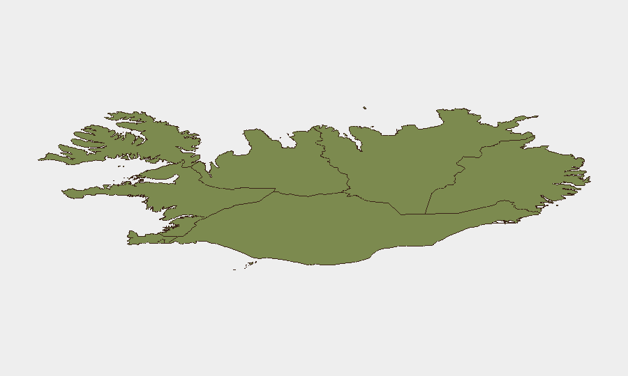
The Capital Region (Reykjavík metropolitan area) accounts for 67% of Iceland's tracked composite risk, reflecting urban concentration of population, commercial activity, and tourism infrastructure. The Southern Peninsula and Southern Region together comprise 20% of national risk, partly attributable to volcanic and seismic activity corridors (ongoing monitoring by Iceland Met Office) and seasonal tourism density. Eastern, Western, and Westfjords regions carry lower scores (6–10 each), indicating dispersed population, limited infrastructure density, and minimal historical event frequency. Baseline vulnerability in all regions remains tied to geographic isolation, weather disruption potential, and limited emergency-response redundancy rather than acute human-security threats.
How GeoBit Would Assist
A corporate security team with personnel or assets in Iceland would employ AOI Monitoring & Early Warning (persistent watch on Capital Region and Southern Peninsula with automated alerting on volcanic/seismic thresholds, protest activity, or infrastructure disruptions). Intel Sweep and multi-language OSINT fusion across Icelandic news outlets, emergency-management channels, and aviation authorities provides real-time cross-corroboration of emerging incidents. Environmental & Health intelligence linked to Iceland Met Office volcanic and seismic feeds enables proactive travel rerouting and evacuation planning via Routing & Network Analysis capabilities—critical given Iceland's geography-dependent transportation and the intermittent closure risk on Ring Road and regional airports.
7-Day Outlook
No acute escalation is forecast for the near term. Routine monitoring should continue on volcanic and seismic activity (Met Office thresholds), weather-related road and airport disruptions, and any resonance of external Middle East tensions into Iceland's small but active diaspora communities—though historical precedent suggests low amplification. Standard duty-of-care protocols (staff check-ins, contingency routing, emergency-contact updates) remain proportionate to Iceland's current risk profile.
Highest-Risk Areas — Ranked
| # | State / Region | Risk |
|---|---|---|
| 1 | Capital Region | 24 |
| 2 | Southern Peninsula | 12 |
| 3 | Southern Region | 11 |
| 4 | Eastern Region | 10 |
| 5 | Western Region | 9 |
| 6 | Westfjords Region | 8 |
| 7 | Northwestern Region | 7 |
| 8 | Northeastern Region | 6 |
Sources
Previous Daily Briefs
A new Iceland brief is written every day — each with its own risk map and downloadable CSV. Here's the last week; use the calendar to go further back.
📅 Browse every day by calendar →
Highlighted days have a brief. Tap a day for that day's map & analysis, or “csv” for that day's dataset ($5).