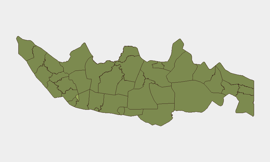
Situation Summary
Indonesia's composite threat score of 36.5 (rank #36 globally) reflects persistent volatility across multiple security domains—including unconventional violence, police-involved armed incidents, and investigative activity linked to extremist networks—concentrated heavily in Jakarta and secondary urban centres. The past 48 hours have generated event signals spanning armed encounters, religious investigation, and high-level political statements, suggesting active operational tempo rather than quiescence. This risk profile demands continuous sub-national monitoring, particularly in the capital and eastern regions where security force engagement remains elevated.
Key Developments
Signal data from 2–4 June indicates:
- 2026-06-04, unconventional violence (actor unspecified): An incident categorised as unconventional violence occurred but precise location and casualty/impact details are not yet disambiguated in available signals.
- 2026-06-04, investigative activity (Islam-linked): Indonesian authorities initiated or continued investigation linked to Islamic networks; no immediate casualty or incident profile is available in current data.
- 2026-06-02, armed police engagement (Jakarta): Conventional military force deployment involving police operations in the capital region; nature and outcome require field confirmation.
- 2026-06-02, armed police engagement (actor vs police): A second police-involved armed encounter on the same date; location(s) and combatant identities remain under-specified in signal feed.
- 2026-06-02, military activity (Yogyakarta): Conventional military force deployment recorded in the Special Region; operational context unclear from event signal alone.
- 2026-06-02, small arms combat (police): Armed engagement involving police firearms; scale and location not yet disaggregated.
- 2026-06-02, multiple high-level public statements: The King, Indonesian government, Cabinet, and at least one corporate entity released public statements; a government statement referenced Mecca, suggesting possible religious or diplomatic dimension.
Note: Open-web indexing has not returned incident-level corroboration or tactical detail for these signals within the last 24–48 hours. GeoBit event signals are being tracked; ground-truth verification and impact assessment are pending.
Highest-Risk Areas
Jakarta's composite risk score of 55.5—nearly 70% above the national average—drives Indonesia's overall threat profile and reflects density of political, criminal, and extremist networks in the capital. South Sulawesi (33.1), North Sumatra (31.7), East Java (31.7), and South Sumatra (31.7) form a secondary risk tier, each exhibiting regional instability, organised crime presence, or historical militancy. West Java and the Special Region of Yogyakarta (both 28.9) round out the top ten, with Yogyakarta's academic and youth density creating particular vulnerability to recruitment and mobilisation. Corporates and duty-of-care teams should treat Jakarta as the primary exposure zone; secondary concentration in South Sulawesi and the eastern Java/Sumatra corridor warrants contingency planning.
How GeoBit Would Assist
Security teams should employ AOI Monitoring & Early Warning for Jakarta, Yogyakarta, and South Sulawesi to detect incident escalation before public reporting; Network & Actor Analysis to map relationships between investigative targets and operational cells; and Intel Sweep (X/Telegram OSINT, multi-language feeds) to track religious and political sentiment shifts that often precede mobilisation. GIS & Spatial Analysis combined with conflict mapping will isolate safe transit corridors and identify secondary-effect risks (demonstrations, checkpoints, infrastructure disruption) around armed incidents.
7-Day Outlook
Near-term trajectory suggests sustained investigative pressure on extremist networks coupled with visible police operations, likely to generate public statements and possible short-term transport/administrative disruptions. Risk of escalation from police engagement into broader civil unrest remains moderate if incidents are perceived as heavy-handed; absence of confirmed mass-casualty events in the last 48 hours does not rule out tactical retaliation or copycat activity within 7 days. Continuous signal monitoring and local-source corroboration are essential.
Highest-Risk Areas — Ranked
| # | State / Region | Risk |
|---|---|---|
| 1 | Special capital Region of Jakarta | 55.5 |
| 2 | South Sulawesi | 33.1 |
| 3 | North Sumatra | 31.7 |
| 4 | East Java | 31.7 |
| 5 | South Sumatra | 31.7 |
| 6 | West Java | 29.3 |
| 7 | West Kalimantan | 28.9 |
| 8 | Special Region of Yogyakarta | 28.9 |
| 9 | Banten | 27.9 |
| 10 | Central Kalimantan | 27.7 |
| 11 | Central Java | 26.7 |
| 12 | South Papua | 26.5 |
Sources
Previous Daily Briefs
A new Indonesia brief is written every day — each with its own risk map and downloadable CSV. Here's the last week; use the calendar to go further back.
📅 Browse every day by calendar →
Highlighted days have a brief. Tap a day for that day's map & analysis, or “csv” for that day's dataset ($5).