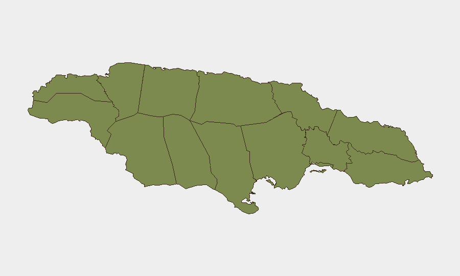
Situation Summary
Jamaica is experiencing a significant spike in gun violence, with 11 fatal shootings recorded in a single 24-hour period as of 8 July—among the most intense short-term surges in recent years. Multiple parishes across the island have been affected by coordinated robberies and shootings linked to organized criminal syndicates, with a 48-hour curfew imposed on March Pen (Saint Catherine) following multiple killings. The national security apparatus has responded with intensified police operations, including the arrest of high-profile wanted individuals, but the rapid clustering of incidents suggests elevated operational tempo among criminal networks.
Key Developments
- March Pen, Saint Catherine (8 July): Police imposed a 48-hour curfew following a spike in fatal shootings, with multiple murders in the community contributing to the wider 24-hour violence spike.
- Island-wide (7–8 July): Jamaica recorded 11 fatal shootings within a 24-hour period, with incidents reported across multiple parishes and characterized as one of the most intense surges in short-term gun violence in recent memory.
- Deanery Road, Kingston (8 July, ~13:36): Armed men conducted a robbery and shooting at a Total service station; investigators link the group to a wider criminal syndicate responsible for similar incidents across the island.
- Multiple parishes (7–8 July): A series of robberies and shootings were reported across multiple locations; a 16-year-old student was killed in one incident, described as part of heightened criminal activity island-wide.
- National arrests (early July): The Jamaica Constabulary Force arrested Oshane "Chucky" Morris, wanted for murder and possession of a prohibited weapon, as part of operations targeting key violent actors.
- National security posture (7–8 July): The Minister of National Security reaffirmed a hard-line stance against criminals, citing murders down in several police divisions but acknowledging ongoing high-profile violent incidents and the need for sustained operations.
Highest-Risk Areas
Trelawny and Saint Catherine dominate the risk ranking, with composite scores of 31.5 and 29.5 respectively, and account for the majority of tracked security events. Saint Catherine is the immediate focus, given the March Pen curfew and the concentration of shootings and robberies in Kingston (Saint Andrew) and surrounding areas over the past 48 hours. The clustering of incidents in these two parishes suggests either territorial gang activity or coordinated criminal operations; Saint James (4.6) remains elevated but lower. All other parishes show minimal tracked activity, indicating risk is heavily concentrated in the Kingston metropolitan area and the northwest corridor.
How GeoBit Would Assist
Security teams should deploy AOI Monitoring & Early Warning on Trelawny and Saint Catherine to receive real-time alerts on incident clustering and curfew extensions. OSINT & Intelligence Sweep (X/Twitter, Telegram, local media feeds) will track police announcements, gang communications, and emerging threats faster than official channels. Network & Actor Analysis will map criminal syndicate structure and predict secondary targets based on robbery patterns, while Routing & Network Analysis will identify safer alternative routes for personnel transiting Kingston and Saint Catherine.
7-Day Outlook
The intensity of the 24-hour spike suggests either a territorial conflict escalating or a coordinated criminal operation; either scenario is unlikely to resolve in under one week without major police intervention or arrests. Curfews may expand if shootings continue; business and school disruptions are possible in high-risk parishes. Monitor for secondary effects: checkpoints, transport delays, and potential workforce absences in Kingston and Saint Catherine.
Highest-Risk Areas — Ranked
| # | State / Region | Risk |
|---|---|---|
| 1 | Trelawny | 31.5 |
| 2 | Saint Catherine | 29.5 |
| 3 | Saint James | 4.6 |
| 4 | Westmoreland | 2.6 |
| 5 | Saint Andrew | 2.6 |
| 6 | Hanover | 1.5 |
| 7 | Saint Elizabeth | 1.5 |
| 8 | Manchester | 1.5 |
| 9 | Saint Ann | 1.5 |
| 10 | Clarendon | 1.5 |
| 11 | Saint Mary | 1.5 |
| 12 | Portland | 1.5 |
Sources
Previous Daily Briefs
A new Jamaica brief is written every day — each with its own risk map and downloadable CSV. Here's the last week; use the calendar to go further back.
📅 Browse every day by calendar →
Highlighted days have a brief. Tap a day for that day's map & analysis, or “csv” for that day's dataset ($5).
Atlas — our AI intelligence desk — emails them this snapshot personally. Nothing else, no list.