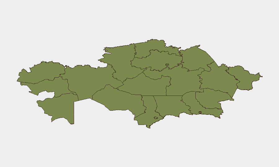
Situation Summary
Kazakhstan remains a low-threat environment with no verified violent incidents, civil unrest, or infrastructure attacks in the 24–48 hours preceding 2026-07-19. The country ranks #132 globally on composite threat metrics, with 228 tracked events but minimal acute security escalation. Recent activity is confined to routine administrative friction, localized safety incidents, and infrastructure maintenance; no indicators suggest imminent shifts in the security posture.
Key Developments
- Kazakhstan–Russia border region (Kostanay/North Kazakhstan), 2026-07-18: Minor earthquake detected along the Kazakhstan–Russia border zone with no reported damage, casualties, or follow-on security implications.
- Forest fire outbreaks, 2026-07-18: Ministry of Ecology reported new fires in Akmola Region, East Kazakhstan Region, and Bayanaul National Park (Pavlodar Region) on state forest lands, creating localized air-quality and fire-safety risks for affected areas and nearby travel routes.
- Almaty city warehouse fire, Rozybakyeva Street 249/1, 2026-07-18: Fire involving lithium-ion batteries and rental electric scooters prompted fire-service response; localized industrial hazard with potential short-term area disruption.
- Aktobe Region travel-agency fraud investigation, 2026-07-18: Police reported ongoing fraud case affecting over 200 residents who lost summer vacation bookings; indicates elevated consumer and travel-service risk in the region.
- Kostanay Region equestrian event incident, 2026-07-18: Child fell from horse at a festive event; regional police opened inquiry; illustrates event-safety concerns but no civil-unrest dimension.
- Kazakhstan eGov portal maintenance, night of 2026-07-18: Electronic government services temporarily suspended for scheduled technical work, affecting administrative and travel-documentation processing.
- Border and customs delays, 2026-07-18: Russian–Kazakh and Kazakhstan–Kyrgyzstan crossing points maintaining tightened fuel-smuggling controls with ongoing administrative delays for passenger and cargo traffic; no escalatory incidents reported in the 16–18 July window.
- Almaty municipal enforcement, 2026-07-18: Authorities continued demolition of illegal building extensions, causing localized disruption (construction, traffic) but reflecting routine enforcement activity.
Highest-Risk Areas
Astana dominates the sub-national risk ranking at 31.8, driven primarily by recent political discourse and administrative activity rather than acute security incidents. Ulytau Region (risk 19) ranks second, though detailed drivers are not prominently reflected in current 24–48 hour reporting. Pavlodar Region (6.1) shows elevated risk partly attributable to forest fire activity detected 2026-07-18. All other tracked regions cluster at low-to-minimal composite scores (1.8–6.1), indicating risk concentration in the capital and selected secondary areas; however, the absence of violent incidents or civil unrest across all regions suggests risk scores reflect administrative, environmental, or political-statement activity rather than immediate kinetic or destabilizing threats.
How GeoBit Would Assist
Security teams with personnel or assets in Kazakhstan should deploy GeoBit's AOI Monitoring & Early Warning capability to track Astana and Ulytau Region for escalatory political or administrative signals, coupled with multi-language OSINT and Telegram/X feeds to monitor emerging civil-unrest indicators. GIS & Spatial Analysis linked to environmental monitoring would flag active fire zones and natural hazards affecting travel corridors and operations. Conflict & Regime-Stability search and Network & Actor Analysis would provide continuous assessment of political tensions and institutional friction.
7-Day Outlook
Near-term trajectory is stable with low probability of acute escalation. Forest fires may persist through warm season, constraining travel and outdoor activity in affected zones. Administrative friction at borders and routine enforcement actions are expected to continue at current low-intensity levels, with no indicators of imminent geopolitical or domestic conflict onset over the next 7 days.
Highest-Risk Areas — Ranked
| # | State / Region | Risk |
|---|---|---|
| 1 | Astana | 31.8 |
| 2 | Ulytau Region | 19 |
| 3 | Pavlodar Region | 6.1 |
| 4 | Turkistan Region | 1.8 |
| 5 | Almaty Region | 1.8 |
| 6 | East Kazakhstan Region | 1.8 |
| 7 | Abay Region | 1.8 |
| 8 | Jetisu Region | 1.8 |
| 9 | West Kazakhstan Region | 1.8 |
| 10 | Atyrau Region | 1.8 |
| 11 | Mangystau Region | 1.8 |
| 12 | Aqtöbe region | 1.8 |
Previous Daily Briefs
A new Kazakhstan brief is written every day — each with its own risk map and downloadable CSV. Here's the last week; use the calendar to go further back.
📅 Browse every day by calendar →
Highlighted days have a brief. Tap a day for that day's map & analysis, or “csv” for that day's dataset ($5).
Atlas — our AI intelligence desk — emails them this snapshot personally. Nothing else, no list.