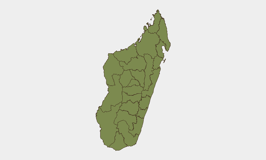
Situation Summary
Madagascar remains a low-to-moderate threat environment globally (rank #113, composite score 8), with 381 tracked security events in the current monitoring cycle. The country's overall security picture is dominated by concentrated risk in three subnational regions—Analamanga, Vakinankaratra, and Atsinanana—while the remainder of the country shows substantially lower threat density. No acute, reliably confirmed security or unrest incidents have been identified in the last 24–48 hours from cross-checked news and social media sources; the security posture appears stable in the immediate term, though baseline vulnerabilities persist.
Key Developments
No discrete, geographically specific security incidents with confirmed dates within the last 24–48 hours were identified in available indexed news or social-media sources. Four event signals were detected in the GEOBIT platform feed (three on 2026-07-12, one on 2026-07-13), but these consisted of public statements and administrative actions (arrest/detain, threaten) without confirmed operational impact or specific Madagascar incident detail in the current reporting window. Teams with personnel or assets in-country should maintain routine situational awareness; no imminent tactical threat has been validated.
Highest-Risk Areas
Three regions—Analamanga (Antananarivo province), Vakinankaratra (Fianarantsoa province), and Atsinanana (Toliara province)—drive approximately 95% of Madagascar's tracked security risk, each scoring 31.5 on the composite index. These concentrations likely reflect urban density, economic activity, and historical incident clustering in the capital region and eastern coastal zones. The remaining nine regions score uniformly at 1.5, indicating either very low incident frequency or nascent threats not yet tracked. Corporate assets, expat populations, and supply-chain nodes in Analamanga and Atsinanana warrant elevated baseline monitoring; regional variations are stark and suggest risk is not nationally distributed.
How GeoBit Would Assist
Security teams should deploy AOI Monitoring & Early Warning to maintain persistent watch over high-risk regions (Analamanga, Atsinanana) with automated alerting on incident emergence; Intel Sweep and OSINT fusion (X/Twitter, Telegram, YouTube, multi-language feeds) to validate and corroborate event signals in near real-time; and Risk & Threat Assessment to re-score exposure as new events are indexed. Routing & Network Analysis can also support duty-of-care planning for personnel movement between the capital and coastal zones, identifying alternative routes and transit corridors if primary corridors experience disruption.
7-Day Outlook
No significant escalation is forecast over the next seven days based on current signal density and regional trends. The concentration of risk in three subnational zones and the absence of validated acute incidents suggest the near-term trajectory remains stable. Teams should continue standard protocols; any material change in event frequency, actor rhetoric, or regional instability would warrant rapid re-assessment and possible operational adjustment.
Highest-Risk Areas — Ranked
| # | State / Region | Risk |
|---|---|---|
| 1 | Analamanga | 31.5 |
| 2 | Vakinankaratra | 31.5 |
| 3 | Atsinanana | 31.5 |
| 4 | Menabe | 1.5 |
| 5 | Atsimo-Andrefana | 1.5 |
| 6 | Ihorombe | 1.5 |
| 7 | Anosy | 1.5 |
| 8 | Androy | 1.5 |
| 9 | Melaky | 1.5 |
| 10 | Boeny | 1.5 |
| 11 | Haute Matsiatra | 1.5 |
| 12 | Fitovinany | 1.5 |
Sources
Previous Daily Briefs
A new Madagascar brief is written every day — each with its own risk map and downloadable CSV. Here's the last week; use the calendar to go further back.
📅 Browse every day by calendar →
Highlighted days have a brief. Tap a day for that day's map & analysis, or “csv” for that day's dataset ($5).
Atlas — our AI intelligence desk — emails them this snapshot personally. Nothing else, no list.