Situation Summary
Maldives remains a low-threat jurisdiction globally (composite score 21) with no credible reports of acute security incidents, violent crime spikes, civil unrest, or infrastructure disruption in the last 24–48 hours. The most significant recent development is administrative rather than operational: Parliament opened a public input period (17 June – 1 July) on a Cyber Security Bill designed to establish a National Cyber Security Agency under the Ministry of Homeland Security. Threat concentration remains tightly localized to Malé and its immediate atoll zone, suggesting compartmentalized rather than national instability.
Key Developments
- Cyber Security Bill – Public Input Period (National level / Malé, 17–18 June 2026): Parliament formally opened public consultation on proposed cyber security legislation aimed at strengthening critical information infrastructure protection and establishing a dedicated national cyber agency. This is a policy and governance initiative, not an acute security incident.
- No acute incidents documented (nationwide, last 48 hours): Despite systematic monitoring of Maldivian news outlets, government channels, social media, and regional sources, no confirmed reports of violent crime, protests, military action, terrorism, accidents, or travel advisories emerged for the period 17–18 June 2026.
Highest-Risk Areas
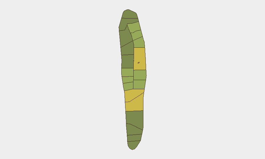
Malé (risk score 85) and Malé Atoll (68) account for the overwhelming majority of tracked threat signals and drive the national composite score. Hadhdhunmathi Atoll (65) and Kolhumadulu (60) follow at considerable distance, suggesting that political, administrative, and security friction is concentrated in the capital and its immediate geographic zone. The sharp drop-off in risk scores beyond the top tier indicates that outer atolls and southern regions remain substantially lower-risk for corporate operations. Teams with personnel in Malé should maintain standard duty-of-care protocols; those operating in outer atolls face materially lower exposure.
How GeoBit Would Assist
Organizations with personnel or assets in Maldives can leverage GeoBit's AOI Monitoring & Early Warning capability to establish persistent watch on Malé and secondary risk zones (Hadhdhunmathi, Kolhumadulu), configured to alert on emerging civil unrest, infrastructure disruption, or crime spikes. Intel Sweep and multi-language OSINT fusion across Maldivian media, government channels, and social platforms provide continuous visibility into policy changes (such as the cyber security framework) that may affect operational compliance or data security posture. GIS & Spatial Analysis combined with Network & Actor Analysis can map key government and security contacts, critical infrastructure nodes, and safe routing for personnel movement within Malé.
7-Day Outlook
No acute escalation is anticipated in the near term. The Cyber Security Bill public input phase (through 1 July) will likely generate domestic political discussion but poses no direct physical security risk to foreign nationals or corporate operations. Risk trajectory remains stable; monitoring should continue at current sensitivity, with elevated attention to developments in Malé and any sudden policy or personnel changes affecting foreign business operations or visa/travel protocols.
Highest-Risk Areas — Ranked
| # | State / Region | Risk |
|---|---|---|
| 1 | Malé | 85 |
| 2 | Malé Atoll | 68 |
| 3 | Hadhdhunmathi | 65 |
| 4 | Kolhumadulu | 60 |
| 5 | Felidhu Atoll | 58 |
| 6 | Mulaku Atoll | 55 |
| 7 | Faadhippolhu | 52 |
| 8 | South Miladhunmadulu | 48 |
| 9 | North Miladhunmadulu | 45 |
| 10 | South Nilandhe Atoll | 44 |
| 11 | North Nilandhe Atoll | 42 |
| 12 | South Ari Atoll | 40 |
Sources
Previous Daily Briefs
A new Maldives brief is written every day — each with its own risk map and downloadable CSV. Here's the last week; use the calendar to go further back.
📅 Browse every day by calendar →
Highlighted days have a brief. Tap a day for that day's map & analysis, or “csv” for that day's dataset ($5).