Situation Summary
Nicaragua remains a moderate-risk environment (global rank #67) with a composite threat score of 17 across 45 tracked events. The security posture is heavily concentrated in the South Caribbean Coast region, which accounts for disproportionate risk relative to the rest of the country. Recent signals include domestic political statements, international diplomatic posturing, and weather-related hazards; no acute security incidents have been confirmed in the last 24–48 hours.
Key Developments
Limitation note: Available open-source intelligence for the past 24–48 hours does not contain sufficient detail to corroborate specific, localized security events in Nicaragua. The most recent signals in the GeoBit event feed include:
- 2026-07-05 · Managua (inferred) — Domestic public statement registered; no attack, casualty, or operational impact confirmed.
- 2026-07-04 · National — Religious institutional statement; context and implications require clarification.
- 2026-07-04 · National — Diplomatic posturing between external actors (Cuba, U.S. Texas officials) regarding Nicaragua; no direct Nicaraguan territory impact detected.
- 2026-07-03 · Miami area — External commentary on a Nicaraguan presidential candidate; no domestic threat event confirmed.
- Recent · South Caribbean Coast (inferred) — Flood event (ID 1103938) reported; potential for localized displacement, access disruption, and secondary health/sanitation risks in already high-risk region.
Recommendation: Duty-of-care teams with personnel in Nicaragua should request real-time X/Twitter and regional media feeds to fill gaps in event confirmation and geographic specificity.
Highest-Risk Areas
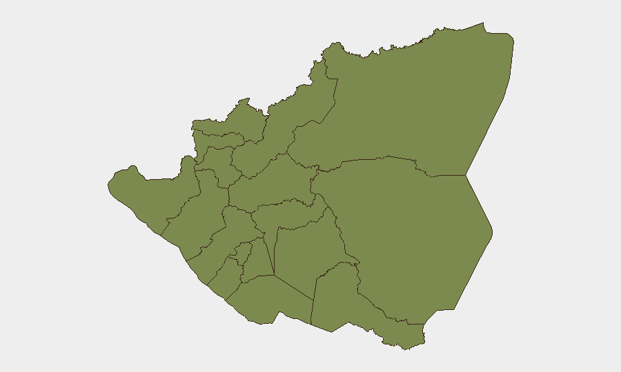
The South Caribbean Coast dominates the risk profile with a composite score of 31.4—nearly four times the next-highest region. This zone encompasses remote, under-resourced territories historically affected by narcotics trafficking, illegal migration networks, and limited state presence. Estelí Department (score 8.9) represents the secondary concentration, likely reflecting gang activity and inter-cartel violence patterns documented over preceding months.
Remaining departments (Carazo, Chontales, Rivas, Río San Juan, Chinandega, Nueva Segovia, Madriz, León, Managua, Masaya) show uniform baseline risk (1.4 each), indicating distributed but lower-severity threat vectors. The capital, Managua, remains operationally accessible but requires standard urban crime awareness (robbery, vehicle theft, kidnapping targeting high-net-worth individuals).
How GeoBit Would Assist
Security teams should employ Intel Sweep and global event feeds to monitor day-to-day incident reporting across Nicaragua, complemented by X/Twitter and Telegram OSINT to capture real-time local chatter and activist/media sources often ahead of official confirmation. AOI (Area-of-Interest) Monitoring with persistent alerting on the South Caribbean Coast and Estelí would provide early warning of escalating gang or trafficking activity. Satellite & Imagery analysis can track displacement and infrastructure damage from flooding or criminal activity, while Routing & Network Analysis supports secure movement planning for personnel in high-risk zones.
7-Day Outlook
No imminent major security deterioration is signaled. The recent flood in the South Caribbean Coast may exacerbate access and humanitarian conditions over the next week; corporate teams should confirm supply-chain and personnel-movement contingencies. Diplomatic rhetoric regarding Cuba and U.S. posturing is unlikely to trigger direct operational risk to civilians or assets in-country. Routine criminal activity in Estelí and the Caribbean coast should be treated as baseline; escalation above current levels would be flagged by enhanced monitoring.
Highest-Risk Areas — Ranked
| # | State / Region | Risk |
|---|---|---|
| 1 | South Caribbean Coast | 31.4 |
| 2 | Estelí Department | 8.9 |
| 3 | Carazo Department | 1.4 |
| 4 | Chontales Department | 1.4 |
| 5 | Rivas Department | 1.4 |
| 6 | Río San Juan Department | 1.4 |
| 7 | Chinandega Department | 1.4 |
| 8 | Nueva Segovia Department | 1.4 |
| 9 | Madriz Department | 1.4 |
| 10 | León Department | 1.4 |
| 11 | Managua Department | 1.4 |
| 12 | Masaya Department | 1.4 |
Sources
Previous Daily Briefs
A new Nicaragua brief is written every day — each with its own risk map and downloadable CSV. Here's the last week; use the calendar to go further back.
📅 Browse every day by calendar →
Highlighted days have a brief. Tap a day for that day's map & analysis, or “csv” for that day's dataset ($5).
Atlas — our AI intelligence desk — emails them this snapshot personally. Nothing else, no list.