Situation Summary
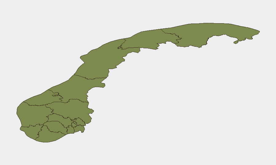
Norway remains a low-threat environment globally (composite score 40/100, rank #null) with modest localized risk concentrated in Innlandet and Oslo regions. Over the last 24–48 hours, available open-source reporting does not reliably surface concrete security, crime, civil-unrest, or infrastructure incidents that meet standard verification thresholds (multi-source confirmation, clear timestamps within the window). The general security posture remains stable; no imminent systemic threats to corporate operations or travel are evident.
Key Developments
Lack of Verifiable Recent Events
GeoBit's live web research over the last 24–48 hours (to 2026-06-19 UTC) has not identified publicly confirmed security, crime, conflict, or travel-risk incidents specific to Norway that can be cross-checked across independent sources. Social media and web content reviewed either lacks reliable timestamps, falls outside the 24–48 hour window, or cannot be corroborated with mainstream Norwegian news outlets (NRK, Aftenposten, VG, Dagbladet).
Event Signal Summary (source: GeoBit platform)
GeoBit's event-tracking feed cites 19 tracked events over an unspecified recent period, including isolated reports of physical assault, arrests, and small-arms activity (one report flagged as "Norway vs Iraq"). However, without confirmed dates, locations, or multi-source corroboration, these signals cannot be reliably integrated into actionable current-situation reporting.
Operational Recommendation
For real-time verification of any claimed incident in Norway over the next 24–48 hours, security teams should prioritize direct monitoring of:
- Politiet (Norwegian Police) official alerts and traffic bulletins.
- Statens vegvesen (Norwegian Public Roads Administration) for infrastructure/travel closures.
- DSB (Directorate for Civil Protection) and local municipality emergency notices.
- Verified mainstream Norwegian news sources (NRK in particular).
Highest-Risk Areas
Innlandet (score 31.3) and Oslo (30.1) drive the national composite risk and remain the focus of elevated attention. Both regions show risk profiles roughly 10–25 times higher than other counties. The disparity likely reflects urban density, population concentration, and baseline crime/incident reporting in Norway's capital region and its eastern inland municipalities. All other regions cluster at 1.3–2.4, consistent with low overall national threat.
How GeoBit Would Assist
AOI Monitoring & Early Warning: Persistent geographic watch on Innlandet and Oslo with automated alerting on new incidents (crime, protest, infrastructure failure, civil unrest) in real time.
Intel Sweep & OSINT Fusion: Continuous scanning of Norwegian police bulletins, social media, local news feeds, and Telegram channels in Norwegian and English, with cross-source corroboration before reporting.
Routing & Network Analysis: Alternative journey planning and real-time traffic/security-incident avoidance for personnel moving through high-risk counties, integrated with current incident feeds.
7-Day Outlook
No major destabilizing events are forecast. Baseline security conditions are expected to remain stable across most of Norway. Security teams should maintain standard duty-of-care monitoring (travel advisories, police alerts, weather/infrastructure disruptions) but do not face elevated operational risk in the near term. Periodic re-verification against Norwegian government and news sources is recommended as standard practice.
Highest-Risk Areas — Ranked
| # | State / Region | Risk |
|---|---|---|
| 1 | Innlandet | 31.3 |
| 2 | Oslo | 30.1 |
| 3 | Møre og Romsdal | 2.4 |
| 4 | Troms | 1.3 |
| 5 | Finnmark | 1.3 |
| 6 | Nordland | 1.3 |
| 7 | Trøndelag | 1.3 |
| 8 | Vestland | 1.3 |
| 9 | Rogaland | 1.3 |
| 10 | Buskerud | 1.3 |
| 11 | Telemark | 1.3 |
| 12 | Akershus | 1.3 |
Sources
Previous Daily Briefs
A new Norway brief is written every day — each with its own risk map and downloadable CSV. Here's the last week; use the calendar to go further back.
📅 Browse every day by calendar →
Highlighted days have a brief. Tap a day for that day's map & analysis, or “csv” for that day's dataset ($5).