Situation Summary
Romania remains a low-to-moderate regional security environment (#150 globally, composite score 4) but faces acute, localized risks concentrated in border counties and the capital. The security picture is shaped by adjacency to Ukraine's active conflict, a significant ongoing cyberattack affecting national land-registry infrastructure, announced civil-unrest risks in the healthcare sector, and routine elevated border-enforcement activity. Near-term trajectory is toward sustained localized volatility rather than systemic deterioration, though service disruptions and weather-related impacts are near-term operational concerns.
Key Developments
- Cyberattack on national land registry (nationwide impact, ongoing since 14 July). Romania's National Agency for Cadastre and Land Registration (ANCPI) remains offline following a significant cyberattack, halting all core land-registration and most real estate transactions across the country. Data integrity is reported intact; recovery operations continue. This directly affects corporate real-estate due diligence and transaction timelines.
- Drone activity near Ukraine border triggers air alert in Tulcea County (evening, 20 July). Romanian Defence Ministry detected aerial targets during a Russian drone attack on Ukrainian targets near the border; a RO-Alert was issued to northern Tulcea County residents. No unauthorized incursions or territorial impact confirmed; however, this signals persistent cross-border drone activity and heightened radar sensitivity in the region.
- LPG vessel struck off Black Sea coast (night of 20 July, reported 21 July). The Liberian-flagged LPG Gas Lisbon was hit approximately 20 nautical miles off the Romanian coast while en route from Egypt to Ukraine, in an incident assessed as likely Russia-linked. Strike occurred outside Romanian territorial waters; maritime-security and environmental-spill risks remain elevated in the Black Sea approaches.
- Healthcare-sector warning strike and escalation threat (strike executed 20 July; general strike threatened from 28 July). Over 400 medical facilities conducted a two-hour warning strike with reduced routine capacity; healthcare unions have announced a potential nationwide general strike from 28 July if demands are unmet. This poses direct operational risk to corporate health-insurance claims, employee medical access, and emergency-service availability.
- Extreme weather and infrastructure damage (recent days, 21–23 July). Multiple RO-ALERT messages issued for severe storms causing infrastructure damage in Bucharest and multiple counties. Effects include road-safety degradation, localized power/water disruptions, and short-term travel delays.
- Elevated border violations and illegal-migration attempts (routine 24-hour report, 17 July). Border Police recorded 75 illegal acts in one 24-hour period (43 crimes, 32 contraventions) across external borders with Serbia, Moldova, and Ukraine; 37 foreign nationals refused entry, 20 Romanian citizens refused exit. These figures reflect sustained elevated but routine border-enforcement activity.
Highest-Risk Areas
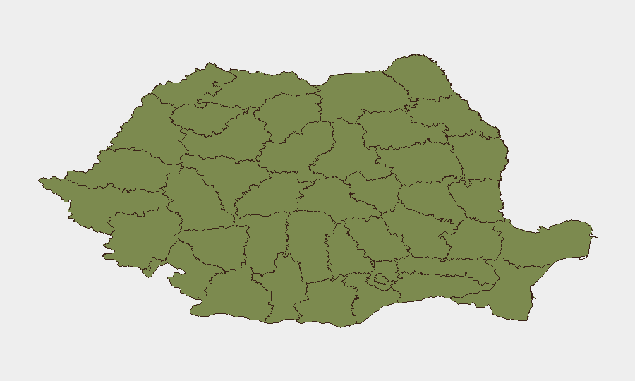
Teleorman County (risk score 31.4) and Bucharest (20.1) account for the majority of tracked risk, driven by proximity to conflict-adjacent borders, cross-border criminality, and concentration of government/institutional targets. Buzău (7.7), Dolj, Brăila, and Tulcea (each 2.6) reflect secondary border and regional crime/trafficking concerns, with Tulcea specifically elevated by recent drone-activity incidents. All other tracked counties remain below 1.5 composite risk.
How GeoBit Would Assist
Security teams should deploy AOI Monitoring & Early Warning on Teleorman, Bucharest, and Tulcea counties to capture escalations in drone activity, border incidents, and civil unrest before they reach corporate operations. Cyber risk and infrastructure search capabilities would track ANCPI recovery timelines and identify alternative land-registry pathways. Routing & Network Analysis would support alternative supply and travel planning around healthcare-strike zones and weather-affected corridors.
7-Day Outlook
Healthcare strike escalation to a general strike (28 July) is the highest-probability near-term operational disruptor; border and drone activity will likely remain at current elevated but localized levels. Extreme-weather impacts are expected to diminish as storm systems move through; cyberattack recovery timelines remain uncertain but are the critical watch item for real-estate and property-transaction workflows.
Highest-Risk Areas — Ranked
| # | State / Region | Risk |
|---|---|---|
| 1 | Teleorman | 31.4 |
| 2 | Bucharest | 20.1 |
| 3 | Buzău | 7.7 |
| 4 | Dolj | 2.6 |
| 5 | Brăila | 2.6 |
| 6 | Tulcea | 2.6 |
| 7 | Vâlcea | 1.4 |
| 8 | Brașov | 1.4 |
| 9 | Bihor | 1.4 |
| 10 | Timiș | 1.4 |
| 11 | Caraș-Severin | 1.4 |
| 12 | Satu Mare | 1.4 |
Sources
Previous Daily Briefs
A new Romania brief is written every day — each with its own risk map and downloadable CSV. Here's the last week; use the calendar to go further back.
📅 Browse every day by calendar →
Highlighted days have a brief. Tap a day for that day's map & analysis, or “csv” for that day's dataset ($5).
Atlas — our AI intelligence desk — emails them this snapshot personally. Nothing else, no list.