Situation Summary
Saint Kitts and Nevis remains a low-threat jurisdiction globally (composite score 3, ranked #180), with no security incidents recorded in the 24–48 hours ending 26 August 2026. Recent activity (8–24 August) indicates routine law enforcement operations—firearms training, fraud prosecutions, and investigation of a mid-August shooting—but no systemic instability, civil unrest, or infrastructure disruption. The security environment is stable and predictable for corporate operations.
Key Developments
No discrete security, crime, unrest, or infrastructure incidents are documented for 25–26 August 2026 in Saint Kitts and Nevis. Web research and open-source feeds show no travel advisories, protests, shootings, or service disruptions within the last 24–48 hours. The most recent dated events fall outside this window:
- Police firearms training exercise (24–25 August, Conaree): Royal St. Christopher and Nevis Police conducted live-fire drills at Baker's Point Rifle Range, eastern St. Kitts, with public exclusion notices issued for Keys and Conaree villages. Exercise concluded as scheduled; no incidents reported.
- Fraud prosecutions (24 August, Basseterre): Three individuals formally charged with computer-related fraud and money laundering linked to offences in October–December 2025. Reflects active financial-crime enforcement, not current physical-security concern.
- Criminal investigation custody (22 August, Basseterre): Person of interest Elvin Mills presented himself at Basseterre Police Station and is in custody. Investigation ongoing; no associated violence or unrest reported.
- Seismic activity (22 August, regional): Minor M3.4 earthquake recorded in Virgin Islands region with Saint Kitts and Nevis tagging. No damage or disruption reported.
Highest-Risk Areas
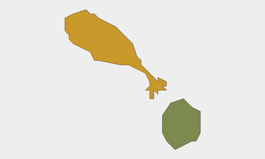
Saint Kitts (composite risk 72) significantly outranks Nevis (28), reflecting historical concentration of gun violence and property crime in Basseterre and surrounding urban parishes. Recent incidents since early August—including a shooting in Newtown (8 August)—confirm ongoing street-level crime activity, though no escalation or organized violence is evident. Nevis remains substantially lower-risk and has not featured in recent incident reporting. Corporate assets and personnel in Basseterre should maintain standard urban-crime awareness (avoidance of night movement in Newtown, Sands Street, and informal settlements), while Nevis poses minimal added risk.
How GeoBit Would Assist
Security teams protecting personnel and assets in Saint Kitts and Nevis should deploy AOI Monitoring & Early Warning on Basseterre and key corporate nodes to detect emerging unrest or infrastructure failure in real time. Intel Sweep and OSINT fusion (X/Twitter, local media, police announcements) provide continuous horizon-scanning for crime trends, enforcement actions, and travel disruptions. GIS & Spatial Analysis enables risk mapping of highest-crime parishes and route-planning for personnel movement, while Conflict & Incident Tracking flags any shift toward organized violence or political instability requiring duty-of-care escalation.
7-Day Outlook
No escalating threats are anticipated in the 7-day window. Routine law enforcement, low-level street crime in Basseterre, and financial-crime prosecutions are likely to continue without systemic disruption. Corporate operations should proceed under standard urban-security protocols; no new travel restrictions or facility lockdowns are forecasted.
Highest-Risk Areas — Ranked
| # | State / Region | Risk |
|---|---|---|
| 1 | Saint Kitts | 72 |
| 2 | Nevis | 28 |
Sources
- nevispages.com
- freedomfm1065.com
- police.kn
- thestkittsnevisobserver.com
- winnmediaskn.com
- thestkittsnevisobserver.com
- thestkittsnevisobserver.com
- thestkittsnevisobserver.com
- thestkittsnevisobserver.com
- nevispages.com
- thestkittsnevisobserver.com
- thestkittsnevisobserver.com
- thestkittsnevisobserver.com
- s1.salientone.eu
- sknis.gov.kn
- arnnewscentre.ae
- whitehouse.gov
- x.com
Previous Daily Briefs
A new Saint Kitts and Nevis brief is written every day — each with its own risk map and downloadable CSV. Here's the last week; use the calendar to go further back.
- August 23, 2026
- August 21, 2026
- August 18, 2026
- August 16, 2026
- August 14, 2026
- August 12, 2026
- August 10, 2026
📅 Browse every day by calendar →
Highlighted days have a brief. Tap a day for that day's map & analysis, or “csv” for that day's dataset ($5).
Atlas — our AI intelligence desk — emails them this snapshot personally. Nothing else, no list.