Situation Summary
Saint Vincent remains a low-threat environment globally (rank #174, composite score 3) but is experiencing sustained violent-crime pressure, particularly in gang-affiliated neighborhoods. A homicide tally of 31 deaths year-to-date reflects ongoing street violence concentrated in Saint George parish and surrounding high-risk districts. Current trajectory suggests continued sporadic incidents rather than systemic escalation, though clustering in Saint George and North Windward warrants close monitoring.
Key Developments
- Rockies, Saint George — 2026-08-07/08 — Fatal shooting of Akeem Ferdinand inside a residence; investigation ongoing with no full details released by police.
- Mesopotamia (near Memorial Funeral Home), Saint George — 2026-08-04 — Michael Jackson, 52-year-old laborer, fatally shot after 23:00 local time; pronounced dead at Levi Latham Health Centre.
- Dickson Village, Saint Andrew — 2026-08-01 — Body of Clydon Cato, 35, discovered with gunshot wounds; suspect Rhyse Henry subsequently charged and remanded.
- Lower All Saints Road — Recent (date not specified in available reporting) — Male victim shot in the leg during late-night incident; hospitalized and police requested public assistance.
- Countrywide tally update — 2026-08-06/07 — Official homicide count reached 31 for 2026, reflecting the clustering of recent fatal incidents and continuation of violent-crime trend.
Highest-Risk Areas
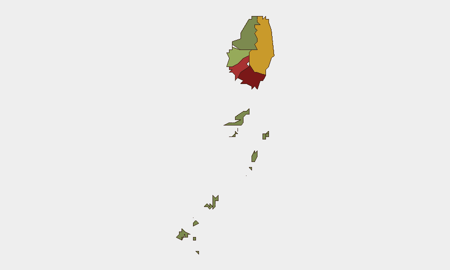
Saint George parish (risk score 92) is the dominant driver of violence, accounting for multiple recent homicides in central and peripheral neighborhoods (Rockies, Mesopotamia). Saint Andrew (78) and Charlotte (71) show elevated secondary risk, with incidents in Dickson Village and surrounding North Windward areas. The Grenadines (12) and Saint David (34) remain substantially lower-risk. Risk concentration in Saint George reflects gang-related street violence and territorial disputes; shootings cluster in residential and commercial zones after dark, suggesting organized rather than random patterns.
How GeoBit Would Assist
Security teams managing personnel or assets in Saint Vincent should employ AOI Monitoring & Early Warning with persistent watch on Saint George, Saint Andrew, and Charlotte; OSINT fusion & corroboration to cross-check police incident reports, X/social channels, and local news for emerging incidents or group activity; and Network & Actor Analysis to map homicide clusters and identify whether incidents reflect gang retaliation cycles or territorial escalation. Risk & Threat Assessment dashboards can flag threshold breaches (e.g., spikes in shootings by parish or time-of-day) and support duty-of-care reporting. Routing & Network Analysis can provide real-time alternative travel planning for personnel in high-risk areas during peak violence hours (typically late evening).
7-Day Outlook
Violent crime in Saint Vincent is expected to remain episodic and geographically concentrated rather than system-wide. No indicators of imminent large-scale escalation, organized gang warfare expansion, or security-sector destabilization are present. Corporate and NGO teams should maintain standard precautions in Saint George and Saint Andrew (avoid late-night movement, verify travel routes, brief personnel on hostile-environment awareness) while treating the broader national environment as routine-risk.
Highest-Risk Areas — Ranked
| # | State / Region | Risk |
|---|---|---|
| 1 | Saint George | 92 |
| 2 | Saint Andrew | 78 |
| 3 | Charlotte | 71 |
| 4 | Saint Patrick | 58 |
| 5 | Saint David | 34 |
| 6 | Grenadines | 12 |
Sources
Previous Daily Briefs
A new Saint Vincent brief is written every day — each with its own risk map and downloadable CSV. Here's the last week; use the calendar to go further back.
📅 Browse every day by calendar →
Highlighted days have a brief. Tap a day for that day's map & analysis, or “csv” for that day's dataset ($5).
Atlas — our AI intelligence desk — emails them this snapshot personally. Nothing else, no list.