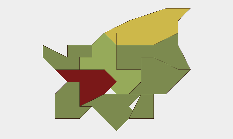
Situation Summary
San Marino remains a low-threat environment with a composite threat score of 3 and no tracked active security events as of 2026-08-07. The most recent documented incident is a traffic collision on 2026-07-30 with no indicators of intentional violence, civil unrest, or infrastructure disruption. Current open-source monitoring has not identified any security, political-stability, or travel-risk developments within the last 24–48 hours that materially alter the overall benign risk profile.
Key Developments
- No confirmed security incidents in the last 24–48 hours. Live web research across San Marino news sources, police statements, and regional feeds yielded no cross-verified events meeting current incident criteria (conflict, crime, civil unrest, infrastructure failure, or travel advisory).
- Traffic incident on 2026-07-30 (via Montepirolo/via Rigardara, Città di San Marino). A San Marino-registered Mini vehicle collided head-on with a commercial van after failing to stop at a junction. This remains the most recent documented event but is non-security in nature and does not indicate broader risk escalation.
- Open-source coverage gaps. Broader regional and Italian media show routine content (water management, border wildfire activity) but no recent San Marino-specific security incidents. Local-language outlet depth and real-time social-media OSINT would be required to improve event detection velocity.
Highest-Risk Areas
Città di San Marino (risk score 85) and Serravalle (risk score 68) account for the majority of sub-national risk exposure. Città di San Marino's elevated score likely reflects concentration of government, tourism, and commercial activity, which in turn correlates with baseline incident frequency (including traffic, minor crime, and administrative disruption). Serravalle's secondary risk profile suggests similar urbanization and transient-population factors. The remaining seven administrative divisions show significantly lower composite scores (52 and below), indicating risk is geographically concentrated rather than territory-wide. No current events explain deviations from these baseline patterns.
How GeoBit Would Assist
Teams with personnel or assets in San Marino should employ AOI Monitoring & Early Warning configured for the Città di San Marino and Serravalle districts to detect emerging incidents in real time; multi-language OSINT and X/Twitter intelligence to close current gaps in local-language event detection; and risk & threat assessment with periodic sub-national scoring refreshes to support duty-of-care documentation and incident-response planning. These capabilities enable shift from passive reporting to persistent, operator-defined alerting on specific locations and threat types.
7-Day Outlook
No significant near-term escalation is anticipated. The security environment is expected to remain stable over the next seven days absent external regional drivers (e.g., Italy-specific incidents with cross-border implications). Routine monitoring of tourist inflows, local government statements, and border-area activity should continue; any deviation from baseline traffic or minor-crime patterns warrants rapid corroboration and stakeholder notification.
Next GeoBit San Marino update: 2026-08-08 | Data timestamp: 2026-08-07 06:00 UTC
Highest-Risk Areas — Ranked
| # | State / Region | Risk |
|---|---|---|
| 1 | Città di San Marino | 85 |
| 2 | Serravalle | 68 |
| 3 | Borgo Maggiore | 52 |
| 4 | Fiorentino | 32 |
| 5 | Domagnano | 28 |
| 6 | Faetano | 22 |
| 7 | Chiesanuova | 18 |
| 8 | Montegiardino | 16 |
| 9 | Acquaviva | 15 |
Sources
Previous Daily Briefs
A new San Marino brief is written every day — each with its own risk map and downloadable CSV. Here's the last week; use the calendar to go further back.
📅 Browse every day by calendar →
Highlighted days have a brief. Tap a day for that day's map & analysis, or “csv” for that day's dataset ($5).
Atlas — our AI intelligence desk — emails them this snapshot personally. Nothing else, no list.