Situation Summary
Taiwan remains at composite threat score 13 globally, with 26 tracked events in the GeoBit system as of 14 June 2026. Recent signal activity reflects diplomatic friction with neighbouring states and internal labour disputes, but no major security incidents, civil unrest, or infrastructure failures have been corroborated in open sources over the last 24–48 hours. The threat environment is elevated but diffuse, concentrated in specific sub-national zones rather than island-wide.
Key Developments
- Diplomatic friction (11–12 June): Multiple public statements and rejections recorded between Taiwan and China, and between Taiwan and the Philippines, suggesting elevated bilateral tension over unspecified policy or maritime matters. No operational security impact confirmed.
- Administrative disapproval signals (11 June): Unspecified administration vs. Taiwan disapproval event recorded; context remains unclear from available open sources.
- Coast Guard media engagement (11 June): News agency public statement involving Coast Guard; no specific incident, casualty, or operational disruption corroborated.
- Labour dispute (12 June): Producer vs. worker disapproval recorded, suggesting potential industrial action or wage/condition grievance; location and scale not yet defined in available reporting.
- Company investigation (12 June): Unspecified corporate investigation initiated; scope, sector, and location unknown from current open sources.
- Taiwan–Japan statement (11 June): Public statement between Taiwan and Japan recorded; substance not yet clarified in corroborated reporting.
Nota bene: No street-level security incidents, arrests in Taiwan proper, infrastructure damage, or travel disruptions have been independently verified in the past 48 hours. One arrest/detain event attributed to "Europe" (13 June) falls outside Taiwan's jurisdiction and is noted for completeness only.
Highest-Risk Areas
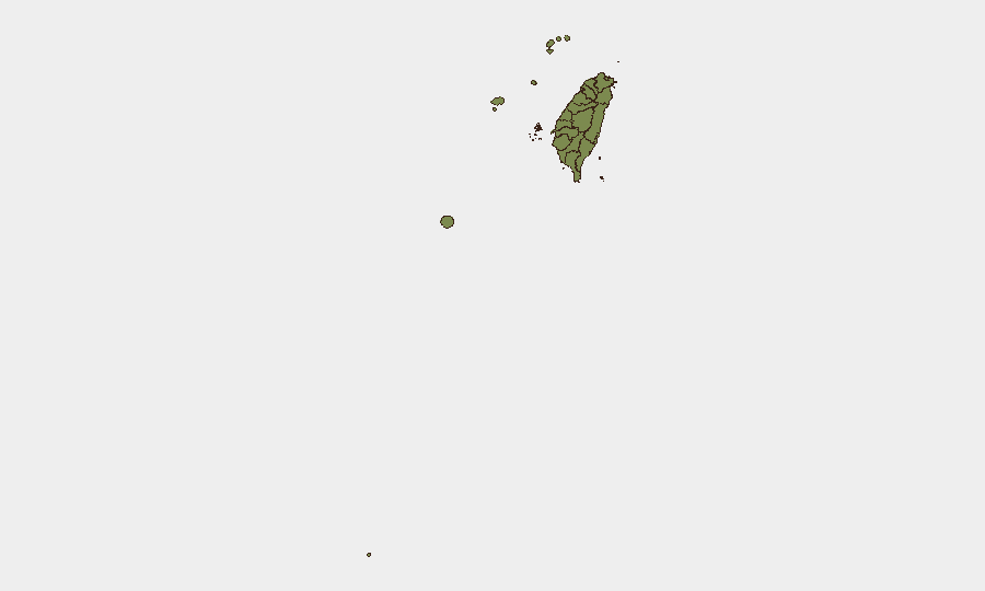
Nantou County dominates the sub-national ranking at 31.3, more than 25 percentage points above Taipei (22.8). This elevated risk in a mountainous, sparsely populated central region warrants investigation into whether it reflects genuine operational threat, historical data clustering, or cross-border activity tracking. Taipei's secondary risk (22.8) aligns with its role as the capital and administrative centre; concentration of government, finance, and media presence naturally increases event frequency. All other regions score below 6, indicating risk concentration is narrow: security planning should weight Nantou and Taipei accordingly while maintaining baseline monitoring of coastal and outlying counties.
How GeoBit Would Assist
Intel Sweep and multi-language OSINT fusion would clarify the substance of the 11–12 June diplomatic signals—GeoBit's multi-language search, entity extraction, and sentiment analysis can correlate official statements, news agency reports, and social-media signals to establish whether friction is rhetorical or operational. AOI Monitoring with persistent alerting on Nantou and Taipei would provide early warning of escalation in these highest-risk zones before incidents reach critical mass. Conflict and regime-stability assessment would help security teams distinguish between normal diplomatic noise and material shifts in cross-strait or regional military posture.
7-Day Outlook
Absent new major incident reporting, the threat environment is likely to remain at current composite score (13) through 21 June, with diplomatic posturing continuing and labour disputes resolving or escalating on sector-specific timelines. Watch for any escalation in maritime incidents or cross-strait military activity; should either surface in the next 72 hours, threat scores will re-calibrate upward and may trigger higher-risk designations for coastal counties.
Highest-Risk Areas — Ranked
| # | State / Region | Risk |
|---|---|---|
| 1 | Nantou County | 31.3 |
| 2 | Taipei | 22.8 |
| 3 | New Taipei | 5.6 |
| 4 | Kaohsiung | 1.3 |
| 5 | Pingtung County | 1.3 |
| 6 | Taitung County | 1.3 |
| 7 | Lienchiang County | 1.3 |
| 8 | Kinmen | 1.3 |
| 9 | Penghu | 1.3 |
| 10 | Changhua County | 1.3 |
| 11 | Miaoli County | 1.3 |
| 12 | Taichung | 1.3 |
Sources
Previous Daily Briefs
A new Taiwan brief is written every day — each with its own risk map and downloadable CSV. Here's the last week; use the calendar to go further back.
📅 Browse every day by calendar →
Highlighted days have a brief. Tap a day for that day's map & analysis, or “csv” for that day's dataset ($5).