Situation Summary
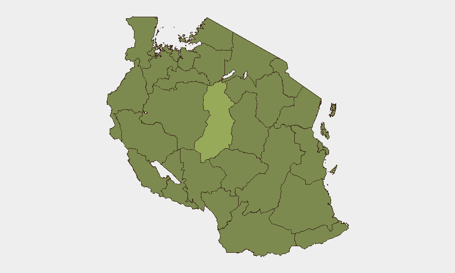
Tanzania maintains a composite threat score of 33 (global rank #62), reflecting moderate overall risk with significant geographic concentration. The past 48 hours show elevated international diplomatic friction, territorial dispute signals with Kenya, and concurrent wildfire activity across multiple regions. Singida Region remains the dominant risk driver (53.3), with Dar es-Salaam (25.6) as the only other major urban center of concern; the remaining nine tracked regions cluster at 23.3, suggesting distributed but lower-intensity hazards.
Key Developments
- Kenya–Tanzania Border (18 June 2026): Occupy Territory event reported; specific locations and casualty figures not yet confirmed by multiple independent sources. Monitor official statements from both governments and border-security channels for clarification on scope and response posture.
- International Diplomatic Signal (19 June 2026): Public statement attributed to Africa-wide and European actors, both critical of Tanzania. Nature and target of criticism not specified in available signals; likely related to political or trade matters rather than acute security incidents.
- Corporate Rejection Event (18 June 2026): Company-attributed rejection event recorded; context and affected entity not detailed in current intelligence. Recommend direct outreach to relevant corporate contacts in-country for confirmation.
- Wildfire Activity (Recent, Multi-Region): At least three separate wildfire events detected (IDs 1028959, 1028919, 1028933); geographic scope suggests Singida Region and surrounding areas are primary concern. No current data on evacuation orders, infrastructure damage, or air-quality impacts; escalation risk if conditions persist into dry season.
Note on Events 19 June 2026: Current signal data does not yet provide location specificity, casualty counts, or multi-source confirmation sufficient for detailed operational assessment. Security teams requiring real-time incident details should cross-check with Tanzanian national media, official government channels, and international wires on a rolling basis.
Highest-Risk Areas
Singida Region dominates the risk landscape at 53.3—more than double any other region—indicating concentration of ongoing threats or volatile triggering conditions. Dar es-Salaam (25.6) is the only other major population/commercial center with elevated risk, driven primarily by urban density, port activity, and demonstration risk. The remaining ten regions (Kigoma, Kagera, Mwanza, Geita, Shinyanga, Tabora, Katavi, Rukwa, Songwe, Mara) cluster at 23.3, suggesting either similar baseline threat profiles or a data-collection artifact. Corporate and NGO operations in Dar es-Salaam warrant standard urban-security postures; operations in or transiting Singida Region require heightened awareness and contingency planning.
How GeoBit Would Assist
A security team monitoring Tanzania should deploy AOI Monitoring & Early Warning on Singida Region, Dar es-Salaam port/airport, and Kenya–Tanzania border crossing points to detect escalations in real time. Intel Sweep (global event feeds, X/Twitter & Telegram OSINT, multi-language search) combined with Entity Extraction would track official government statements, opposition movements, and corporate-sector disruptions as they emerge. Routing & Network Analysis would enable rapid alternative-route planning if border closures, wildfire-induced road damage, or protest-related blockades disrupt primary supply or personnel-movement corridors.
7-Day Outlook
Diplomatic tensions with Kenya and broader international criticism may sustain elevated political rhetoric and minor border-monitoring activity without escalating to armed confrontation. Wildfire conditions warrant close tracking; if drought conditions persist or fires spread toward populated areas or critical infrastructure, evacuation and supply-chain disruptions are plausible. Overall threat trajectory remains stable unless Singida or border incidents produce sudden escalation signals.
Highest-Risk Areas — Ranked
| # | State / Region | Risk |
|---|---|---|
| 1 | Singida Region | 53.3 |
| 2 | Dar es-Salaam | 25.6 |
| 3 | Kigoma Region | 23.3 |
| 4 | Kagera | 23.3 |
| 5 | Mwanza Region | 23.3 |
| 6 | Geita | 23.3 |
| 7 | Shinyanga Region | 23.3 |
| 8 | Tabora Region | 23.3 |
| 9 | Katavi Region | 23.3 |
| 10 | Rukwa Region | 23.3 |
| 11 | Songwe Region | 23.3 |
| 12 | Mara Region | 23.3 |
Sources
Previous Daily Briefs
A new Tanzania brief is written every day — each with its own risk map and downloadable CSV. Here's the last week; use the calendar to go further back.
📅 Browse every day by calendar →
Highlighted days have a brief. Tap a day for that day's map & analysis, or “csv” for that day's dataset ($5).