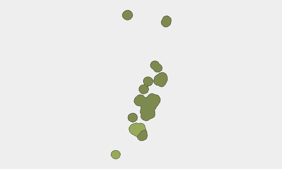
Situation Summary
Tonga remains a low-threat jurisdiction globally (composite score 3) with no tracked security events in the current reporting window. The Kingdom's security environment is stable, with risk concentrated in the capital region and main population centers rather than distributed across the archipelago. No active conflict, terrorism, or organized crime incidents are present. Current exposure for corporate assets and personnel is predominantly administrative and infrastructure-dependent rather than threat-driven.
Key Developments
No discrete security events have been recorded in Tonga over the last 24–48 hours. Live web research for the past 24 hours returned no actionable intelligence or incident reporting. Monitoring will resume on standard cadence; any emerging incidents will be flagged immediately upon detection.
Highest-Risk Areas
Tongatapu (composite risk 45) accounts for the majority of measurable risk, reflecting its role as the administrative and economic hub—home to the capital Nuku'alofa, government institutions, port infrastructure, and the largest population concentration. Vavaʻu (risk 28) ranks second, driven by its secondary commercial importance and maritime exposure. Haʻapai (risk 22), ʻEua (risk 18), and Ongo Niua (risk 12) carry lower but monitored profiles. Risk scores in Tonga reflect exposure vectors—infrastructure criticality, population density, and maritime logistics—rather than active conflict or organized threat presence. Duty-of-care teams should prioritize asset and personnel welfare in Tongatapu during any disruption to essential services or transportation.
How GeoBit Would Assist
Security teams with personnel or assets in Tonga should deploy AOI Monitoring & Early Warning on key corporate locations and critical infrastructure (ports, airports, telecommunications hubs) in Tongatapu to detect incidents in near-real time. Intelligence & OSINT (Intel Sweep, multi-language social media monitoring, sentiment analysis) will track emerging political or civil unrest narratives before they escalate. Maritime & Aviation tracking and Routing & Network Analysis capabilities support contingency planning for personnel evacuation or supply-chain resilience should regional disruption occur.
7-Day Outlook
No indicators suggest deterioration in Tonga's security posture over the next seven days. The risk environment is expected to remain stable and low-threat. Routine monitoring will continue; any changes to event signals, infrastructure status, or regional maritime or political developments will be escalated to subscribers immediately.
Report Date: 2026-06-13
Data Window: 24–48 hours + sub-national rankings (current)
Confidence: Low-event environment; confidence is high in *absence* of threat, moderate in early-warning sensitivity given limited live research availability.
Highest-Risk Areas — Ranked
| # | State / Region | Risk |
|---|---|---|
| 1 | Tongatapu | 45 |
| 2 | Vavaʻu | 28 |
| 3 | Haʻapai | 22 |
| 4 | ʻEua | 18 |
| 5 | Ongo Niua | 12 |
Previous Daily Briefs
A new Tonga brief is written every day — each with its own risk map and downloadable CSV. Here's the last week; use the calendar to go further back.
📅 Browse every day by calendar →
Highlighted days have a brief. Tap a day for that day's map & analysis, or “csv” for that day's dataset ($5).