Situation Summary
Uganda remains classified as a moderate-risk operating environment (global rank #64, composite threat score 18) with 988 tracked events on record. Today's signal cluster—including military force deployment, small-arms combat, and official investigations spanning multiple actors—suggests a localized security incident or escalation is unfolding, though precise details and geographic scope remain under clarification. Underlying vulnerabilities persist across terrorism, organized crime, and civil unrest, concentrated in the Western and Central regions.
Key Developments
- 2026-07-05 · Conventional Military Force & Small-Arms Combat: UGANDA security forces and unidentified armed parties engaged in small-arms combat; simultaneous military force deployment recorded. Specific location and casualty status not yet confirmed in available reporting.
- 2026-07-05 · Official Investigation: Ugandan authorities launched investigation into incident; Australian diplomatic authorities also initiated parallel inquiry, suggesting possible international dimension or foreign national involvement.
- 2026-07-05 · Public Statements & Political Response: Multiple public statements issued by President Museveni, Ugandan civil society, and the general population; official statement of rejection by Uganda government entity (target/subject unclear from available signals).
- 2026-07-04 · Health Sector Alert: Public statement issued by Uganda regarding a hospital; timing and context suggest potential health facility disruption or casualty surge related to ongoing incident.
- 2026-07-04 · Regional Diplomatic Shift: African states signaled reduction in relations with Israel; no direct Uganda security incident, but reflects broader regional political strain.
- Ongoing Health Threat: Sudan virus disease remains active in Uganda epidemiological monitoring; no acute outbreak signal in last 24 hours, but standing surveillance indicator.
Status Caveat: Web research over the past 24–48 hours has not yielded independently verified granular incident details (location, casualty count, actor names, trigger). GeoBit event signals are present and clustering; field-level verification is ongoing.
Highest-Risk Areas
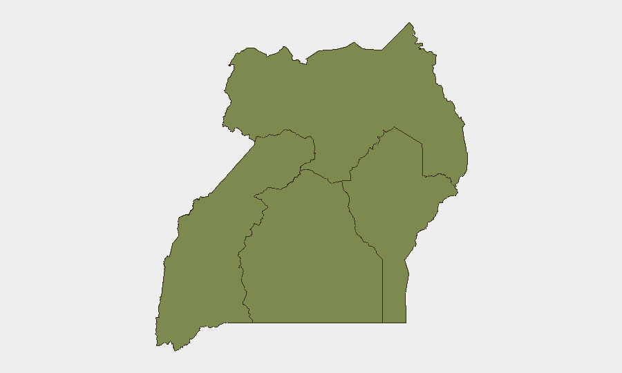
Western Region dominates Uganda's risk profile (composite score 32), followed by Central Region (22.4). The Western Region's elevation reflects persistent armed-group activity, cross-border instability linked to the Democratic Republic of Congo, and localized inter-communal tensions. Central Region's score, anchored primarily on Kampala and surrounding districts, reflects urban crime, protest risk, and the concentration of government and foreign-national assets. Northern and Eastern regions score substantially lower (4.4 and 2 respectively), indicating reduced near-term event frequency, though they remain subject to seasonal pastoralist conflict and banditry. Today's incident signals are not yet geo-tagged to sub-national level; clarification of epicenter location will refine risk assessment.
How GeoBit Would Assist
Security teams should employ Intel Sweep and OSINT fusion to cross-confirm incident actors, timeline, and casualty toll across X/Twitter, Telegram, and local media in real time. AOI Monitoring with persistent alerting on Western and Central regions will provide early warning of follow-on violence, movement of armed groups, or escalation in the next 48–72 hours. Conflict and Military force-structure tracking, combined with Network & Actor Analysis, will identify whether today's engagement involves known terrorist, militia, or criminal networks—critical for duty-of-care and evacuation planning.
7-Day Outlook
Immediate risk is contingent on incident resolution and official communication. If today's military engagement concludes without cascading violence, threat level may stabilize within 48 hours. However, if the incident triggers reprisal actions, mass protest, or cross-border spillover, Western and Central regions face elevated risk through week's end. Monitoring for follow-on statements, casualty reports, and security-force repositioning over the next 72 hours is essential to forecast trajectory.
Highest-Risk Areas — Ranked
| # | State / Region | Risk |
|---|---|---|
| 1 | Western Region | 32 |
| 2 | Central Region | 22.4 |
| 3 | Northern Region | 4.4 |
| 4 | Eastern Region | 2 |
Sources
Previous Daily Briefs
A new Uganda brief is written every day — each with its own risk map and downloadable CSV. Here's the last week; use the calendar to go further back.
📅 Browse every day by calendar →
Highlighted days have a brief. Tap a day for that day's map & analysis, or “csv” for that day's dataset ($5).
Atlas — our AI intelligence desk — emails them this snapshot personally. Nothing else, no list.