Situation Summary
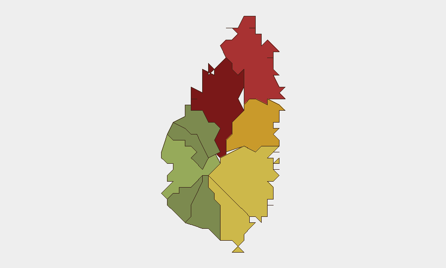
Saint Lucia remains a low-threat jurisdiction globally (rank #169, composite score 6) with no tracked security events during the reporting week. However, sub-national risk is heavily concentrated in the capital and northern urban centers, particularly Castries (risk 95), where gang-related violence, armed robbery, and drug trafficking persist as chronic drivers of harm. Recent isolated incidents—a gun injury in Babonneau and a traffic casualty in Cas En Bas on 2–5 October—reflect underlying violence and infrastructure-safety patterns rather than a deteriorating security posture. Near-term outlook remains stable absent major political or economic shocks.
Key Developments
- 6–7 October, Bexon and Cul de Sac (Dennery): Heavy rainfall and thunderstorms from a tropical wave caused street flooding and waterlogging; Dennery North MP Shawn Edward documented conditions via photo. Flash flooding poses secondary risk to transport, access, and informal settlements.
- 7 October, Saint Lucia-wide: Infrastructure Minister issued public appeal to residents and local authorities to clear drains and remove debris, citing widespread waterway blockages and inadequate runoff management. Indicates systemic vulnerability to weather-driven disruption.
- 13 October, Saint Lucia-wide: Government announced increased fuel subsidies to hold retail fuel prices stable despite upward pressure from global crude markets. Removes near-term trigger for fuel-price shock, transportation strikes, or cost-of-living unrest.
Highest-Risk Areas
Castries and Grous Islet together account for the majority of documented sub-national risk (scores 95 and 78), driven by urban density, gang presence, and socioeconomic inequality. Dennery (72) and Vieux Fort (68) follow, with Dennery currently experiencing compounded flood exposure; Micoud (65) rounds the critical tier. These five zones warrant priority for corporate presence checks, asset hardening, and staff movement protocols. Rural and southern districts (Canaries, Choiseul, Laborie) present minimal tactical risk and serve as lower-threat alternatives for operations or temporary relocation. The concentration in northern and central urban areas suggests that security budgets and duty-of-care efforts should prioritize Castries, Grous Islet, and Dennery for the foreseeable term.
How GeoBit Would Assist
Security teams protecting personnel or assets in Saint Lucia should deploy AOI Monitoring & Early Warning on Castries and Grous Islet to detect emerging violence clusters, gang activity, or civil unrest in near-real time. Intel Sweep and OSINT fusion (X/Twitter, Telegram, local news) will corroborate and timestamp incidents faster than official police releases, enabling rapid duty-of-care escalation. GIS & Spatial Analysis combined with Routing & Network Analysis allows security teams to model safe movement corridors around high-risk districts and identify alternative supply or evacuation routes during flooding or civil disruption.
7-Day Outlook
Weather-related disruption from tropical systems poses the highest near-term risk; further heavy rainfall in Dennery and adjacent districts could degrade road access and increase strain on informal settlements. Criminal activity in Castries and Grous Islet will likely remain at chronic baseline absent major gang-conflict escalation or police intervention; fuel-price stability reduces one potential trigger for civil unrest. No major political, security, or economic events are forecast for the coming week.
Highest-Risk Areas — Ranked
| # | State / Region | Risk |
|---|---|---|
| 1 | Castries | 95 |
| 2 | Gros Islet | 78 |
| 3 | Dennery | 72 |
| 4 | Vieux Fort | 68 |
| 5 | Micoud | 65 |
| 6 | Soufrière | 42 |
| 7 | Laborie | 38 |
| 8 | Choiseul | 35 |
| 9 | Anse La Raye | 28 |
| 10 | Canaries | 12 |
Sources
Previous Weekly Briefs
A new Saint Lucia brief is written every Monday, covering the week — each with its own risk map and downloadable CSV. Use the calendar to go further back.
- October 6, 2026
- September 29, 2026
- September 22, 2026
- September 15, 2026
- September 9, 2026
- September 3, 2026
- August 31, 2026
📅 Browse past briefs by calendar →
Highlighted days have a brief. Tap a day for that day's map & analysis, or “csv” for that day's dataset ($5).
Atlas — our AI intelligence desk — emails them this snapshot personally. Nothing else, no list.