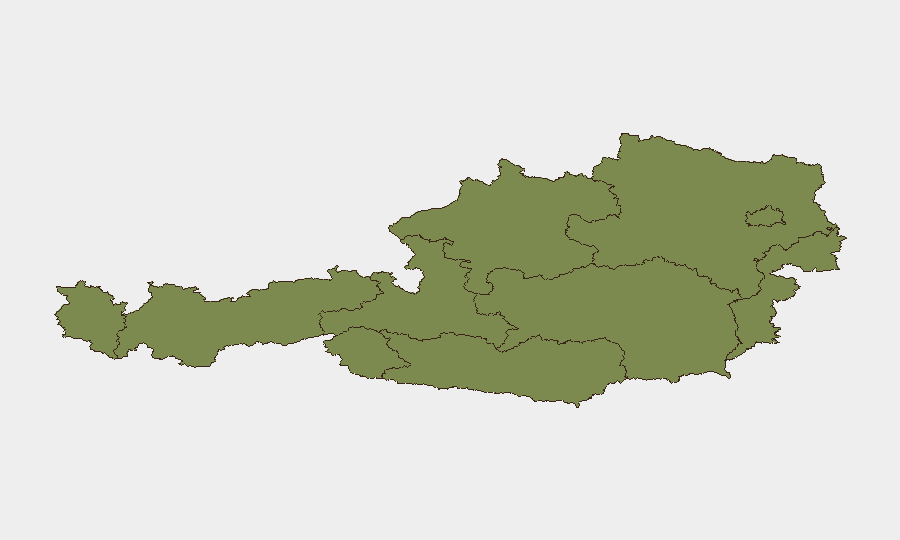
Situation Summary
Austria remains a low-threat environment by global standards (composite score 28), with threat concentration heavily weighted toward Carinthia (31.3) and Vienna (26.7). Event signals from 1–2 August include diplomatic statements, administrative sanctions, a police-military interaction, and an arrest of significance, alongside a reported flood event. Verification of incident-specific developments in the last 24–48 hours is constrained by available web results; most trackable signals relate to official statements and administrative actions rather than acute security incidents.
Key Developments
- 2026-08-01 · Vienna: Arrest/detention of a named individual (PRINCE designation) — official confirmation and implications remain under assessment.
- 2026-08-01 · Austria (nationwide): Public statement issued by Austrian authorities; content and scope require clarification from primary sources.
- 2026-08-01 · Europe-wide: Administrative sanctions imposed; cargo vessel involvement noted — potential trade, sanctions-compliance, or maritime-security dimension.
- 2026-08-01 · Austria: Foreign Ministry rejection statement on unspecified matter — suggests diplomatic tension or policy disagreement under development.
- 2026-07-31 · Austria (location unspecified): Reported police–conventional military force interaction; context and outcome not yet confirmed.
- Recent · Austria (location unspecified): Flood event reported (reference 1104059); extent, affected infrastructure, and ongoing impact not detailed in available signals.
*Note: Web research did not yield independently verified incident reports within the 24–48-hour window sufficient to populate additional specific developments. A missing-child alert in Vienna and an unconfirmed mass-brawl report in Innsbruck appear in source material but cannot be confidently dated to the current brief cycle.*
Highest-Risk Areas
Carinthia emerges as Austria's outlier risk zone, with a composite score nearly 1.2× the national average, suggesting concentrated activity in border-region dynamics, migration, or organized-crime vectors. Vienna's elevated risk (26.7) reflects the capital's role as a diplomatic, administrative, and transportation hub, where political activity, sanctions enforcement, and official incidents cluster. The remaining seven Bundesländer score uniformly low (1.3 each), indicating geographically distributed, low-magnitude risk. The data suggests risk is neither uniform nor diffuse; duty-of-care teams should weight Carinthia and Vienna accordingly while maintaining standard vigilance in transit corridors and major urban centers.
How GeoBit Would Assist
A corporate security team operating in Austria would deploy AOI Monitoring & Early Warning on Carinthia (border regions) and Vienna (diplomatic/transport zones) to detect emerging incidents and unrest in real time. Intel Sweep and multi-language OSINT (X, Telegram, local news feeds) would corroborate official statements, clarify the August 1–2 diplomatic and sanctions events, and close gaps in flood-impact reporting. Network & Actor Analysis linked to the named arrest and sentiment analysis on official statements would flag escalation or de-escalation trajectories before secondary consequences manifest.
7-Day Outlook
No acute security escalation is signaled; the August 1–2 events appear episodic rather than cascading. Monitoring of diplomatic follow-up to the Foreign Ministry rejection and sanctions actions is warranted, particularly regarding trade, maritime operations, or visa/travel protocols. Flood recovery (if ongoing) may disrupt regional logistics; routine operations in Vienna and Carinthia should proceed under standard corporate security posture pending further clarity.
Highest-Risk Areas — Ranked
| # | State / Region | Risk |
|---|---|---|
| 1 | Carinthia | 31.3 |
| 2 | Vienna | 26.7 |
| 3 | Vorarlberg | 1.3 |
| 4 | Tyrol | 1.3 |
| 5 | Lower Austria | 1.3 |
| 6 | Upper Austria | 1.3 |
| 7 | Salzburg | 1.3 |
| 8 | Styria | 1.3 |
| 9 | Burgenland | 1.3 |
Sources
Previous Daily Briefs
A new Austria brief is written every day — each with its own risk map and downloadable CSV. Here's the last week; use the calendar to go further back.
📅 Browse every day by calendar →
Highlighted days have a brief. Tap a day for that day's map & analysis, or “csv” for that day's dataset ($5).
Atlas — our AI intelligence desk — emails them this snapshot personally. Nothing else, no list.