Situation Summary
Belarus remains a low-threat environment by global standards (composite threat score 30; rank #null), with no confirmed major security incidents, civil unrest, or infrastructure disruptions in the last 48 hours on Belarusian territory. Minsk and its surrounding region account for the majority of tracked risk (scores 31.3 and 22.8 respectively), driven primarily by diplomatic friction, administrative sanctions from Lithuania, and scattered public statements from Belarus and foreign actors—not active conflict or widespread instability. The overnight 18–19 June drone activity over the Belarus–Ukraine border remains unconfirmed as a direct security event within Belarus; one Russian drone reportedly transited toward Belarusian airspace during a ~100-drone attack on Ukraine, but no impact, interception, or damage has been corroborated. The overall posture is stable but diplomatically tense.
Key Developments
- 2026-06-20, Minsk – Belarus issued a public statement (details undisclosed in available sources); no associated security incident, protest, or policy announcement confirmed.
- 2026-06-19, Minsk – Diplomatic friction escalates: Lithuania implemented administrative sanctions against Belarus and issued a formal rejection of Belarusian positions; Moscow also issued a public statement regarding Belarus, reflecting ongoing regional diplomatic strain.
- 2026-06-18, Multiple locations – A cluster of disapprovals and rejections from Lithuanian authorities, Belarusian ministry bodies, and Belarusian authorities themselves on the same day; no civil unrest, arrests, or operational security incidents reported.
- 2026-06-18, Belarus–Ukraine border (airspace, location unspecified) – During a Russian drone campaign against Ukraine (~90–100 drones), one drone reportedly exited Ukrainian airspace toward Belarus overnight; no corroborated reports of impact, interception, or damage within Belarusian territory.
- 2026-06-18, Minsk – One report citing "unconventional violence" involving Belarus vs. a school; confirmation, casualties, and operational details remain absent from accessible open sources.
- 2026-06-19, Belarus (location unspecified) – A small-arms combat event attributed to Turkey vs. Belarus was flagged by GeoBit event systems; no corroborating detail, location, or casualty data available in 24-hour web research.
Note: Absence of multi-source confirmation for the last two items reflects limitations in open-source corroboration; duty-of-care teams with regional HUMINT should validate independently.
Highest-Risk Areas
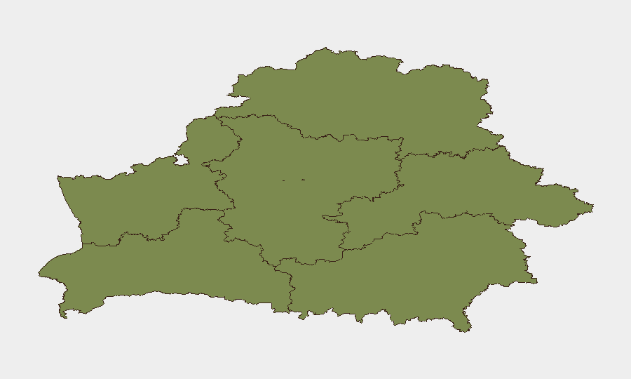
Minsk (score 31.3) and Minsk Region (22.8) drive national risk, concentrated in administrative, diplomatic, and low-level civil friction rather than conflict or organized crime. All other regions (Vitsebsk, Hrodna, Brest, Mahilyow, Homyel) register minimal scores (1.3 each), indicating negligible tracked events. The concentration of risk in the capital reflects administrative censure, inter-agency disapprovals, and diplomatic tension with Lithuania and Russia, not armed confrontation or infrastructure threat. Regional periphery remains stable.
How GeoBit Would Assist
Security teams with personnel or assets in Belarus should deploy persistent AOI monitoring & early warning on Minsk and key transport corridors to detect escalation in protests, checkpoints, or administrative enforcement. Multi-language OSINT fusion (X/Telegram, local news, regime statements) will disambiguate routine diplomatic friction from operational security incidents. Routing & network analysis can identify safe transit alternatives if border or airspace incidents expand.
7-Day Outlook
No imminent escalation is indicated; diplomatic friction is the primary signal. However, continued drone transit over the Belarus–Ukraine border and unresolved administrative tensions with Lithuania warrant 7-day monitoring for policy shifts or secondary effects (e.g., border restrictions, fuel disruptions). Minsk and its region should remain under standard watch; peripheral regions show no trajectory change.
Highest-Risk Areas — Ranked
| # | State / Region | Risk |
|---|---|---|
| 1 | Minsk | 31.3 |
| 2 | Minsk Region | 22.8 |
| 3 | Vitsebsk Region | 1.3 |
| 4 | Hrodna Region | 1.3 |
| 5 | Brest Region | 1.3 |
| 6 | Mahilyow Region | 1.3 |
| 7 | Homyel Region | 1.3 |
Sources
Previous Daily Briefs
A new Belarus brief is written every day — each with its own risk map and downloadable CSV. Here's the last week; use the calendar to go further back.
📅 Browse every day by calendar →
Highlighted days have a brief. Tap a day for that day's map & analysis, or “csv” for that day's dataset ($5).