Situation Summary
Brunei's security environment remains stable and low-risk, with no credible reports of new security, civil unrest, crime, political instability, infrastructure disruption, or travel incidents in the last 24–48 hours. The composite threat score of 7 reflects minimal tracked events; web and social-media monitoring across major outlets and regional feeds returned no verified reports of protests, violence, accidents, or emergency declarations. Brunei-Muara District remains the highest-risk sub-national zone, though absolute risk levels remain contained. The overall trajectory is neutral to stable.
Key Developments
- 2026-06-11 · Brunei-Muara District – Public statement issued by state ministry; content and impact not further specified in available reporting.
- 2026-06-11 · Brunei-Muara District – Public statement involving ministry and school entities; nature of statement and any operational impact unclear from available sources.
- 2026-06-11 · Brunei-Muara District – Arrest or detention action by police; individuals involved and charges not detailed in available signals.
- 2026-06-11 · Cross-border – Detention event flagged as "Indonesia vs Brunei"; context unclear; may involve immigration, labor, or maritime jurisdiction matter.
- Note on June 9 event – One signal flagged "Admin Sanctions · BENIN" (Benin, West Africa, unrelated to Brunei); likely data-classification artifact; no Brunei relevance.
*No verified reports of new security incidents, infrastructure failures, or travel disruptions emerged from English-language news, regional security feeds, X/Twitter monitoring, or official government/emergency channels during the 24–48 hour window.*
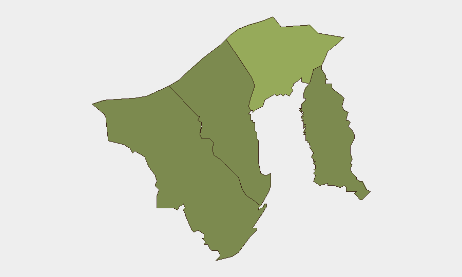
Highest-Risk Areas
Brunei-Muara District (composite risk 45) significantly outpaces other regions and drives the country's overall risk profile; it encompasses the capital Bandar Seri Begawan, government ministries, and port facilities. Tutong District (risk 20) remains secondary; Belait and Temburong are minimal-risk zones. The concentration of administrative, commercial, and transport infrastructure in Brunei-Muara means that any civil-unrest, labor, immigration, or port-related event is likely to surface there first. Current signal clustering around June 11 public statements and law-enforcement actions in Brunei-Muara reflects routine governance and police activity; no escalation or emergency conditions are evident.
How GeoBit Would Assist
Corporate security and duty-of-care teams operating in Brunei would employ AOI Monitoring & Early Warning to establish persistent watch over Brunei-Muara District and port/energy facilities in Muara; persistent alerting would flag protest formation, emergency declarations, or labor actions before they reach mainstream news. Intel Sweep and multi-language OSINT (including X/Twitter and Telegram feeds) would provide real-time corroboration of official statements and arrest/detention activity, reducing reliance on delayed news reporting. Routing & Network Analysis would enable contingency route planning for staff or supply chains in the event of port closure or infrastructure disruption in high-risk districts.
7-Day Outlook
No indicators suggest material escalation or new security threats over the next seven days. The June 11 administrative and police signals appear routine and localized. Continued monitoring of Brunei-Muara is warranted, particularly around port operations, labor, and immigration matters; however, absent credible reporting of protest mobilization, political tension, or infrastructure risk, the near-term outlook remains stable.
Highest-Risk Areas — Ranked
| # | State / Region | Risk |
|---|---|---|
| 1 | Brunei-Muara District | 45 |
| 2 | Tutong District | 20 |
| 3 | Belait District | 15 |
| 4 | Temburong District | 10 |
Sources
Previous Daily Briefs
A new Brunei brief is written every day — each with its own risk map and downloadable CSV. Here's the last week; use the calendar to go further back.
📅 Browse every day by calendar →
Highlighted days have a brief. Tap a day for that day's map & analysis, or “csv” for that day's dataset ($5).