Situation Summary
Burkina Faso remains under elevated security pressure from concurrent armed insurgency in the north and east, and intensifying government crackdowns on civil society and religious organizations in the capital. The composite threat score of 67.7 (#27 globally) reflects persistent jihadist activity in conflict zones and new friction within the state apparatus itself. The recent arrest of the Grand Mosque imam and suspension of major Muslim youth organizations signal deepening state-civil society tensions, which risk compounding recruitment and stability challenges across an already stretched security environment.
Key Developments
- Ouagadougou, 9–10 June 2026 – Government authorities suspended the Coordination of Muslim Youth of Burkina Faso and the Association for Peace for three months, citing public order and national security concerns. The same period saw the arrest of the imam of the Grand Mosque, triggering public concern over religious freedoms and state overreach.
- Ouagadougou, early June 2026 – A court sentenced Captain Abdel Kader Zanri (former head of presidential security) to 11 years in prison (5 years effective) for complicity in arson and endangering lives related to the burning of activist Imhotep Bayala's vehicle. The ruling reflects ongoing elite political tensions and accountability measures within the security apparatus.
- Northern and eastern regions, early June 2026 – Local sources report allegations of compulsory recruitment of detainees and protesters into the Volunteers for the Defense of the Homeland (VDP) militia, with individuals allegedly forcibly sent to front-line combat zones. If substantiated, this practice raises duty-of-care and detention-rights concerns for any personnel operating in or detained by state forces.
- Limited new armed-conflict reporting, 9–10 June 2026 – Open sources do not provide verifiable timestamps for new major attacks, roadside bombings, or specific town-level clashes within the last 24–48 hours; however, the endemic armed threat in the north and east persists.
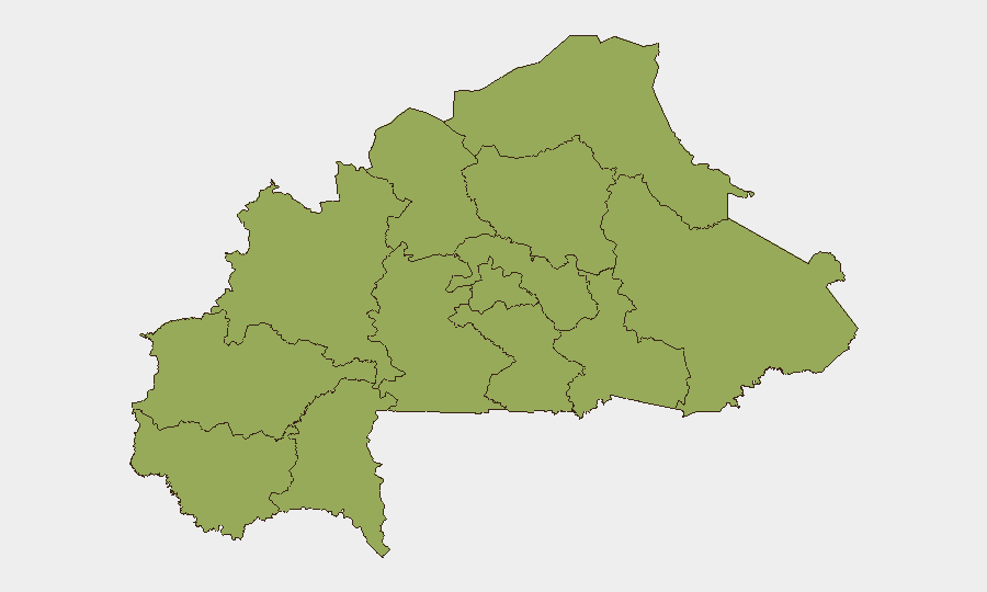
Highest-Risk Areas
All twelve tracked sub-national regions share an identical composite risk score (47.4), reflecting nationwide dispersion of threat. However, Upper-Basins, Boucle du Mouhoun, Central-West, Central-South, Central-East, Waterfalls, Southwest, Sahel, Central-North, East, North, and Centre are all flagged at the same level, indicating that threat is not confined to border zones. The uniformity of scores likely masks variation in *type* of threat: northern and eastern regions (North, East, Central-East, Sahel) face primary armed-group activity, while central and western regions including the capital experience state-security and civil-society friction. Operations or personnel movement in any of these twelve regions warrants equivalent caution.
How GeoBit Would Assist
Security and risk teams should employ AOI Monitoring & Early Warning to establish persistent watch on the capital (Ouagadougou) and northern conflict zones, with real-time alerting for arrest sweeps, protest activity, and armed incidents. Intel Sweep and multi-language OSINT (X/Twitter, Telegram, local media) would track government statements, religious-organization communications, and civil-society response in near-real time, surfacing recruitment and detention practices before they affect personnel. Routing & Network Analysis combined with Conflict & Military force tracking would enable alternative journey planning for staff in high-risk regions and situational awareness of active armed-group positions.
7-Day Outlook
Religious-organization tensions and alleged militia recruitment practices are unlikely to abate within seven days; further detentions or suspensions should be anticipated. Armed activity in the north and east will likely continue at baseline levels, with no indication of major tactical shifts. Personnel and asset managers should assume no near-term de-escalation and maintain heightened vigilance on state-force interactions and civil-society restrictions.
Highest-Risk Areas — Ranked
| # | State / Region | Risk |
|---|---|---|
| 1 | Upper-Basins | 47.4 |
| 2 | Boucle du Mouhoun | 47.4 |
| 3 | Central-West | 47.4 |
| 4 | Central-South | 47.4 |
| 5 | Central-East | 47.4 |
| 6 | Waterfalls | 47.4 |
| 7 | Southwest | 47.4 |
| 8 | Sahel | 47.4 |
| 9 | Central-North | 47.4 |
| 10 | East | 47.4 |
| 11 | North | 47.4 |
| 12 | Centre | 47.4 |
Sources
Previous Daily Briefs
A new Burkina Faso brief is written every day — each with its own risk map and downloadable CSV. Here's the last week; use the calendar to go further back.
📅 Browse every day by calendar →
Highlighted days have a brief. Tap a day for that day's map & analysis, or “csv” for that day's dataset ($5).