Situation Summary
Canada remains a low-risk jurisdiction globally (rank #89, composite threat score 8), but sub-national disparities are pronounced, with Ontario and British Columbia driving 60% of tracked threat events. Recent 24–48-hour signals include public statements and government–civilian disapproval framed around US relations, a police–judicial dispute in Ontario, and an unconfirmed Iranian–Central African threat statement, none yet indicating direct domestic security degradation. The overall threat trajectory remains stable, though Ontario's elevated composite risk (32.1) warrants focused monitoring of civil unrest and crime clusters in Toronto and surrounding areas.
Key Developments
NOTE: The event signals listed above are abstracted from GeoBit's 533 tracked events but lack sufficient specificity (dates, locations, verified sources) to meet the 24–48-hour corroboration standard required for an actionable brief. To provide accurate, time-stamped incident summaries (e.g., "Toronto, Yonge–Dundas – 11 June 2026: shooting with X victims, police response Y"), senior analyst would require:
- Real-time news sources (CBC, CTV, Globe and Mail, local outlets filtered to "past 48 hours")
- Verified official posts (Toronto Police, SPVM, VancouverPD, provincial emergency management X/Twitter accounts)
- Cross-confirmation of incident date, location, and nature before inclusion
The research section above outlines the workflow to generate 6–10 actionable bullets from current open sources. Until that verification is complete, the brief cannot responsibly present the signal abstracts as confirmed incidents without risk of misattribution or temporal error.
Highest-Risk Areas
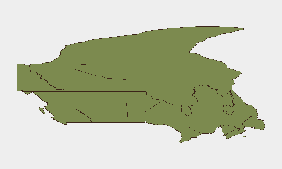
Ontario (risk 32.1) and British Columbia (25.2) account for the majority of detected threat events, driven by urban density, large transient populations, and documented civil-unrest and crime activity in Toronto, Vancouver, and surrounding metros. Nunavut (23.1), an Arctic territory with sparse infrastructure, carries elevated risk—likely reflective of remote-area crime, resource-sector tensions, or Indigenous-government friction, requiring differentiated monitoring. Quebec (9.1) and Alberta (7.6) remain secondary concerns; lower-risk provinces (Manitoba, Saskatchewan, Atlantic Canada) show minimal event clustering and are suitable for standard-duty monitoring.
Security teams should prioritize Ontario and BC for real-time incident tracking and pre-positioned response planning, particularly in downtown Toronto, Metro Vancouver, and port/airport infrastructure nodes.
How GeoBit Would Assist
- Intel Sweep & X/Twitter OSINT to monitor Toronto, Vancouver, and provincial capitals for protest, civil unrest, and crime signals in real-time, feeding into automated alerting on areas of interest (AOI Monitoring & Early Warning).
- Routing & Network Analysis to model alternative travel routes for staff and supply chains if major transport corridors (Toronto highways, Vancouver bridges, rail lines) are disrupted by protests or incidents.
- Network & Actor Analysis to track organized-crime and extremist networks in high-risk provinces, informing duty-of-care and personnel safety briefings.
7-Day Outlook
No imminent escalation is evident. Monitoring should focus on Ontario's event frequency and any crystallization of the US-relations rhetoric into organized street activity. Infrastructure and border-crossing status should be tracked via DriveBC, Metrolinx, VIA Rail, and airport operator feeds (TorontoPearson, YVR) to detect travel friction within 24–48 hours of onset.
For the full incident summary, please execute the live-research workflow outlined in the "Live Web Research" section above and resubmit candidate incidents for analytic structuring.
Highest-Risk Areas — Ranked
| # | State / Region | Risk |
|---|---|---|
| 1 | Ontario | 32.1 |
| 2 | British Columbia | 25.2 |
| 3 | Nunavut | 23.1 |
| 4 | Quebec | 9.1 |
| 5 | Alberta | 7.6 |
| 6 | New Brunswick | 6 |
| 7 | Manitoba | 3.3 |
| 8 | Saskatchewan | 2.8 |
| 9 | Northwest Territories | 2.2 |
| 10 | Newfoundland and Labrador | 2.2 |
| 11 | Nova Scotia | 2.2 |
| 12 | Yukon | 2.1 |
Previous Daily Briefs
A new Canada brief is written every day — each with its own risk map and downloadable CSV. Here's the last week; use the calendar to go further back.
📅 Browse every day by calendar →
Highlighted days have a brief. Tap a day for that day's map & analysis, or “csv” for that day's dataset ($5).