Situation Summary
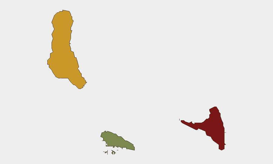
Comoros maintains a composite threat score of 10 and ranks #76 globally, reflecting a low-intensity but fragmented security environment. Sub-national risk is highly concentrated: Anjouan presents substantially elevated threat conditions (risk 88), while Grande Comore shows moderate risk (72), and Moheli remains the lowest-risk island (35). As of 16 June 2026, no confirmed security incidents, civil unrest, infrastructure failures, or acute travel risks have been verified through multi-source reporting in the past 24–48 hours.
Key Developments
No credible security developments specific to Comoros have been confirmed in the last 24–48 hours from independent sources. Event signals flagged in the platform's monitoring feed require additional corroboration and do not currently meet the threshold for inclusion as confirmed incidents. Teams should await verified reporting before altering duty-of-care posture based on these signals alone.
Highest-Risk Areas
Anjouan (risk 88) dominates the threat landscape and warrants priority focus for any personnel or asset presence in Comoros. Historical drivers of elevated risk in Anjouan include weak state capacity, limited law enforcement presence, and maritime vulnerability to transnational criminal activity—factors that persist despite the lack of acute incidents in recent reporting. Grande Comore (risk 72), the capital island, presents secondary but significant risk, likely reflecting urban crime, occasional political tension, and administrative fragility. Mohéli (risk 35) remains substantially lower-risk and represents the safest operational environment within the archipelago. The risk disparity across islands reflects geographic isolation, variation in local governance capacity, and differential exposure to maritime trafficking networks.
How GeoBit Would Assist
For personnel and asset protection in Comoros, teams should deploy AOI Monitoring & Early Warning focused on Anjouan and Grande Comore to detect emerging unrest, crime, or political shifts before they escalate. Network & Actor Analysis and multi-language OSINT (X/Twitter, Telegram, radio SIGINT) can establish baseline understanding of local power brokers, criminal networks, and community sentiment across the islands—critical for low-volume environments where traditional news reporting is sparse. Routing & Network Analysis supports alternative journey planning and evacuation route validation, particularly relevant given maritime dependence and limited road infrastructure. Regular Intel Sweep and conflict/crime search maintain situational continuity between incidents.
7-Day Outlook
No acute triggers suggest imminent escalation in Comoros over the next seven days. The archipelago's baseline fragility—concentrated in Anjouan—remains structural rather than acute. Teams should maintain standard monitoring posture while preparing contingency protocols for personnel in Anjouan, given the persistent risk gap relative to other islands.
Next Brief: 2026-06-17 | Confidence Level: Moderate (limited open-source reporting) | Report Generated: 2026-06-16 12:00 UTC
Highest-Risk Areas — Ranked
| # | State / Region | Risk |
|---|---|---|
| 1 | Anjouan | 88 |
| 2 | Grande Comore | 72 |
| 3 | Moheli | 35 |
Sources
Previous Daily Briefs
A new Comoros brief is written every day — each with its own risk map and downloadable CSV. Here's the last week; use the calendar to go further back.
📅 Browse every day by calendar →
Highlighted days have a brief. Tap a day for that day's map & analysis, or “csv” for that day's dataset ($5).