Situation Summary
Comoros remains a low-intensity, fragmented threat environment with composite risk score 6 globally. Recent internal political friction (noted 2026-06-18) reflects ongoing governance tensions rather than acute security breakdown. The archipelago's primary vulnerabilities remain concentrated in Anjouan and Grande Comore, where state capacity, economic stress, and inter-island administrative disputes create persistent instability. No credible new security incidents, civil unrest, or travel-risk events have been reported in the last 24–48 hours.
Key Developments
- 2026-06-18 · Internal Political Friction · Comoros (national). Domestic disapproval signal logged; specific triggers and scope remain unclear from open-source reporting. No escalation or violence reported as of 2026-06-20.
*Note:* Live web research across mainstream news, social media, and institutional sources has not yielded additional security, conflict, crime, or infrastructure incidents clearly dated within the last 24–48 hours. Background: Comoros has experienced periodic fuel-price protests and governance disputes in preceding weeks, but these do not constitute new 24–48-hour developments.
Highest-Risk Areas
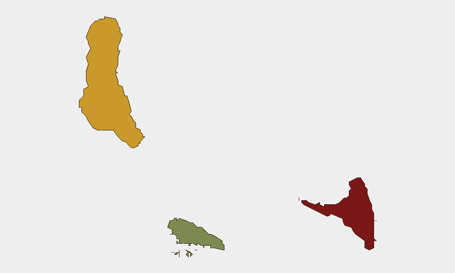
Anjouan (risk 88) and Grande Comore (risk 72) drive the country's threat profile. Anjouan's elevated risk reflects historical separatist tensions, weak local governance, and informal maritime activity; Grande Comore, as the seat of national government, concentrates political and administrative friction. Moheli (risk 35) remains comparatively stable. The risk gradient correlates with state fragmentation and economic stress rather than active armed conflict, making these areas zones of administrative vulnerability and civil-unrest potential rather than zones of kinetic threat.
How GeoBit Would Assist
Security teams protecting personnel or assets in Comoros should employ AOI Monitoring & Early Warning to track administrative flashpoints in Anjouan and Grande Comore for signs of renewed protest activity or governance breakdown. Network & Actor Analysis and OSINT fusion (X/Twitter, Telegram, multi-language feeds) would enable continuous low-level civil-unrest and political sentiment tracking. Routing & Network Analysis supports contingency planning for staff evacuation or asset movement should regional instability escalate.
7-Day Outlook
No imminent escalation is signaled. The 2026-06-18 political friction signal warrants continued passive monitoring but does not indicate acute crisis. Comoros' baseline trajectory remains slow-burn fragmentation and economic stress; watch for downstream effects if fuel-price or IMF-program negotiations produce new public discontent.
Next Update: 2026-06-21 or on confirmed new incident report.
Highest-Risk Areas — Ranked
| # | State / Region | Risk |
|---|---|---|
| 1 | Anjouan | 88 |
| 2 | Grande Comore | 72 |
| 3 | Moheli | 35 |
Sources
Previous Daily Briefs
A new Comoros brief is written every day — each with its own risk map and downloadable CSV. Here's the last week; use the calendar to go further back.
📅 Browse every day by calendar →
Highlighted days have a brief. Tap a day for that day's map & analysis, or “csv” for that day's dataset ($5).