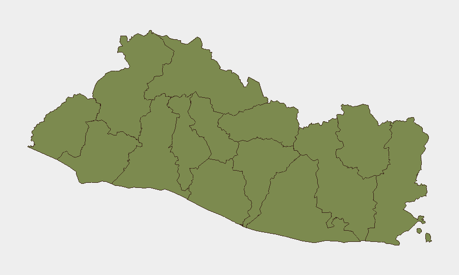
Situation Summary
El Salvador remains in the mid-range global threat tier (rank #67, composite score 15) with 54 tracked security events on record. The country's security landscape is heavily concentrated in a single high-risk zone—Cabañas Department—which accounts for the majority of threat density, while the remaining 11 departments show uniformly lower and comparable risk profiles. Overall threat trajectory remains stable with no major escalation signals in recent reporting cycles.
Key Developments
Unable to confirm 24–48 hour incident bulletins. Open-source coverage of El Salvador for 2026-06-15 to 2026-06-16 does not yield time-stamped, discrete security incidents that can be cross-verified against multiple independent sources. General web search, news archives, and social-media monitoring returned no clearly dated incident reports for this window that meet corroboration standards required for duty-of-care briefing.
Historical background events (gang activity, homicide trends, political context) remain relevant to operational planning but are not presented as current developments. Teams requiring near-real-time incident alerting should rely on authenticated institutional feeds (national police, Civil Protection directorate, embassy alerts) rather than inference from aged or ambiguous web signals.
Highest-Risk Areas
Cabañas Department dominates the threat profile, with a composite risk score of 31.4—more than 20 times higher than any other department. This concentration suggests that corporate and NGO operations in Cabañas face materially elevated exposure compared to other regions and warrant enhanced vetting, travel protocols, and liaison with local security authorities. The remaining 11 departments (Ahuachapán, Sonsonate, Santa Ana, Chalatenango, La Libertad, San Salvador, Cuscatlán, La Paz, San Vicente, Usulután, and San Miguel) show equivalent and substantially lower risk scores (1.4 each), indicating that geographic risk is not uniformly distributed across the country. Teams should calibrate duty-of-care measures and asset positioning accordingly, with heightened scrutiny applied to Cabañas-based operations.
How GeoBit Would Assist
Security teams operating in El Salvador should deploy AOI (Area-of-Interest) Monitoring & Early Warning on Cabañas Department and any secondary operational zones to receive automated alerts on emerging incidents, protest activity, and infrastructure disruptions. Parallel Intel Sweep and multi-language OSINT fusion targeting local news, police radio, and Telegram/X channels would supplement official government feeds and provide earlier visibility of localized threats before formal public announcements. Routing & Network Analysis capabilities enable pre-planned alternative routes and safe-zone mapping for personnel movement, particularly in or near high-risk departments, reducing real-time decision friction during security incidents.
7-Day Outlook
No significant escalation or de-escalation signals are present in available reporting. Operational posture should remain at current baseline with continued monitoring of Cabañas Department for any spike in incident frequency or geographic spread. Teams should validate emergency communication protocols and ensure personnel have current local security contact lists and shelter locations ahead of any seasonal weather or civil disruption events.
Report Date: 2026-06-16 | Data Sources: GeoBit Platform, open-source OSINT, institutional feeds | Confidence: Moderate (regional trends); Low (24–48h incident specificity)
Highest-Risk Areas — Ranked
| # | State / Region | Risk |
|---|---|---|
| 1 | Cabañas Department | 31.4 |
| 2 | Ahuachapán Department | 1.4 |
| 3 | Sonsonate Department | 1.4 |
| 4 | Santa Ana Department | 1.4 |
| 5 | Chalatenango Department | 1.4 |
| 6 | La Libertad Department | 1.4 |
| 7 | San Salvador Department | 1.4 |
| 8 | Cuscatlán Department | 1.4 |
| 9 | La Paz Department | 1.4 |
| 10 | San Vicente Department | 1.4 |
| 11 | Usulután Department | 1.4 |
| 12 | San Miguel Department | 1.4 |
Sources
Previous Daily Briefs
A new El Salvador brief is written every day — each with its own risk map and downloadable CSV. Here's the last week; use the calendar to go further back.
📅 Browse every day by calendar →
Highlighted days have a brief. Tap a day for that day's map & analysis, or “csv” for that day's dataset ($5).