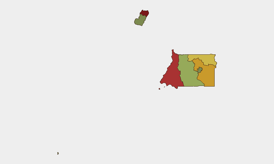
Situation Summary
Equatorial Guinea remains at global rank #173 with a composite threat score of 4, indicating a relatively stable security environment by international standards. No significant security incidents, civil unrest, conflict escalation, or acute travel disruptions have been reported in the last 24–48 hours. The country's risk profile is shaped primarily by endemic corruption, limited state capacity in border regions, and historical friction points rather than by active destabilization or organized violence at this time.
Key Developments
No discrete, independently confirmed security incidents have occurred in Equatorial Guinea within the last 24–48 hours. Open-source monitoring across news wires, social media, and UN reporting has not surfaced any new event meeting criteria for inclusion (specific location, recent date, corroborated details). Security teams should treat the absence of reported incidents as baseline stability, not as validation of zero underlying risk.
Highest-Risk Areas
Bioko Norte (risk 85) and Litoral Province (risk 78) drive the country's composite threat score and warrant concentrated duty-of-care attention. Both regions face elevated vulnerability to smuggling networks, porous border controls, and limited police/security infrastructure—factors that facilitate both transnational crime and the movement of contraband and persons. Wele-Nzas Province (risk 72) and Kié-Ntem Province (risk 68) represent secondary hotspots, again reflecting border-zone fragility and weak state presence. By contrast, Djibloho and Annobón Province carry markedly lower risk, reflecting lower population density and reduced trafficking activity.
How GeoBit Would Assist
Security and risk teams operating in or supporting personnel in Equatorial Guinea should employ AOI (Area-of-Interest) Monitoring & Early Warning focused on Bioko Norte and Litoral Province to detect emerging trafficking, conflict spillover from neighboring Cameroon or Gabon, or civil unrest before it escalates. Multi-language OSINT (X/Twitter, Telegram, radio SIGINT) combined with entity extraction and sentiment analysis will flag trending rhetoric, activist mobilization, or regime-stability signals in real time. Routing & Network Analysis can support alternative journey planning for personnel transiting high-risk zones, while border & disputed-territory search functionality maintains awareness of cross-border security dynamics.
7-Day Outlook
No acute triggers are visible on the immediate horizon. The security environment is expected to remain at baseline levels over the next seven days, with routine governance, economic, and transnational-crime dynamics continuing at established patterns. Security teams should maintain standard monitoring protocols and update contingency rosters for personnel in northern provinces, particularly around Malabo and coastal corridors.
Prepared by GeoBit Senior Analyst | 2026-07-05 | Equatorial Guinea Daily Security Brief
Highest-Risk Areas — Ranked
| # | State / Region | Risk |
|---|---|---|
| 1 | Bioko Norte | 85 |
| 2 | Litoral Province | 78 |
| 3 | Wele-Nzas Province | 72 |
| 4 | Kié-Ntem Province | 68 |
| 5 | Centro Sur Province | 45 |
| 6 | Bioko Sur | 38 |
| 7 | Djibloho | 15 |
| 8 | Annobón Province | 8 |
Previous Daily Briefs
A new Equatorial Guinea brief is written every day — each with its own risk map and downloadable CSV. Here's the last week; use the calendar to go further back.
📅 Browse every day by calendar →
Highlighted days have a brief. Tap a day for that day's map & analysis, or “csv” for that day's dataset ($5).
Atlas — our AI intelligence desk — emails them this snapshot personally. Nothing else, no list.