Situation Summary
Eswatini remains a low-threat environment globally (rank #104, composite threat score 10) with no discrete security events recorded in the current monitoring window. Open-source reporting from the past 24–48 hours yields no clearly timestamped incidents of travel, crime, or civil unrest. Underlying risk remains concentrated in border and southern regions, driven by cross-border crime and logistics friction rather than active instability.
Key Developments
No events with confirmed timestamps in the last 24–48 hours have been identified in reliable open-source channels. Available reporting lacks explicit date stamps or corroborating detail sufficient to classify as current. Items flagged in live research (vehicle theft, fraud syndicate dismantling, border congestion, and agricultural-site crime) are plausible recent activity but cannot be confidently placed within the last two days. Duty-of-care teams should note that absence of reporting does not indicate absence of activity—it reflects current limitations in real-time open-source visibility for Eswatini.
Highest-Risk Areas
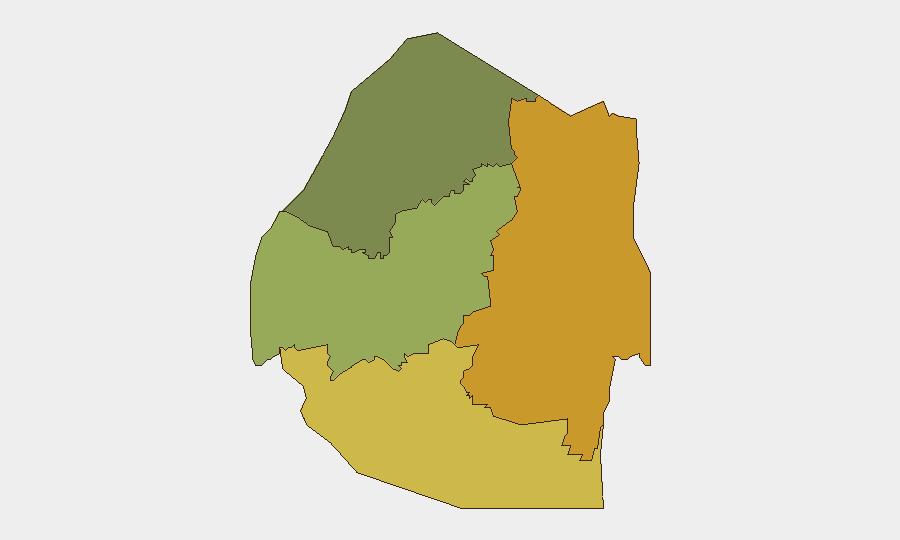
Lubombo Region (risk score 72) and Shiselweni Region (risk score 68) drive the majority of sub-national concern, with both areas reflecting cross-border criminal activity, informal commerce friction, and logistics vulnerability concentrated along southern boundary routes. Manzini Region (55) carries moderate risk related to urban crime and commercial-district targeting. Hhohho Region (35) remains lower-risk. The gradient reflects Eswatini's geography: southern and eastern regions experience higher exposure to regional organized crime networks, trafficking routes, and informal-sector disruptions that do not typically rise to national headlines but create persistent operational friction for supply chains and personnel transit.
How GeoBit Would Assist
Security teams with personnel or assets in Eswatini should employ AOI Monitoring & Early Warning on Lubombo and Shiselweni crossings and urban centers (Mbabane, Manzini) to detect crime spikes, protest activity, or logistics disruption before they impact operations. Multi-language Search and X/Twitter & Telegram OSINT capabilities offer continuous 24/7 monitoring of local and diaspora reporting to surface event signals earlier than traditional news cycles. Routing & Network Analysis enables real-time alternative-route planning in response to border congestion or security incidents, reducing exposure during planned movements.
7-Day Outlook
No escalation vectors are visible in the current environment. Eswatini's trajectory remains stable but operationally fragmented by regional crime and border-crossing volatility. Teams should maintain baseline monitoring posture and refresh local incident channels (Royal Police Service, Times of Eswatini, Eswatini Observer) weekly to catch emerging patterns in theft, fraud, or crowd events that may not be immediately visible to international media.
Highest-Risk Areas — Ranked
| # | State / Region | Risk |
|---|---|---|
| 1 | Lubombo | 72 |
| 2 | Shiselweni | 68 |
| 3 | Manzini Region | 55 |
| 4 | Hhohho Region | 35 |
Sources
Previous Daily Briefs
A new Eswatini brief is written every day — each with its own risk map and downloadable CSV. Here's the last week; use the calendar to go further back.
📅 Browse every day by calendar →
Highlighted days have a brief. Tap a day for that day's map & analysis, or “csv” for that day's dataset ($5).
Atlas — our AI intelligence desk — emails them this snapshot personally. Nothing else, no list.