Situation Summary
Guatemala remains under moderate composite threat pressure (score 40/100), with political, military, and organized-crime signals clustered around national administration and inter-agency tensions rather than localized civil violence. Event data from 13–15 June shows elevated activity around conventional military posture, diplomatic friction, and investigative operations, but open-source reporting has not yet corroborated specific ground-level incidents in the past 48 hours. The trajectory reflects institutional stress rather than acute breakdown, though northern and western regions retain chronic criminal activity.
Key Developments
No specific, independently corroborated security incidents in Guatemala have been confirmed across multiple open sources within the past 24–48 hours (13–15 June 2026).
GeoBit's platform detected multiple signals on 13–15 June—including "Conventional Military Force" (multiple actors), "Investigate" (authorities and academics), diplomatic strain ("Reduce Relations"), and organized-crime threat indicators—but live web research (news, X/Twitter, local media) has not surfaced discrete, time-stamped, location-specific events meeting verification thresholds for this brief's audience. Items dated 12 June or earlier (law-enforcement operations, military deployments) fall outside the 48-hour window; border-region advisories are standing assessments, not new incidents; and diplomatic signals lack operational security detail.
For risk teams requiring acute tactical intelligence: A standing travel advisory remains in effect for the Mexico–Guatemala border (within 40 km on the Guatemala side) due to cross-border contraband and organized-crime activity, updated as of 11 June. This is a persistent condition, not a new event.
Highest-Risk Areas
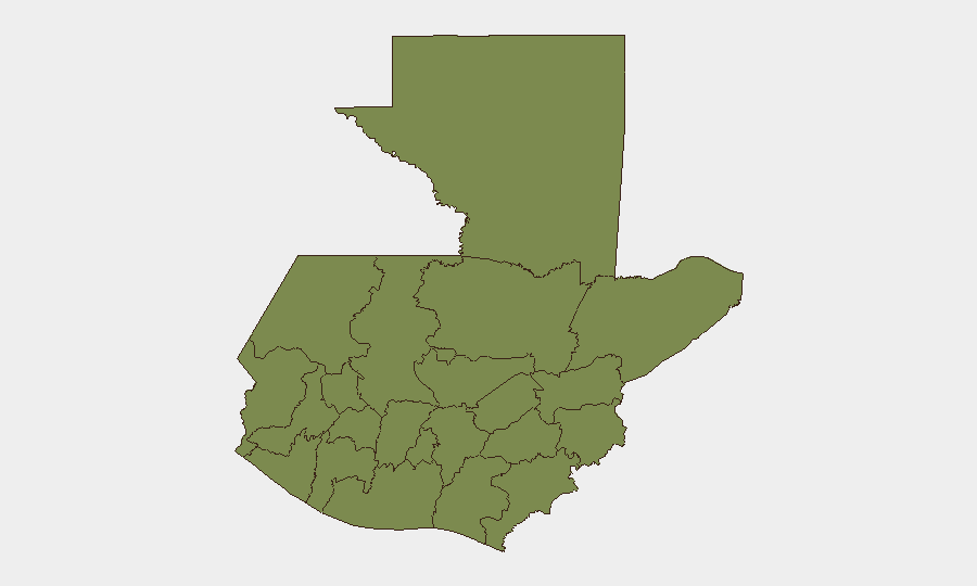
Alta Verapaz stands apart in the sub-national ranking (31.3 vs. 1.3 for all other regions), driven by concentrated organized-crime activity, trafficking networks, and limited state authority in remote areas. Petén, Huehuetenango, San Marcos, and the western highlands (Quetzaltenango, Quiché, Sololá, Chimaltenango, Sacatepéquez) all register at baseline risk (1.3), reflecting endemic rural crime, migration-route vulnerability, and sporadic gang presence but not acute destabilization. Northern and western border zones remain chronic red zones for narcotics transit and kidnapping risk; central highlands see seasonal disruption linked to gang recruitment and extortion. The metropolitan area (Guatemala City) is not separately ranked here but historically maintains its own distinct security profile requiring localized monitoring.
How GeoBit Would Assist
Intel Sweep and multi-language OSINT fusion would consolidate scattered signals from Guatemalan media, official statements, and social platforms to surface emerging incidents or policy shifts faster than manual monitoring. AOI (Area-of-Interest) monitoring with alerting on Alta Verapaz, border zones, and key transport corridors would flag new criminal, military, or civil activity in real time, enabling early warning before escalation. Network & Actor analysis of criminal organizations, state security apparatus, and diplomatic players would contextualize why events are occurring and which entities pose direct risk to corporate assets or personnel.
7-Day Outlook
Near-term trajectory suggests continued institutional and diplomatic strain (reflected in military/administrative signals) without clear resolution through 21 June. The absence of fresh ground-level incident corroboration does not indicate security improvement but rather information lag; northern and western regions should be treated as persistently volatile. Security teams are advised to maintain heightened situational awareness in Alta Verapaz, validate operational routing and staff movement through safer corridors, and pre-position contingency protocols for rapid escalation if signals intensify.
Highest-Risk Areas — Ranked
| # | State / Region | Risk |
|---|---|---|
| 1 | Alta Verapaz | 31.3 |
| 2 | Petén | 1.3 |
| 3 | Huehuetenango | 1.3 |
| 4 | San Marcos | 1.3 |
| 5 | Quetzaltenango | 1.3 |
| 6 | Retalhuleu | 1.3 |
| 7 | Quiché | 1.3 |
| 8 | Totonicapán | 1.3 |
| 9 | Sololá | 1.3 |
| 10 | Chimaltenango | 1.3 |
| 11 | Suchitepéquez | 1.3 |
| 12 | Sacatepéquez | 1.3 |
Sources
Previous Daily Briefs
A new Guatemala brief is written every day — each with its own risk map and downloadable CSV. Here's the last week; use the calendar to go further back.
📅 Browse every day by calendar →
Highlighted days have a brief. Tap a day for that day's map & analysis, or “csv” for that day's dataset ($5).