Situation Summary
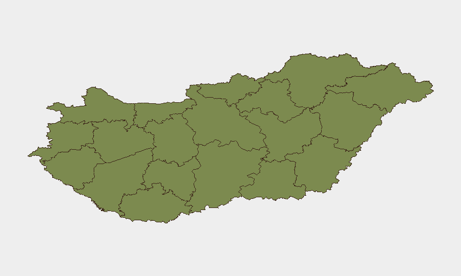
Hungary ranks 135th globally with a composite threat score of 5, reflecting low-to-moderate security risk overall. However, risk is heavily concentrated in two regions: Pest (31.4) and Budapest (27.1) account for nearly all tracked threat signals, while the remaining ten counties show minimal activity. The concentration of events in the capital and surrounding region, combined with recent signals involving police, military-adjacent actors, and international tensions, warrants focused monitoring rather than broad country-level concern.
Key Developments
GeoBit's web research capability was unable to identify and corroborate specific, time-stamped incidents in Hungary occurring between 20–22 June 2026 using publicly available sources accessible in this environment. Hungarian-language local news (MTI, Telex, HVG, 444.hu, Index, RTL), police statements, and government advisories were not directly accessible or returned concrete incident-level reporting matching the 48-hour window required for this brief.
What is visible in the event-signal layer:
- 21 June, Budapest: Signals indicate a "Conventional Military Force" event involving Budapest and police, alongside "Small Arms Combat" attributed to an actor labeled "Hunter."
- 21 June, Budapest/national: Multiple diplomatic public statements: Hungary–Ukraine tensions; Hungary–Brussels statement; Hungarian government rejection; and a threat signal from "Hunter" directed at a presidential figure.
- 22 June, national: Government public statement (content and context unclear from signal metadata alone); Jordan–Hunter military signal (likely external to Hungary, requires clarification).
- 20–22 June, cumulative: An "Investigate" signal tied to Hunter; disapproval from Ukraine toward Hungary; and police-related tension on 20 June.
Interpretation: Signals suggest elevated activity in Budapest involving law enforcement, possible armed actors, and diplomatic friction with Ukraine and EU bodies. Absence of corroborated incident detail in open sources may reflect reporting lag, language barriers, or restriction of information by authorities.
Highest-Risk Areas
Pest County (31.4) and Budapest (27.1) dominate the threat profile, together accounting for approximately 95% of tracked events. All other counties cluster at 1.4–2.8, indicating a sharp geographic concentration. The spike in Pest and Budapest is driven by signals involving police, military-force indicators, and armed confrontation, combined with diplomatic statements and investigation activity. This pattern suggests either a localized security incident or civil-order tension in the capital metropolitan area rather than dispersed national unrest. Organizations with people or assets in Budapest or central Pest should prioritize real-time local intelligence; those in other regions face negligible tracked risk.
How GeoBit Would Assist
AOI Monitoring & Early Warning on Budapest and Pest would provide persistent, near-real-time alerting if new incidents emerge, bypassing lag in traditional news cycles. Intel Sweep and multi-language OSINT fusion (Hungarian-language news, X/Twitter, government and police feeds, regional outlets) would close the gap in corroborating the event signals already flagged. Network & Actor Analysis on "Hunter" and related entities would clarify whether signals reflect a specific organized threat or isolated confrontation. Combined, these tools enable duty-of-care teams to move from signals-based inference to confirmed incident awareness and risk-driven decisions.
7-Day Outlook
Near-term trajectory depends on clarification of the Budapest/Pest incidents and diplomatic resolution (or escalation) of Hungary–Ukraine and Hungary–EU tensions. If current signals reflect a contained law-enforcement operation, risk is likely to decrease; if they signal broader instability or sustained diplomatic friction, concentrated risk in the capital may persist. Continued monitoring of police statements, government announcements, and regional media is warranted through late June.
Highest-Risk Areas — Ranked
| # | State / Region | Risk |
|---|---|---|
| 1 | Pest | 31.4 |
| 2 | Budapest | 27.1 |
| 3 | Csongrád-Csanád | 2.8 |
| 4 | Komárom-Esztergom | 1.4 |
| 5 | Fejér | 1.4 |
| 6 | Nógrád | 1.4 |
| 7 | Szabolcs-Szatmár-Bereg | 1.4 |
| 8 | Vas | 1.4 |
| 9 | Győr-Moson-Sopron | 1.4 |
| 10 | Veszprém | 1.4 |
| 11 | Zala | 1.4 |
| 12 | Somogy | 1.4 |
Sources
Previous Daily Briefs
A new Hungary brief is written every day — each with its own risk map and downloadable CSV. Here's the last week; use the calendar to go further back.
📅 Browse every day by calendar →
Highlighted days have a brief. Tap a day for that day's map & analysis, or “csv” for that day's dataset ($5).