Situation Summary
Ireland remains at composite threat level 6 globally (#143), with 102 tracked security events. The principal current risk driver is acute civil unrest in Northern Ireland, centred on Belfast, where anti-immigration protests have escalated to violence over the past 48 hours, including arson, property destruction, and police confrontation. Within the Republic, County Tipperary and County Dublin show elevated composite risk scores; however, the immediate and most volatile threat is concentrated in Belfast and surrounding communities, where ethnic-minority populations face direct safety concerns and further disorder is assessed as possible if community tensions are not rapidly de-escalated.
Key Developments
- Belfast, Northern Ireland, evening 11 June 2026: Anti-immigration protests turned violent for a second consecutive night, with masked protesters setting small fires, throwing bricks and bottles at police, and attacking property. PSNI deployed water cannons for crowd control.
- West Belfast, Northern Ireland, night 10–11 June 2026: Masked men set fire to multiple homes believed to house immigrant families and torched a Belfast bus during anti-migrant disorder linked to anger over a recent stabbing incident.
- Belfast Magistrates' Court, 11 June 2026: A 30-year-old Sudanese man, Hadi Alodid, appeared charged with attempted murder and related offences for a stabbing that left a local man seriously injured and blinded in one eye; authorities confirm this incident directly catalysed the current anti-immigrant violence.
- Belfast, Northern Ireland, 11–12 June 2026: PSNI Chief Constable Jon Boutcher and UK Secretary of State for Northern Ireland Hilary Benn held a public briefing on anti-immigrant violence, outlining security operations and warnings of further disturbances.
- Northern Ireland (ethnic-minority communities), last 48 hours: The Ethnic Minority Sports Organisation reported heightened fear and safety concerns among migrant families in response to the knife attack and unrest.
- Cricket Ireland announcement, 11–12 June 2026: Cricket Ireland indicated it will decide within 48 hours whether scheduled fixtures will proceed, signalling that security and public-order risk are serious enough to disrupt civilian events and travel.
- Republic of Ireland, viral incident within last 48 hours: A widely shared Instagram video shows a local man physically restrained by multiple individuals, framed in online discourse around policing and community safety, contributing to broader grievance narratives.
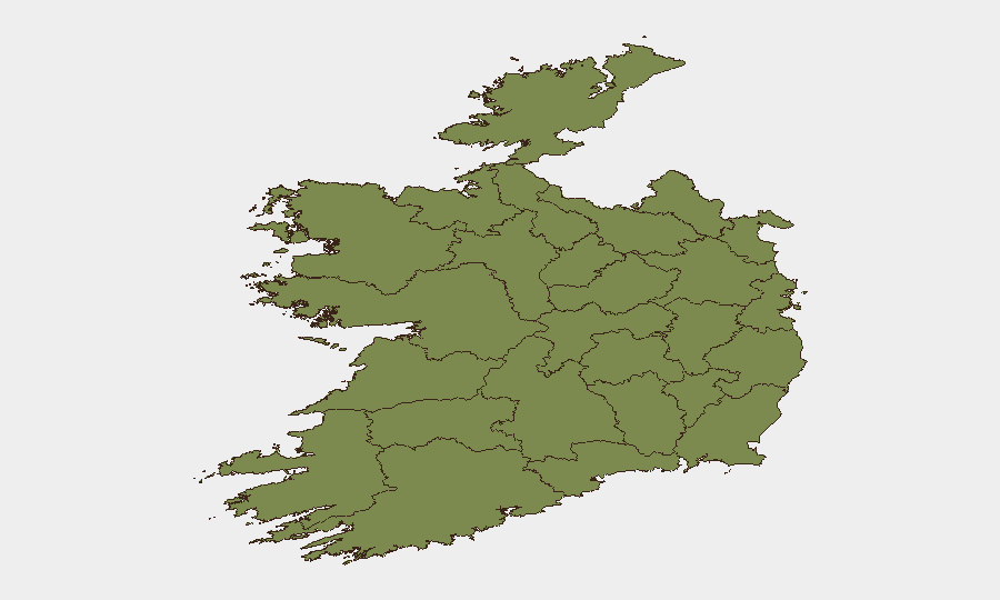
Highest-Risk Areas
County Tipperary (risk 31.4) and County Dublin (risk 27.7) dominate GeoBit's sub-national ranking, though the data does not yet detail specific drivers. The immediate operational threat is concentrated in Belfast and West Belfast, where active civil unrest, arson, and police engagement are documented. Louth (2.1), Westmeath (1.8), Donegal, Wexford, Mayo, Sligo, Galway, Clare, Limerick, and Leitrim carry lower but sustained risk signals. Organizations with personnel or assets in Belfast should treat current conditions as a high-priority monitoring zone; those in Dublin and Tipperary should review duty-of-care protocols and situational awareness, pending further intelligence on the drivers of those composite scores.
How GeoBit Would Assist
Security teams should deploy AOI Monitoring & Early Warning on Belfast and surrounding localities to track further protest activity, police response, and community disorder in real time. OSINT fusion (X/Twitter, Telegram, Instagram, multi-language feeds) combined with sentiment & temporal analysis will detect escalation signals and coordinate messaging across ethnic-minority networks. Risk & Threat Assessment and Network & Actor Analysis capabilities enable profiling of protest organizers and grievance drivers to forecast next flashpoints.
7-Day Outlook
Further anti-immigration protests are probable in Belfast and possibly other Northern Irish towns if the stabbing case proceeds and community anger remains unaddressed. Sporting events, public gatherings, and commercial travel may face disruption or cancellation. Cross-border spillover into the Republic cannot be ruled out if tensions remain high; monitoring of Dublin and border counties is warranted.
Highest-Risk Areas — Ranked
| # | State / Region | Risk |
|---|---|---|
| 1 | County Tipperary | 31.4 |
| 2 | County Dublin | 27.7 |
| 3 | County Louth | 2.1 |
| 4 | County Westmeath | 1.8 |
| 5 | County Donegal | 1.6 |
| 6 | County Wexford | 1.6 |
| 7 | County Mayo | 1.4 |
| 8 | County Sligo | 1.4 |
| 9 | County Galway | 1.4 |
| 10 | County Clare | 1.4 |
| 11 | County Limerick | 1.4 |
| 12 | County Leitrim | 1.4 |
Previous Daily Briefs
A new Ireland brief is written every day — each with its own risk map and downloadable CSV. Here's the last week; use the calendar to go further back.
📅 Browse every day by calendar →
Highlighted days have a brief. Tap a day for that day's map & analysis, or “csv” for that day's dataset ($5).