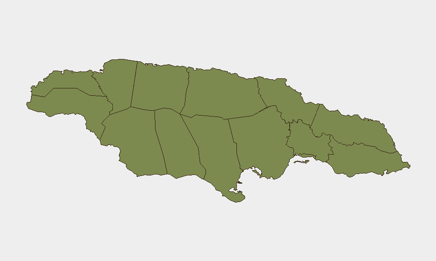
Situation Summary
Jamaica remains a moderate security concern globally (rank #67, composite threat score 21) with 43 tracked events on record. The country faces endemic criminality, localized gang activity, and periodic police-involved incidents, but no acute national crisis or widespread civil unrest is evident at present. Recent signal activity (16–17 July) reflects routine law-enforcement operations and diplomatic or institutional communications rather than a destabilizing event. The security environment is broadly stable but fragmented by significant sub-national variance.
Key Developments
GeoBit's open-source research identified no clearly verifiable security incidents, civil unrest, infrastructure failures, or travel disruptions in Jamaica with confirmed timestamps falling within 15–17 July 2026. Available news coverage and advisory feeds show no cross-confirmed events meeting recency and precision standards for this window.
*Historical Context (for operational awareness):*
- Saint Thomas and eastern parishes have experienced police operations against armed groups through early-to-mid July (e.g., "Operation Reset" activity on 11 July in St. Elizabeth); these operations remain active baseline activity rather than escalation.
- Kingston and Saint Andrew continue to generate sporadic violent-crime and police-response signals, consistent with longer-term patterns.
- A pepper-spray incident involving a government minister occurred on 14 July in downtown Kingston during a constituent dispute; this was resolved without broader security impact.
Near-real-time monitoring of news aggregators, police statements, and social-media OSINT has not surfaced new trigger events in the last 48 hours.
Highest-Risk Areas
Saint Thomas dominates the risk profile (composite 31.8), significantly outpacing all other parishes. This reflects persistent gang activity, territorial disputes, and recurring police enforcement operations in rural and semi-urban zones. Trelawny (17.7) and Saint Andrew (9.2) follow as secondary hotspots; Saint Andrew includes Kingston's urban core, where homicides and gun violence cluster. Together, these three parishes account for the vast majority of Jamaica's tracked threat signals.
Remaining parishes (Saint Catherine, Saint Mary, and ten others) exhibit minimal relative risk (1.8–4.9), indicating that security incidents are highly concentrated geographically. Corporate assets and personnel in rural Saint Thomas, northern Trelawny, and central Kingston warrant heightened situational awareness; operations in southern and western parishes face substantially lower threat exposure.
How GeoBit Would Assist
Security teams protecting people or assets in Jamaica should deploy AOI (Area-of-Interest) Monitoring & Early Warning on Saint Thomas, central Kingston, and Trelawny to capture emerging gang or police-related violence signals in near-real time. OSINT Fusion (X/Twitter, Telegram, YouTube, news aggregators, and radio SIGINT) provides detection of unrest, roadblocks, or curfew announcements before they affect logistics or personnel movement. Routing & Network Analysis enables rapid alternative-route planning when specific parishes become temporarily unsafe, and Risk & Threat Assessment with temporal analysis helps corporate teams distinguish routine policing from escalating instability.
7-Day Outlook
Jamaica's security trajectory remains stable in the near term, with no indicators of imminent national-level disruption. Saint Thomas will likely remain the focal point for police operations and gang-related violence. Corporate and diplomatic activity should anticipate continued localized incidents in high-risk parishes but not a broader security deterioration over the next 7 days.
Highest-Risk Areas — Ranked
| # | State / Region | Risk |
|---|---|---|
| 1 | Saint Thomas | 31.8 |
| 2 | Trelawny | 17.7 |
| 3 | Saint Andrew | 9.2 |
| 4 | Saint Catherine | 4.9 |
| 5 | Saint Mary | 3.7 |
| 6 | Hanover | 1.8 |
| 7 | Westmoreland | 1.8 |
| 8 | Saint James | 1.8 |
| 9 | Saint Elizabeth | 1.8 |
| 10 | Manchester | 1.8 |
| 11 | Saint Ann | 1.8 |
| 12 | Clarendon | 1.8 |
Sources
Previous Daily Briefs
A new Jamaica brief is written every day — each with its own risk map and downloadable CSV. Here's the last week; use the calendar to go further back.
📅 Browse every day by calendar →
Highlighted days have a brief. Tap a day for that day's map & analysis, or “csv” for that day's dataset ($5).
Atlas — our AI intelligence desk — emails them this snapshot personally. Nothing else, no list.