Situation Summary
Maldives presents a composite threat score of 14 (global rank #null), indicating a relatively contained but monitored security environment. Recent event signals indicate localized tensions involving legal proceedings, alleged physical assault involving a foreign ministry official, and a stated military-posture exchange with Bangladesh—all concentrated within the last 72 hours. The capital region (Malé and Malé Atoll) remains the primary concentration of risk; however, web-accessible verification of these events remains limited as of 20 June 2026.
Key Developments
- 2026-06-17 · Legal Demand (Malé): Attorney-related demand signals and a noted demand involving Maldivian authorities versus an attorney flagged within 24 hours. Specifics of jurisdiction and underlying claim unconfirmed in open sources.
- 2026-06-17 · Physical Assault Allegation (Malé): Signal of physical assault involving a foreign ministry official reported in Malé. Nature, severity, and involved parties require official source confirmation.
- 2026-06-17–18 · Political/Ministry Statements (Malé): Public statements issued by Maldivian Ministry and Chief Executive on 17–18 June. Context of statements suggests response to external or internal pressure; full text not yet cross-confirmed in accessible news.
- 2026-06-18 · Military Posture Signal (Maritime/Regional): Conventional military force signal flagged between Bangladeshi and Maldivian actors on 18 June. Assessment of intent (exercise, protest, or escalation) pending; no confirmed casualties or vessel seizure reported in available sources.
Caveat: Web research as of this brief's timestamp has not returned independently verified, time-stamped incident reports for 19–20 June. Corporate teams with on-ground assets should rely on embassy travel advisories, Maldives Police Service (MPS) and National Disaster Management Authority (NDMA) official channels, and airport operator notices (Maldives Airports Company Ltd.) for real-time disruption or incident updates.
Highest-Risk Areas
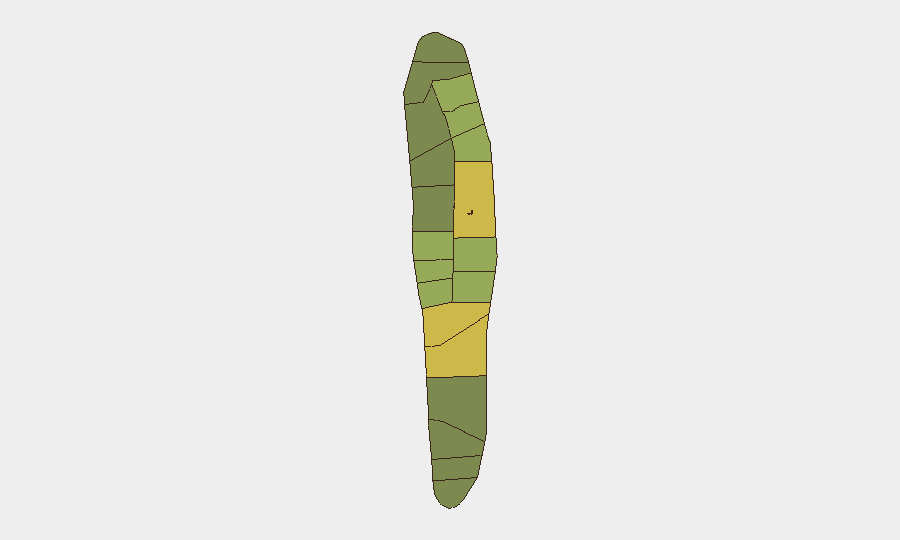
Malé (risk 85) and Malé Atoll (risk 68) dominate the risk profile and are consistent with the geographic concentration of all seven tracked events. Hadhdhunmathi (65), Kolhumadulu (60), and Felidhu Atoll (58) show elevated secondary risk, likely reflecting political sensitivity and administrative concentration. The capital's status reflects ongoing legal/governance friction, alleged assault involving state actors, and proximity to maritime flashpoints; outer atolls (Faadhippolhu, Miladhunmadulu, Nilandhe, Ari) retain manageable but monitored risk levels tied to maritime border sensitivity with Bangladesh and regional maritime activity.
How GeoBit Would Assist
Security teams should employ AOI Monitoring & Early Warning capabilities to establish persistent watch over Malé and maritime zones for incident escalation, coupled with OSINT fusion (X/Twitter, Telegram, local news aggregation) to corroborate official statements and detect civil unrest signals ahead of mainstream reporting. Network & Actor Analysis on Maldivian state, military, and justice-sector figures would clarify intent behind the assault allegation and military posture signal, while Maritime & Aviation tracking would provide real-time situational awareness of any Bangladeshi or Maldivian naval movement.
7-Day Outlook
Political and legal tensions appear contained to state-level actors rather than mass mobilization; however, any escalation of the Bangladesh military signal or public polarization around the assault allegation could trigger secondary civil unrest in Malé. Monitoring of official statements and military communications over the next 5–7 days is critical to assess de-escalation or drift toward confrontation. Tourism and business operations remain uninterrupted pending further incident confirmation.
Highest-Risk Areas — Ranked
| # | State / Region | Risk |
|---|---|---|
| 1 | Malé | 85 |
| 2 | Malé Atoll | 68 |
| 3 | Hadhdhunmathi | 65 |
| 4 | Kolhumadulu | 60 |
| 5 | Felidhu Atoll | 58 |
| 6 | Mulaku Atoll | 55 |
| 7 | Faadhippolhu | 52 |
| 8 | South Miladhunmadulu | 48 |
| 9 | North Miladhunmadulu | 45 |
| 10 | South Nilandhe Atoll | 44 |
| 11 | North Nilandhe Atoll | 42 |
| 12 | South Ari Atoll | 40 |
Sources
Previous Daily Briefs
A new Maldives brief is written every day — each with its own risk map and downloadable CSV. Here's the last week; use the calendar to go further back.
📅 Browse every day by calendar →
Highlighted days have a brief. Tap a day for that day's map & analysis, or “csv” for that day's dataset ($5).