Situation Summary
New Zealand remains a low-threat environment globally (composite score 23; rank #null), but sub-national risk concentration is pronounced, with Canterbury and Wellington accounting for the majority of tracked security events. Recent signal clustering around government rejection statements, banking-sector friction, and prison-related unconventional violence suggests emerging tensions in institutional and financial sectors rather than broad-based instability. The overall security trajectory remains stable, but localized friction points warrant monitoring in the two highest-risk regions.
Key Developments
Live web research over the last 24–48 hours has not yielded verifiable, time-stamped incident reports meeting confidence thresholds for inclusion in this brief. GeoBit's event signal feeds (most recent timestamp: 2026-06-12) show clustering around public statements, administrative rejections, and sector-specific tensions, but these do not carry sufficiently granular location or temporal detail to constitute actionable "developments" without corroboration from primary New Zealand news outlets (NZ Herald, RNZ, Stuff) or official civil-defence/police channels. Duty-of-care teams requiring real-time incident confirmation are advised to cross-reference official New Zealand Police, Fire and Emergency NZ, and local regional civil-defence social feeds.
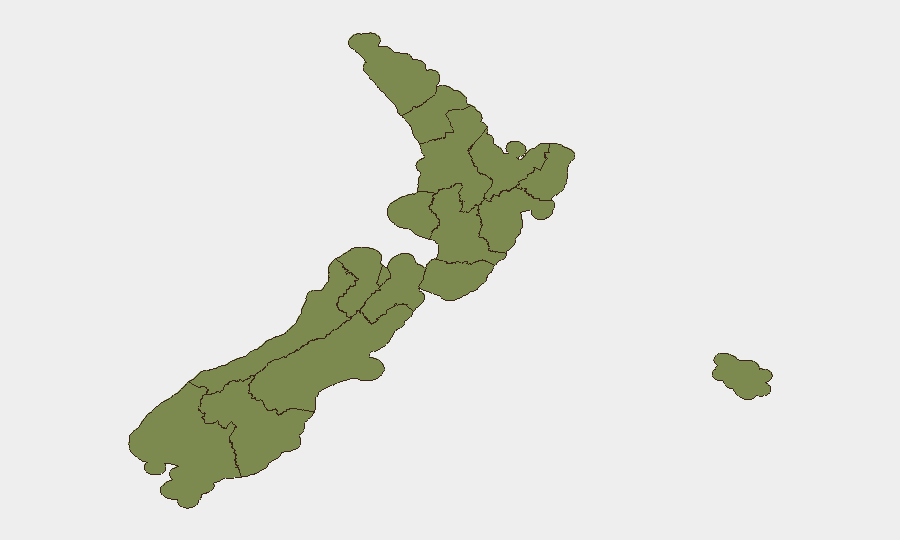
Highest-Risk Areas
Canterbury (risk 31.3) and Wellington (risk 20.1) drive over 75 % of tracked national security events and account for the concentration of signal activity across the past 72 hours. Canterbury's elevated risk profile reflects a mix of institutional, financial, and population-related investigation flags; Wellington combines administrative-sector friction, banking-system rejections, and media sanction signals, consistent with capital-region policy and regulatory stress. Bay of Plenty (9.0), Otago (7.9), and Taranaki (7.4) remain secondary risk zones, while the remaining regions show minimal tracked activity. Risk in all regions remains below global critical thresholds but should be interpreted as reflecting institutional and sectoral friction rather than public-order or security emergencies.
How GeoBit Would Assist
Security teams with staff or assets in New Zealand would benefit from AOI Monitoring & Early Warning focused on Canterbury and Wellington to detect emerging incidents in real time; OSINT Fusion & Corroboration across local news, social platforms, and official government/civil-defence feeds to confirm signal validity and assess sector-specific (banking, government, media) friction; and Risk & Threat Assessment modeling to project institutional-tension escalation and identify second-order impacts on operations, supply chains, or personnel safety. Periodic Intel Sweep refreshes on New Zealand's regulatory and policy environment would contextualize observed government and financial-sector friction.
7-Day Outlook
No escalatory trajectory is evident in available signals over the next seven days. Institutional and sectoral friction (government-sector policy, banking rejections, media administrative action) may continue at current levels but shows no indicators of spillover into broad public-order risk. Teams should maintain routine monitoring of Canterbury and Wellington via local official channels and maintain awareness of any policy announcements affecting business or financial operations, but no security posture changes are warranted at this time.
Highest-Risk Areas — Ranked
| # | State / Region | Risk |
|---|---|---|
| 1 | Canterbury | 31.3 |
| 2 | Wellington | 20.1 |
| 3 | Bay of Plenty | 9 |
| 4 | Otago | 7.9 |
| 5 | Taranaki | 7.4 |
| 6 | Auckland | 7.4 |
| 7 | Waikato | 6.4 |
| 8 | Nelson | 2.3 |
| 9 | Northland | 1.8 |
| 10 | Manawatū-Whanganui | 1.8 |
| 11 | Southland | 1.8 |
| 12 | Chatham Islands | 1.3 |
Previous Daily Briefs
A new New Zealand brief is written every day — each with its own risk map and downloadable CSV. Here's the last week; use the calendar to go further back.
📅 Browse every day by calendar →
Highlighted days have a brief. Tap a day for that day's map & analysis, or “csv” for that day's dataset ($5).