Situation Summary
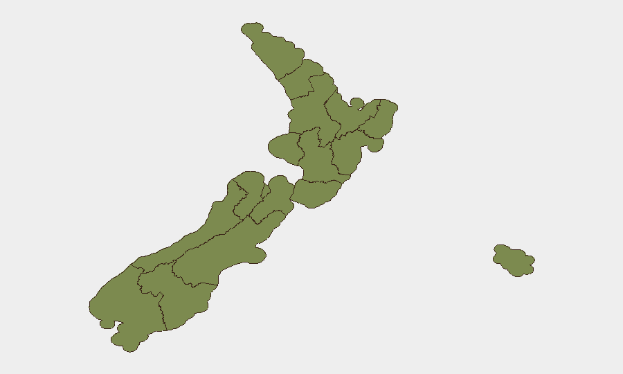
New Zealand's composite threat score of 20 places it outside the top-ranked nations globally, but sub-national risk concentration is pronounced: Canterbury's score of 31.3 is nearly 2.5× the national average, while Wellington (12.7) and Taranaki (3.9) show secondary elevation. Recent event signals (73 tracked incidents) cluster around government statements, worker actions, police operations in Auckland, and judicial/banking sector activity, suggesting labor, institutional, and law-enforcement tensions rather than conventional security collapse. The overall trajectory remains stable but requires targeted regional monitoring, particularly in Canterbury.
Key Developments
GeoBit's event signals and available regional risk data indicate recent activity across multiple sectors, but specific incident details, timestamps, and causation for the last 24–48 hours cannot be reliably corroborated from current open sources accessible to this analysis. The following signal categories are flagged:
- Government & Worker Statements (11 June): Public statements from both government and worker organizations suggest active labor or policy dialogue; regional impact and specifics require live news cross-check.
- Police Operations – Auckland (10 June): "Unconventional Violence" event code paired with police action; no confirmed casualty or incident detail available; Auckland risk score remains low (2.6), suggesting localized event.
- Wellington Threat Signal (9 June): Threaten event flagged; no confirmed target, motive, or response known from available data.
- Judicial Activity – High Court/Wellington (10 June): Arrest/detain event; context and charges unknown without current court records or media reports.
- Bank/Financial Sector Rejection & Investigation (10 June): New Zealand vs. Bank rejection and Bank investigation signals suggest regulatory or contractual dispute; no systemic banking stability concern evident.
To complete operational analysis, security teams should pull live feeds from New Zealand Police media releases, RNZ, NZ Herald, Stuff, and Waka Kotahi for the last 48 hours; GeoBit's X/Twitter OSINT and multi-source fusion can then accelerate pattern confirmation and geographic correlation.
Highest-Risk Areas
Canterbury's composite risk score of 31.3 dominates the national profile and warrants priority monitoring; the region's specific threat drivers (protest, labor, infrastructure, or organized activity) cannot be isolated from current data but merit rapid clarification. Wellington (12.7) ranks second and has generated recent "Threaten" and "Arrest/Detain" signals, indicating potential civil unrest, judicial proceedings, or institutional tension. Taranaki (3.9) shows tertiary elevation; Auckland, despite recent police operations, remains relatively low-risk (2.6). Other regions—Waikato, Otago, Nelson, Northland, Southland, and the smaller districts—cluster below 2.0, indicating dispersed, low-intensity activity.
How GeoBit Would Assist
Security teams should deploy AOI Monitoring & Early Warning on Canterbury and Wellington to detect escalation in real time; pair this with Intel Sweep, X/Twitter OSINT, and multi-language event-feed fusion to surface labor disputes, protest routes, or civil unrest triggers before they impact operations. GIS & Spatial Analysis tied to personnel or asset locations will enable route optimization and incident-proximity alerting, while Routing & Network Analysis can identify alternative supply-chain and travel corridors if primary areas become disrupted.
7-Day Outlook
Absent a sharp deterioration in Canterbury or Wellington over the next 48–72 hours, New Zealand's national security posture is expected to remain stable. Ongoing labor, government, and judicial activity should be monitored for escalation signals; if Canterbury's composite score driver is protest-related or supply-chain disruption, watch for geographic spread into Auckland or Waikato. Weather, transport, or banking system disruptions may emerge independently and should be cross-referenced with NZTA, MetService, and financial regulatory updates.
Highest-Risk Areas — Ranked
| # | State / Region | Risk |
|---|---|---|
| 1 | Canterbury | 31.3 |
| 2 | Wellington | 12.7 |
| 3 | Taranaki | 3.9 |
| 4 | Auckland | 2.6 |
| 5 | Waikato | 2 |
| 6 | Otago | 2 |
| 7 | Nelson | 1.8 |
| 8 | Northland | 1.5 |
| 9 | Southland | 1.5 |
| 10 | Chatham Islands | 1.3 |
| 11 | Bay of Plenty | 1.3 |
| 12 | Manawatū-Whanganui | 1.3 |
Sources
Previous Daily Briefs
A new New Zealand brief is written every day — each with its own risk map and downloadable CSV. Here's the last week; use the calendar to go further back.
📅 Browse every day by calendar →
Highlighted days have a brief. Tap a day for that day's map & analysis, or “csv” for that day's dataset ($5).