Situation Summary
Niger remains at moderate global threat rank (#25 composite score) with no confirmed discrete security incidents reported in the last 24–48 hours across open-source feeds, embassy advisories, or regional media. The country faces persistent baseline threats—terrorist kidnapping, violent crime, and armed group activity—concentrated in the northern and eastern border zones, but the immediate operational environment shows no new incident reporting. Structural instability and counter-terrorism operations continue, but without documented escalation or new tactical events in the current reporting window.
Key Developments
No independently confirmed, time-stamped security, conflict, civil-unrest, crime, or infrastructure incidents meeting recency and corroboration standards have been identified inside the Republic of Niger during the 24–48 hour window ending 2026-07-17. Open-source security feeds, regional media monitoring, and embassy alert channels have not reported discrete attacks, protests, kidnappings, or disruptions with specific Niger locations and dates in this period. Ongoing counter-terrorism and law-enforcement operations continue as structural baseline activity, but without new incident-level events to report.
Highest-Risk Areas
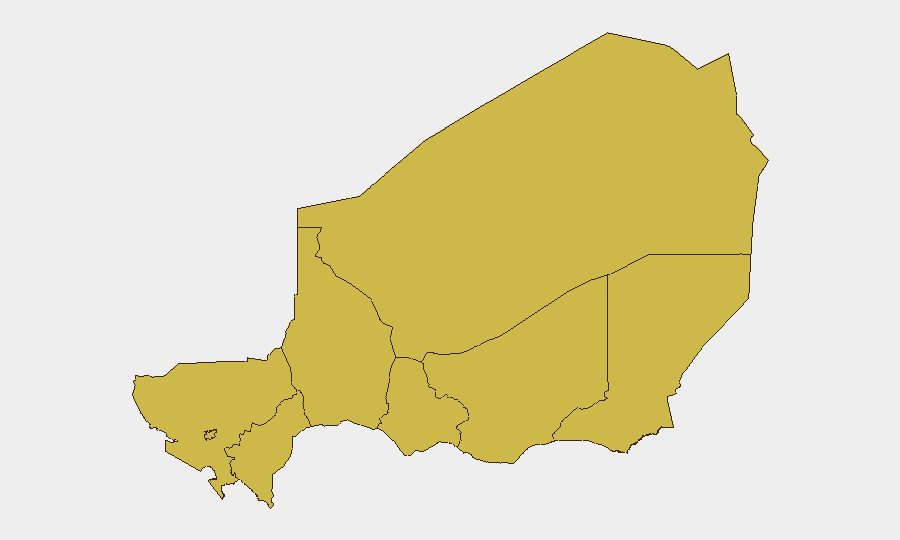
All eight sub-national regions carry equivalent composite risk scores (66.2), indicating diffuse, nation-wide threat distribution rather than geographically concentrated hotspots. The northern zones—Agadez, Zinder, Diffa, and Tillabéri—historically correlate with terrorist kidnapping, armed-group activity, and cross-border infiltration linked to regional Sahel instability and the Alliance of Sahel States defense posture. Niamey and southern regions (Tahoua, Dosso, Maradi) face elevated violent-crime and kidnapping risk despite lower militant presence, reflecting both criminal opportunism and transregional recruitment networks. Risk is effectively panoramic; no area qualifies as materially safer than others under current threat modeling.
How GeoBit Would Assist
AOI Monitoring & Early Warning with persistent area-of-interest watch on known militant and criminal zones (northern Tillabéri, Diffa, Agadez) with real-time alerting on any new incidents, military/police concentrations, or cross-border movement signatures. Intel Sweep and OSINT fusion combining multi-language social media (X, Telegram), regional media feeds, and open-source conflict databases to catch incident reporting with minimal latency and filter false positives through cross-source corroboration. Battle Mapping and Force Structure tracking to monitor counter-terrorism force deployments and armed-group positioning, enabling threat-exposure assessment for corporate or NGO personnel in transit or stationed in-country. Routing & Network Analysis for alternative journey planning that avoids highest-risk nodes and real-time corridor assessment during movement operations.
7-Day Outlook
No significant escalation indicators are visible in the near term; diplomatic and defense coordination within the AES continues without public crisis signaling. Baseline kidnapping, violent-crime, and counter-terror activity will persist across northern and eastern regions. Security teams should maintain standard duty-of-care protocols (movement restrictions, location reporting, comms discipline) and activate GeoBit monitoring for any threshold breach or incident emergence in the coming week.
Highest-Risk Areas — Ranked
| # | State / Region | Risk |
|---|---|---|
| 1 | Agadez Region | 66.2 |
| 2 | Zinder Region | 66.2 |
| 3 | Diffa Region | 66.2 |
| 4 | Tillabéri Region | 66.2 |
| 5 | Niamey | 66.2 |
| 6 | Tahoua Region | 66.2 |
| 7 | Dosso Region | 66.2 |
| 8 | Maradi Region | 66.2 |
Sources
Previous Daily Briefs
A new Niger brief is written every day — each with its own risk map and downloadable CSV. Here's the last week; use the calendar to go further back.
📅 Browse every day by calendar →
Highlighted days have a brief. Tap a day for that day's map & analysis, or “csv” for that day's dataset ($5).
Atlas — our AI intelligence desk — emails them this snapshot personally. Nothing else, no list.