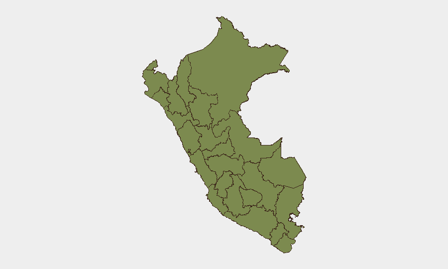
Situation Summary
Peru remains a moderate-threat environment (global rank #null, composite score 24) with concentrated risk in northern and central urban zones. Lima continues as the epicenter of violent crime, with a marked cluster of shooting incidents, extortion attacks, and organized-crime settling of scores across multiple districts over the past 48 hours. Northern regions—particularly Piura, Lambayeque, and Ucayali—show elevated threat scores driven by drug-trafficking and criminal-organization activity. The trajectory indicates sustained, localized volatility rather than nationwide destabilization.
Key Developments
- Lima, Villa María del Triunfo (28 Jul) – Two fatalities and two injuries in a shooting on Av. Pachacútec; victims included a private security guard and vehicle passenger, consistent with targeted organized-crime violence.
- Lima, historic center (28 Jul) – Armed robbery of a money changer in Jirón de la Unión; heightened fear among other currency exchangers in this busy commercial corridor signals criminal targeting of informal financial sectors.
- Lima, Villa María del Triunfo (28 Jul) – Construction-union leader and security agent killed in a separate balacera; attack suggests extortion or territorial conflict within the construction sector.
- Lima, Chorrillos (27–28 Jul) – Two separate incidents: vehicle arson targeting a mototaxi-association leader (intimidation/extortion); and a targeted homicide inside a vehicle, likely "ajuste de cuentas" (organized-crime settling of scores).
- Lima, San Martín de Porres (27–28 Jul) – Explosive device detonated at a private residence; no fatalities but material damage; consistent with extortion-style attacks in northern Lima districts.
- Lima, Lurigancho-Chosica/Huachipa (27–28 Jul) – Gun attack at a bus stop; driver and bystander injured; reflects spillover violence affecting public transport infrastructure.
- Lima, Puente Piedra/Zapallal (27–28 Jul) – Targeted homicide of a man exiting a party; incident reflects rising lethal violence in Lima Norte despite police presence.
- Lima, Santa Anita (27–28 Jul) – Police arrested four suspected extortionists targeting transport operators; operation underscores organized extortion networks against combi and bus sectors.
Highest-Risk Areas
Piura (31.3) and Lima (29.8) drive Peru's overall threat profile, followed by Ucayali (28.3). Lima's risk is concentrated in southern districts (Villa María del Triunfo, Chorrillos, San Martín de Porres) and reflects urban criminal competition, extortion networks targeting transport and informal sectors, and organized-crime violence. Piura and Ucayali are primarily drug-trafficking and cartel-activity zones linked to cocaine production and trafficking routes. Lambayeque and Cusco show secondary elevations tied to similar narcotics and territorial dynamics. Southern and eastern regions (Tacna, Amazonas, Loreto) remain comparatively stable.
How GeoBit Would Assist
Organizations with personnel or assets in Peru should employ AOI Monitoring & Early Warning on high-risk districts (Villa María del Triunfo, San Martín de Porres, Puente Piedra, and northern Piura) to trigger alerts on shooting, extortion, or explosive incidents in near-real time. OSINT Fusion & Corroboration (X/Twitter, Telegram, local media feeds) enables rapid verification of emerging incidents and criminal claims. Routing & Network Analysis supports alternative journey planning for staff traveling between Lima and regional hubs, avoiding known hotspots during high-risk windows (dusk to dawn).
7-Day Outlook
Violent crime and extortion in Lima's districts will likely persist at current elevated levels, with organized-crime settling of scores and turf disputes continuing to drive homicides in southern and northern urban zones. Police arrest operations (as in Santa Anita) may temporarily disrupt extortion networks but are unlikely to materially reduce overall incident frequency. No imminent nationwide destabilization is indicated, though tactical security measures for Lima-based operations should remain heightened.
Highest-Risk Areas — Ranked
| # | State / Region | Risk |
|---|---|---|
| 1 | Piura | 31.3 |
| 2 | Lima | 29.8 |
| 3 | Ucayali | 28.3 |
| 4 | Lambayeque | 20.8 |
| 5 | Cusco | 19.3 |
| 6 | La Libertad | 16.3 |
| 7 | Ancash | 14.8 |
| 8 | Junín | 10.3 |
| 9 | Tacna | 5.8 |
| 10 | Amazonas | 4.3 |
| 11 | Loreto | 2.8 |
| 12 | Huánuco | 2.8 |
Sources
Previous Daily Briefs
A new Peru brief is written every day — each with its own risk map and downloadable CSV. Here's the last week; use the calendar to go further back.
📅 Browse every day by calendar →
Highlighted days have a brief. Tap a day for that day's map & analysis, or “csv” for that day's dataset ($5).
Atlas — our AI intelligence desk — emails them this snapshot personally. Nothing else, no list.