Situation Summary
Qatar remains at low global threat rank (#64, composite score 18) with concentrated risk in industrial infrastructure rather than broad civil or political instability. The 21–23 June Ras Laffan gas-processing explosion—killing at least 13, injuring 54–66, with 18 missing—has dominated the threat landscape and triggered emergency response, operational shutdown, and diplomatic coordination at the leadership level. No secondary threats, civil unrest, or wider security incidents have been reported nationwide in the past 48 hours; risk remains localized to the industrial zone and energy-sector operational disruption. The near-term trajectory depends on search-and-rescue outcomes, damage assessment timelines, and any operational/market consequences for Qatar's LNG export capacity.
Key Developments
- Ras Laffan Industrial City, Al Khor – evening 21 June, with updates through 23 June: Internal explosion and major fire at Barzan gas-processing facility (part of Qatar's critical LNG/gas export infrastructure) killed at least 13 workers, injured 54–66, and left 18 missing. Qatar's Ministry of Interior and QatarEnergy confirmed the incident as a "technical incident during restart operations" with no hazardous leaks outside the industrial zone.
- Ras Laffan – 22–23 June (ongoing emergency ops): International Search and Rescue Group (Lekhwiya) and Civil Defence teams continue operations to locate 18 missing workers; the site remains under tight security control with no public access.
- National energy infrastructure – 22–23 June (operational impact): The explosion has disrupted operations at a key LNG/gas export node, prompting operational shutdown and damage assessment; temporary reduction in Qatar's global gas export capacity is anticipated pending technical clearance.
- Doha – 23 June (diplomatic signalling): Regional social-media reporting indicates phone consultation between Qatar's Emir Sheikh Tamim bin Hamad Al Thani and UAE President Sheikh Mohamed bin Zayed on 23 June, framed as solidarity and diplomatic coordination following the Ras Laffan incident.
- Ministry of Interior – 21–23 June (public reassurance): Multiple official statements confirming containment of blast to industrial zone, absence of dangerous gas leakage, and no wider threat to nearby communities; authorities requested residents avoid the area and refrain from spreading rumours.
- Nationwide – 22–23 June (threat environment assessment): No confirmed civil unrest, political violence, major crime spikes, or secondary security incidents reported across Qatar; risk remains concentrated in industrial/infrastructure domain.
Highest-Risk Areas
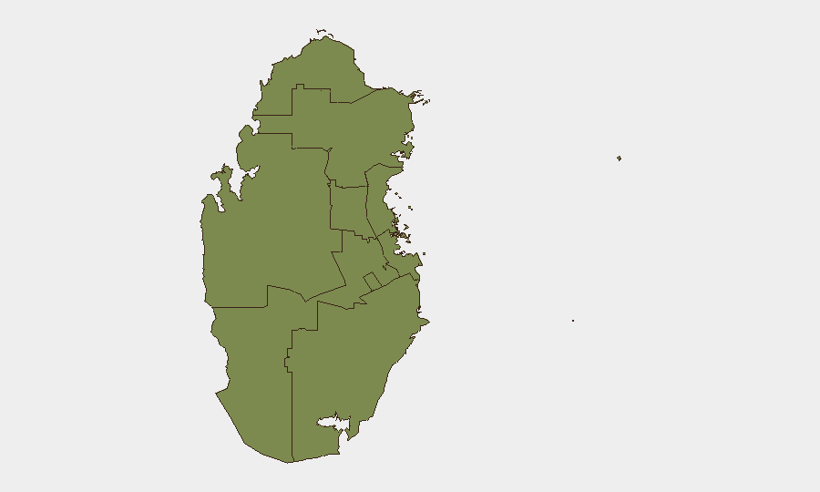
Al Shahaniya emerges as the highest-risk region (composite score 32), though the immediate driver is the Ras Laffan incident in neighbouring Al Khor and Al Thakhira (score 15.4), home to Qatar's critical gas and LNG export infrastructure. Doha (score 16) ranks second, reflecting national-level political and diplomatic activity rather than localized public-order threats. The remaining regions (Ash Shamal, Al Rayyan, Al-Daayen, Umm Salal, Al Wakrah) all score 2 or below, indicating negligible acute risk. Risk in Qatar is therefore sectoral—concentrated in energy infrastructure and supply-chain continuity—rather than geographic or population-based.
How GeoBit Would Assist
Security teams managing people or assets in Qatar would deploy AOI (Area-of-Interest) Monitoring & Early Warning on Ras Laffan and other critical industrial zones to detect facility disruptions, safety incidents, and operational changes in real time. Intel Sweep and multi-source OSINT fusion (X/Twitter, Telegram, local media, official MOI statements, satellite imagery) provide rapid corroboration of incident scope, casualty counts, and containment status—essential for duty-of-care and supply-chain continuity decisions. GIS & Spatial Analysis and Satellite & Imagery analysis enable damage assessment and timeline projection for facility restart, informing corporate exposure and operational planning.
7-Day Outlook
Search-and-rescue operations are expected to conclude within 3–5 days, after which focus will shift to damage assessment and root-cause investigation. Barzan facility restart timelines remain uncertain; any extended shutdown could amplify global LNG market volatility and draw further international diplomatic engagement. No secondary incidents or widening civil unrest are anticipated; risk remains confined to industrial operations and energy-sector continuity.
Highest-Risk Areas — Ranked
| # | State / Region | Risk |
|---|---|---|
| 1 | Al Shahaniya | 32 |
| 2 | Doha | 16 |
| 3 | Al Khor and Al Thakhira | 15.4 |
| 4 | Ash Shamal | 2 |
| 5 | Al Rayyan | 2 |
| 6 | Al-Daayen | 2 |
| 7 | Umm Salal | 2 |
| 8 | Al Wakrah | 2 |
Sources
Previous Daily Briefs
A new Qatar brief is written every day — each with its own risk map and downloadable CSV. Here's the last week; use the calendar to go further back.
📅 Browse every day by calendar →
Highlighted days have a brief. Tap a day for that day's map & analysis, or “csv” for that day's dataset ($5).