Situation Summary
Romania is experiencing a sharp escalation in airspace security incidents driven by repeated incursions of suspected Russian reconnaissance and attack drones near its northeastern border and Black Sea territorial waters. Over a 72-hour period (24–26 July), Romanian Air Force F‑16s shot down three drones, with at least one confirmed as a Russian Shahed-type UAV. The pattern reflects spillover risk from Russia's war against Ukraine and has triggered civil alerts, diplomatic action (expulsion of a Russian diplomat on 27 July), and heightened military readiness across eastern Romania.
Key Developments
- Padina, Buzău County – Friday, 24 July, ~late afternoon
Romanian F‑16 from Fetești air base shot down a Shahed-type drone of confirmed Russian origin over an unpopulated area near Padina after radar detection near the Ukrainian border; prosecutors and Foreign Ministry later confirmed attribution.
- Near Sfântu Gheorghe village, Danube Delta, Tulcea County – Saturday, 25 July, ~08:30
Two F‑16s scrambled and destroyed a second drone ~10 km west of Sfântu Gheorghe in an unpopulated area, marking the second shoot-down in less than 24 hours.
- Sulina–Chilia sector, Black Sea territorial waters – Sunday, 26 July, 10:13
Two F‑16s under NATO command shot down a third suspected Russian drone over Romanian territorial waters in the Sulina–Chilia area; authorities issued RO‑Alert civil warnings for northern Tulcea County directing residents to shelter indoors away from windows.
- Northern Tulcea County – Sunday, 26 July
RO‑Alert warnings issued across border and Danube Delta zone reflecting civil-protection response to drone incursions and heightened airspace threat.
- Tulcea County airspace – Monday, 27 July, early morning
A fourth drone briefly entered Romanian airspace near the Ukrainian border and subsequently returned to Ukraine; F‑16s were scrambled and RO‑Alert reissued, though this drone was not engaged.
- Bucharest, Foreign Ministry – Monday, 27 July
Romanian Foreign Ministry announced expulsion of a Russian Embassy diplomat in direct response to repeated airspace violations, signaling diplomatic escalation and political intolerance for continued incursions.
Highest-Risk Areas
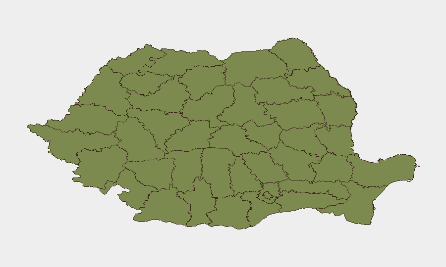
Bucharest carries the highest composite risk score (31.3) due to political decision-making, diplomatic and government facilities, and media/information operations during a time of heightened NATO coordination. However, the immediate physical security threat concentrates in eastern Romania: Tulcea County and the Danube Delta region are now the primary operational risk zones, driven by three confirmed drone shoot-downs in 48–72 hours, active civil alerts, and proximity to both the Ukrainian border and Black Sea. Secondary risk extends to Buzău County (Padina incident), Brăila, and other northeastern counties along the Ukrainian border corridor. Risk in these areas reflects direct spillover from the Russia–Ukraine conflict, including reconnaissance missions, potential targeting infrastructure, and the inherent danger of air-defense operations in populated or transit zones.
How GeoBit Would Assist
AOI Monitoring & Early Warning would establish persistent watch over Tulcea County, the Danube Delta, and northeastern border zones to detect and alert on future drone activity before engagement. Maritime & Aviation Tracking combined with Conflict & Military capabilities would enable real-time correlation of radar signatures, drone routing, and F‑16 responses to forecast incursion patterns and threat windows. OSINT Fusion (X/Telegram monitoring, radio SIGINT, YouTube intelligence) would track Russian/Ukrainian force posture, diplomatic messaging, and civil-alert protocols to anticipate escalation and inform duty-of-care decisions for personnel in affected regions.
7-Day Outlook
Drone incursions are likely to continue at elevated frequency given the proximity of active combat operations in Ukraine and Russia's apparent reconnaissance priorities. Additional shoot-downs, RO‑Alert issuances, and further diplomatic responses should be expected. Risk of civilian or infrastructure impact remains low but non-negligible; security teams should maintain heightened situational awareness in Tulcea, Buzău, and Brăila counties and coordinate with Romanian authorities on travel, asset placement, and contingency protocols.
Highest-Risk Areas — Ranked
| # | State / Region | Risk |
|---|---|---|
| 1 | Bucharest | 31.3 |
| 2 | Mehedinți | 10.3 |
| 3 | Vrancea | 6.3 |
| 4 | Brăila | 4 |
| 5 | Mureș | 3.8 |
| 6 | Bistrița-Năsăud | 2.5 |
| 7 | Arad | 1.9 |
| 8 | Cluj | 1.9 |
| 9 | Buzău | 1.6 |
| 10 | Prahova | 1.5 |
| 11 | Ialomița | 1.5 |
| 12 | Călărași | 1.5 |
Sources
Previous Daily Briefs
A new Romania brief is written every day — each with its own risk map and downloadable CSV. Here's the last week; use the calendar to go further back.
📅 Browse every day by calendar →
Highlighted days have a brief. Tap a day for that day's map & analysis, or “csv” for that day's dataset ($5).
Atlas — our AI intelligence desk — emails them this snapshot personally. Nothing else, no list.